
Parts of NSW sweated through the warmest October night in decades, with minimum temperatures in some areas failing to fall below 22°C.
The warm night followed an exceptionally hot day in NSW, with temperatures soaring into the high 30’s across parts of the state on Tuesday.
The hot airmass was transported over NSW by strong and gust northwesterly winds ahead of a low-pressure system.
The satellite image below shows a thick band of cloud moving over NSW on Tuesday night, which acted as a blanket and trapped the warmth in overnight.
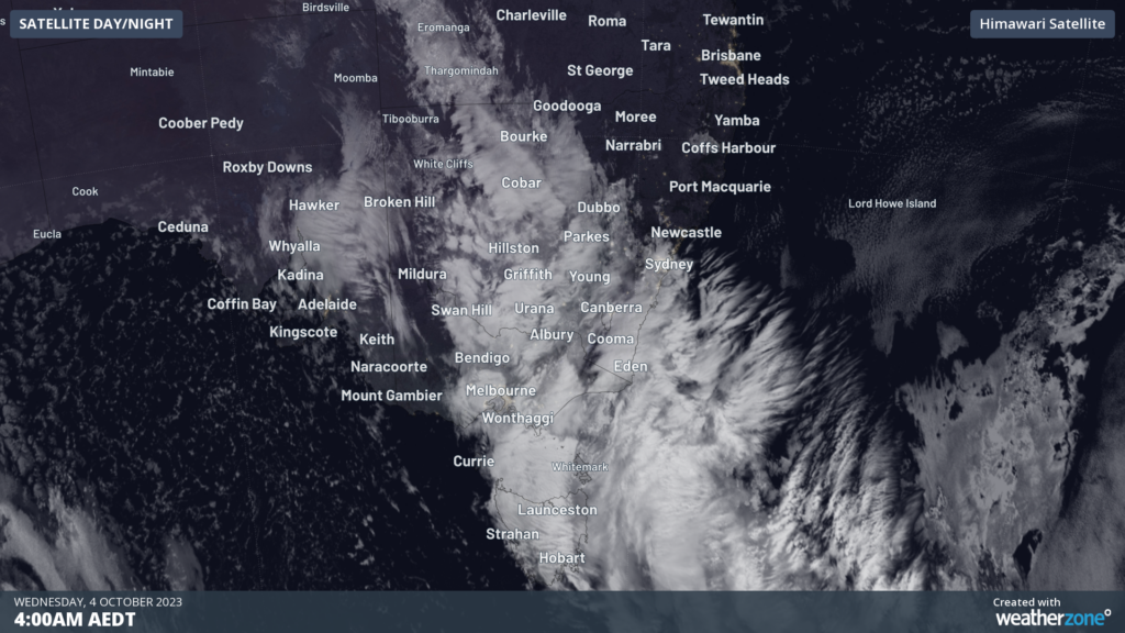
Image: Himawari satellite image at 4am on Wednesday, October 4.
The warmest night in the state was recorded in the states far northwest, with Borrona Downs temperature only dropping to 27.7°C
Bathurst’s overnight temperature was the warmest October night in 68 years, with the temperature only dropping to 17.7°C.
The map below shows the warm minimums’ extending from the northwest through to the central NSW coastline.
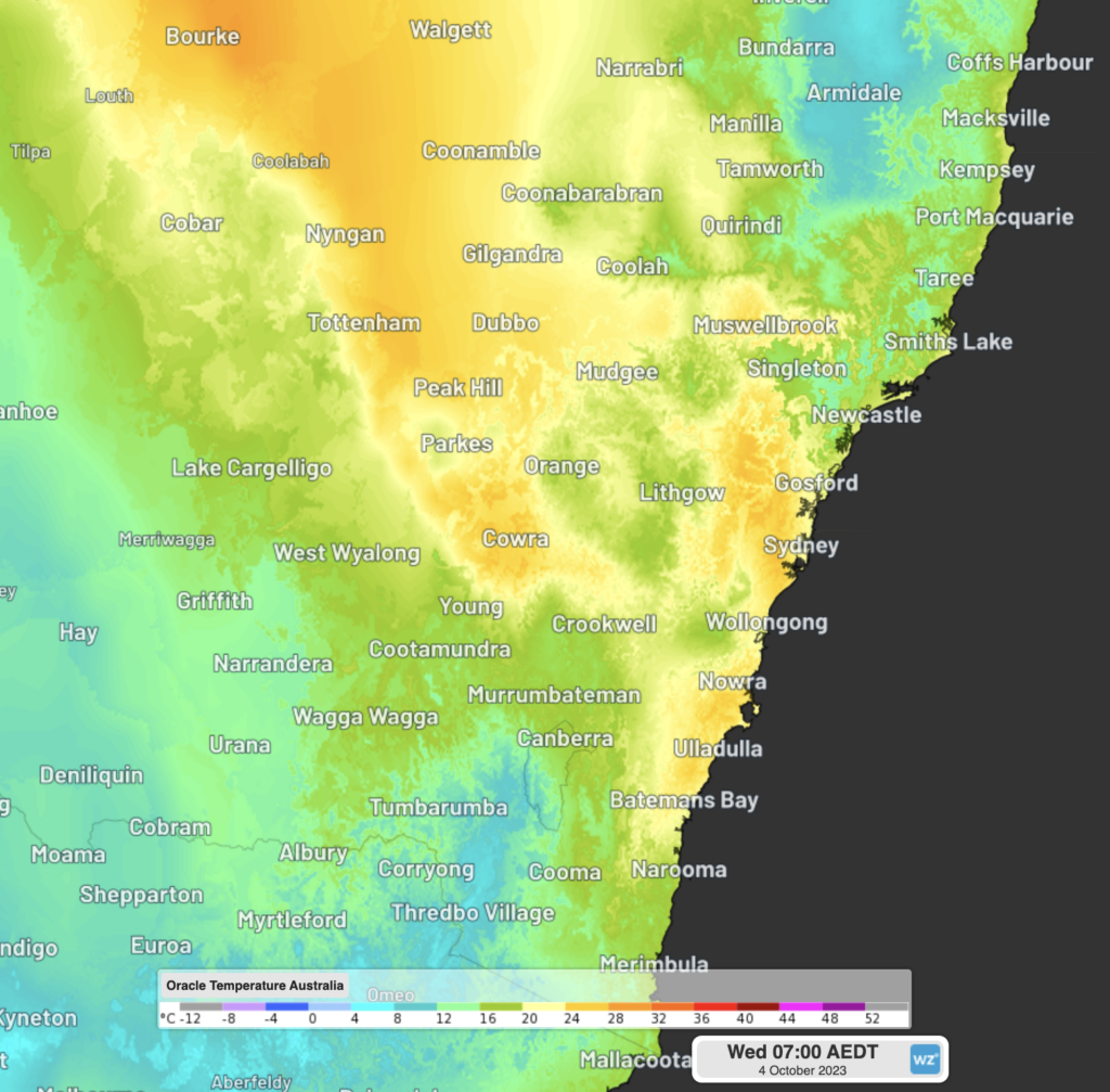
Image: Minimum temperatures on Wednesday morning, October 4.
Some of the warmest October nights in decades were also recorded in parts of the Sydney Metropolitan area on Wednesday morning;
- Bankstown’s minimum temperature was 22.7°C, the warmest October night in 42 years.
- Sydney Olympic Park only dropped to 24.4°C, a whopping 12°C above average.
- Richmond’s failed to drop below 22.8°C, the warmest October night in 28 years
- Horsley Park’s overnight temperature was 23.9°C, the warmest October night in 25 years
Tonight, minimum temperatures will drop significantly as a gusty and stormy cool change arrives providing much needed relief across the state.
The see-saw in overnight temperatures will see some areas recording a 10-14°C drop tonight compared to last night.
Bathurst should see the temperature drop to around 4°C and Bankstown’s to around 12°C.
Independently verified to significantly outperform other industry models, Opticast gives you a strategic advantage if weather impacts your enterprise. Armed with the most accurate nowcasting and forecasting data, you can mitigate operational and safety risks, and plan to make the most of severe weather windows.
Opticast is powered by machine learning, intelligently adapting to the local conditions of your site area. Gain a world-leading forecasting system that rapidly responds to changing conditions.
We give you the foresight to make quick and powerful decisions when you need to protect your valuable team and assets, and ensure maximum productivity. For more information, please contact us at apac.sales@dtn.com.


