Unseasonably heavy rain and flooding could cut off roads in the Kimberley and central Australia this week.
The satellite images below show a large northwest cloudband extending across Australia on Monday morning. This colossal cloudband, which is being fuelled by tropical moisture from the Indian Ocean, will produce widespread rain over a broad area of Australia this week.
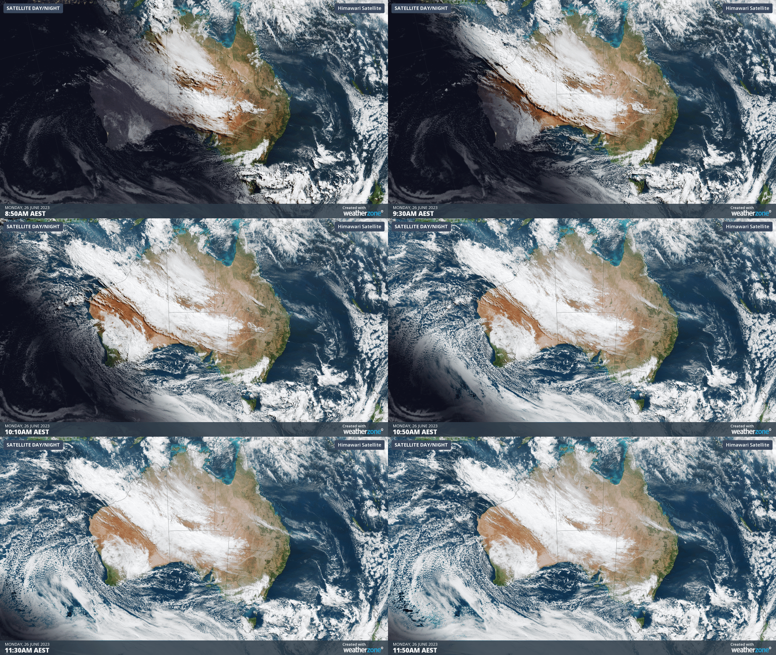
Image: Himawari-9 satellite images showing a northwest cloudband extending over Australia on Monday, June 26, 2023.
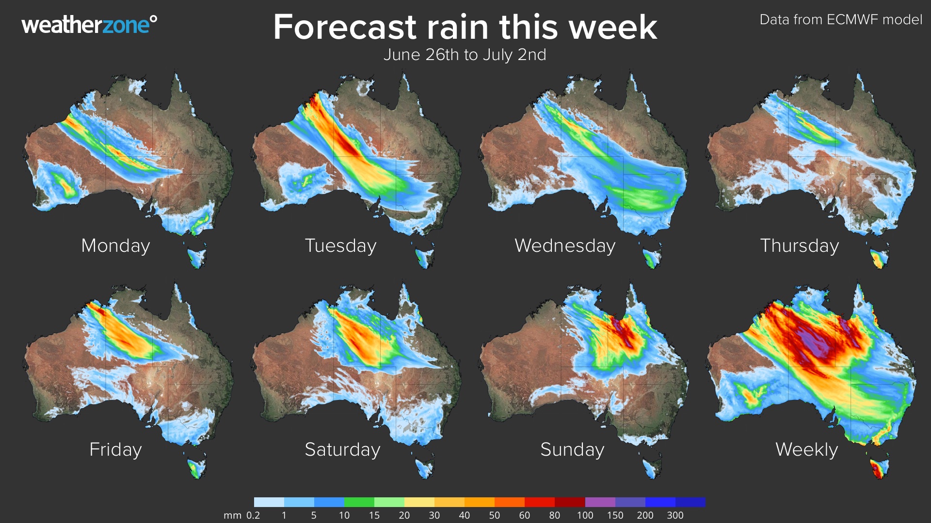
The heaviest rain on Monday and Tuesday will fall over the Kimberley and Interior of WA, and over the Western Interior of the NT. The map below shows the predicted rain during these two days combined.
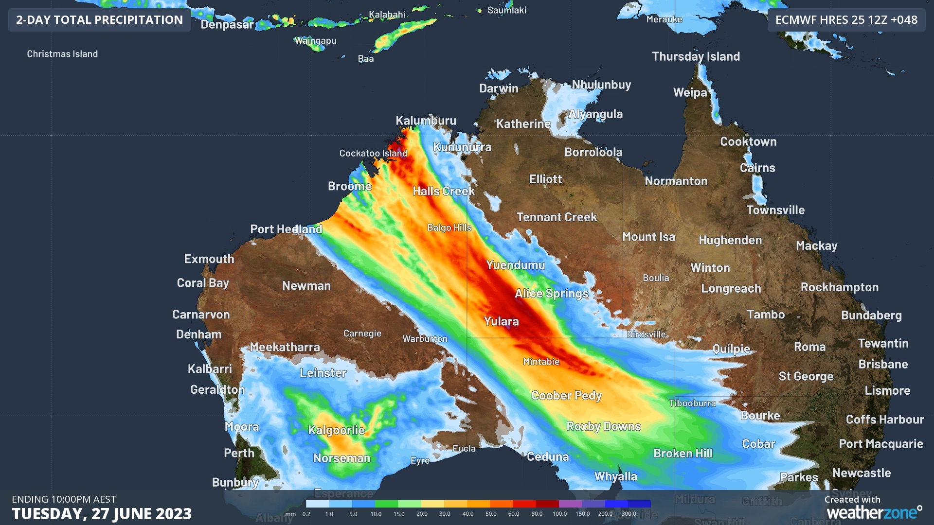
Image: Forecast accumulated rain during the 48 hours ending at 10pm AEST on Tuesday, June 27, 2023.
Flood Watches have already been issued in both states, with some road closures also announced in the Kimberley for the coming days. These include the Gibb River Road, which will close from Tuesday, and Fitzroy Crossing Bridge, which may close later in the week.
On Wednesday, rain will continue over parts of central and northwestern Australia and spread into the nation’s southeast as well.
Later in the week, a second round of heavy rain is expected to develop over the Kimberley and NT from Friday, before spreading towards the east and affecting Qld on the weekend and possibly into the start of next week.
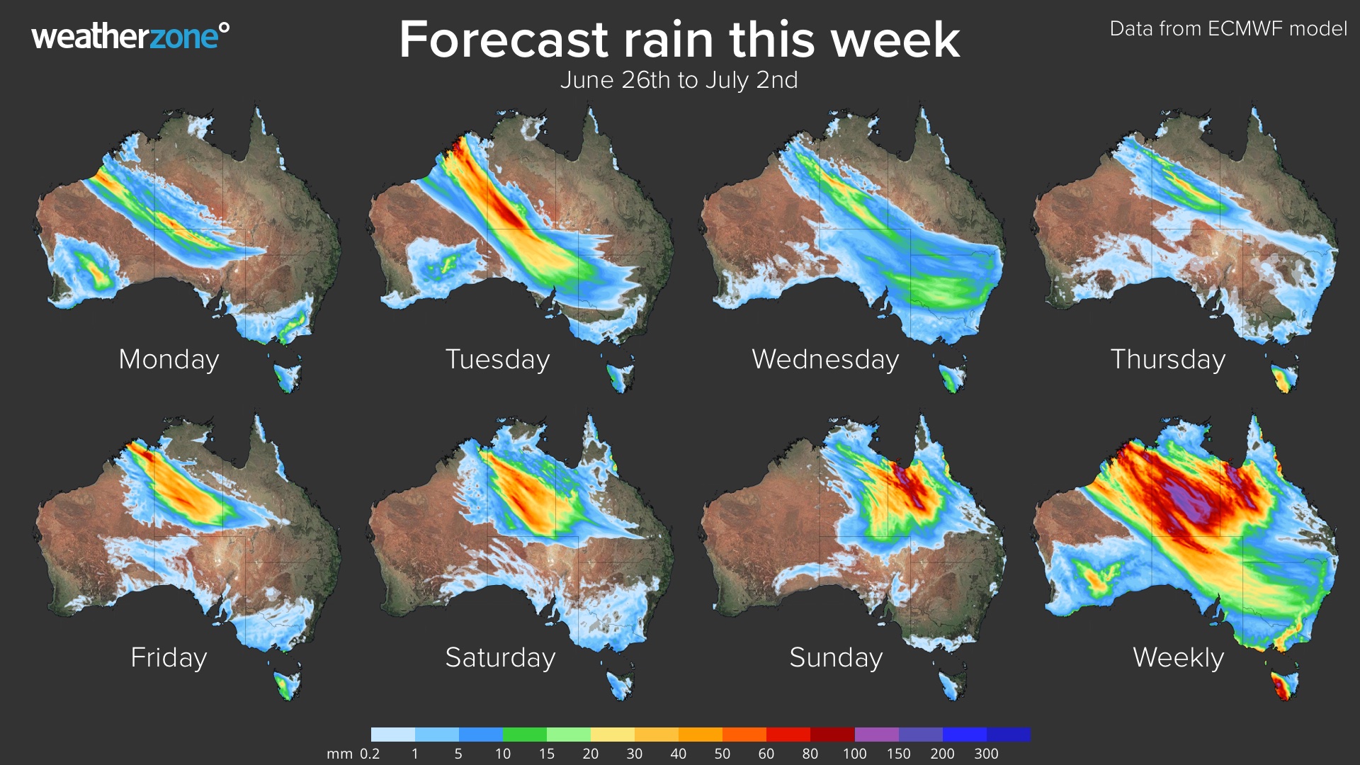
Image: Forecast daily rainfall this week, according to the ECMWF-HRES model.
This system will deliver widespread and prolonged rainfall to parts of Australia that typically see little of no rain at this time of year. This will cause out-of-season flooding and may catch some communities and travellers by surprise.
Be sure to check the latest warnings and road closures before travelling across the Australian outback in the next couple of weeks.
DTN APAC has heavy rainfall and flooding alerts to help you keep track and prioritise assets that require attention. To find out more, please email us at apac.sales@dtn.com.

