
Rain, and plenty of it, has drenched Perth overnight, in a welcome soaking for the WA capital.
A total of 71.2 mm rain fell in the 24 hours to 9 am (AWST) Monday, most of it in a series of storms that lashed the WA capital not long after dark. That made it:
- The wettest day in any month in almost five-and-a-half years (since January 16, 2018, when unusually heavy summer rain fell as the remnants of ex-Tropical Cyclone Joyce moved southwards)
- The wettest June day in 37 years (since June 25, 1986)
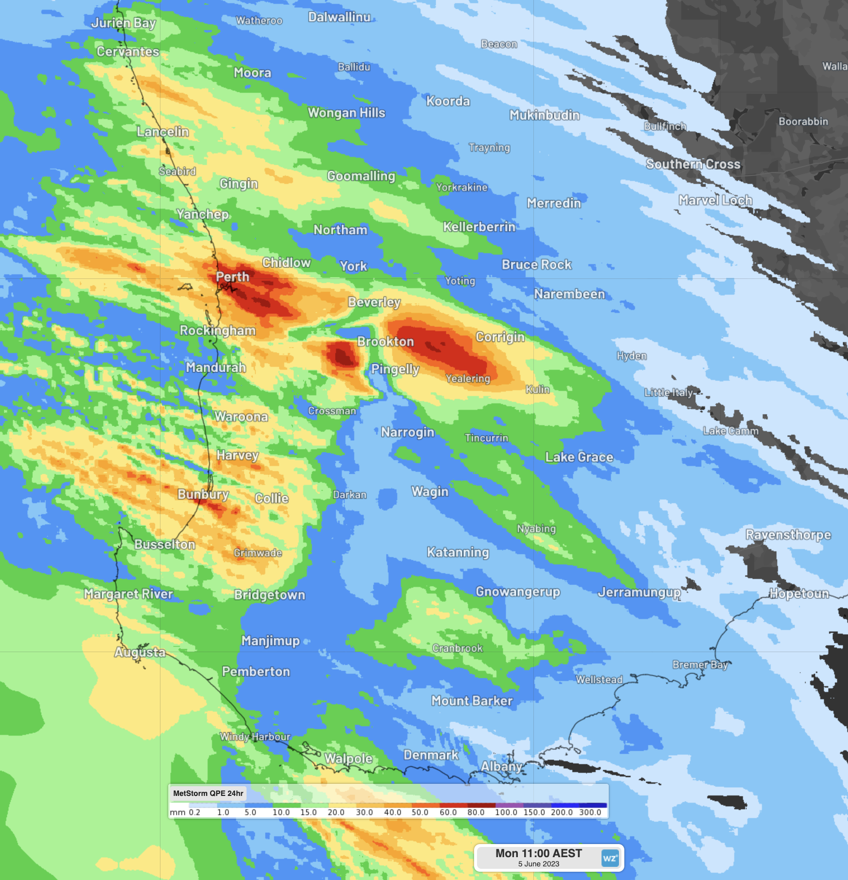
Perth locals of course expect rain at this time of year. The winter months are by far the wettest of the year, each averaging well over 100 mm.
But even by Perth winter standards, the rainfall rate during Sunday night’s showers was extremely heavy, with 13.8 mm in 10 minutes at one point just after 8 pm during a storm, resulting in flash flooding being reported in some suburbs.
With the storms also came lightning: 464 Lightning strikes were detected by the Total Lightning Network within 50km of Perth (48 ground strikes, 16,658 strikes around southwest WA).
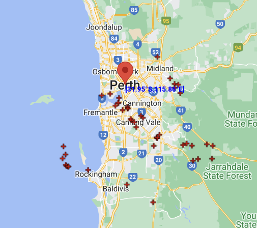
Image: 48 ground strikes recorded within 50km of Perth on Sunday evening and Monday morning
As mentioned, this was welcome rain after a relatively dry year to date. May is Perth’s fourth-wettest month on average, but the May 2023 total rainfall of 26.4 mm was only around a quarter of the long-term average. As you can see below, the whole state was dry in May.

Image: WA rainfall deciles in May 2023 showing deficiencies across virtually the whole state. Source: BoM.
What next for Perth?
In short, more rain. The rain that fell overnight came via a series of pre-frontal troughs. A cold front moving through the southwest of WA on Monday morning will bring cooler temps and further heavy showers and possible totals of at least 15 mm on both Monday and Tuesday.
Generally showery weather with max temps in the mid-to-high teens then persists for the rest of the week as a classic winter pattern sets in.
The Total Lightning Network (WZTLN) detects lightning flashes using our vast global sensor network, with a better than 200m accuracy. To find out how the WZTLN can help your business, please visit our website or email us at apac.sales@dtn.com.


