Prosper in a dynamic world
Search

Satellite captures Moon’s shadow during solar eclipse

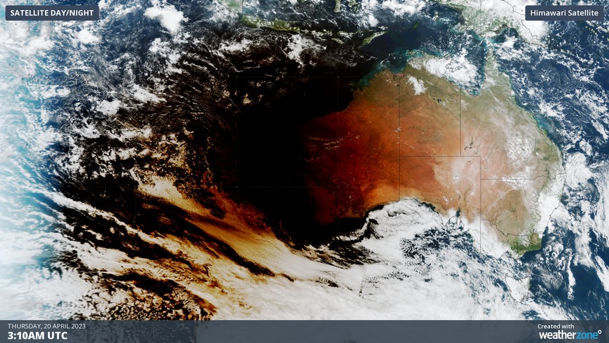
A satellite just captured the shadow of the Moon darting across the Indian Ocean and glancing northwestern Australia during today’s total solar eclipse.

More than 20,000 people converged on Exmouth in the far northwest corner of WA on Thursday to witness a total solar eclipse. This rare spectacle occurs when the moon passes between Earth and the Sun, causing the Moon to briefly cast a shadow on the Earth’s surface.

Exmouth and the surrounding Ningaloo Coast region was the only place on the Australian mainland to witness Thursday’s solar eclipse in its entirety. Every other part of the country only saw a partial eclipse, where the moon only covered a portion of the sun.

But while the view of the eclipse from Earth was limited to a thin sliver of land and ocean, the Himawari-9 satellite, sitting 36,000 km above Earth’s surface, captured an impressive top-down view of the phenomenon for all to see.

The video below shows the shadow of the Moon passing across Earth’s surface on Thursday, initially moving over the Indian Ocean before skimming WA and then continuing towards the Timor Sea and Indonesia.
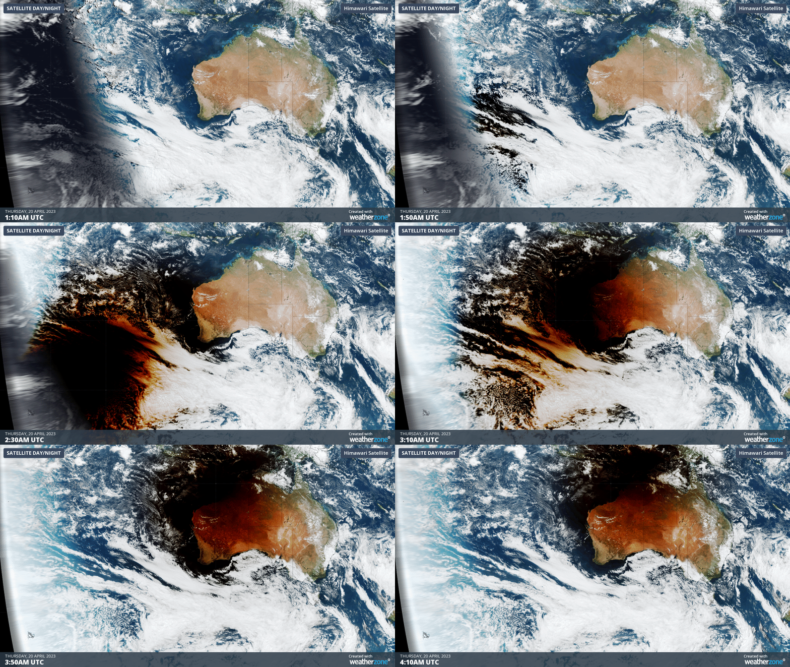
Impressively, the temperature dropped by several degrees during the darknes of the eclipse. Carnarvon Airport cooled by 3.4ºC between 10:23am and 11:30am local time.

Below are a few more images of the event captured by the Weatherzone community in WA.

Image: Safety first in Wonthella, WA. Source: @impactn.massage.clinic / Instagram
Satellite captures Moon's shadow during solar eclipse

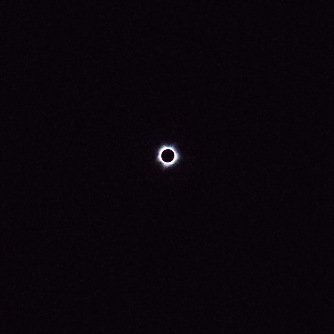
Image: Total solar eclipse as seen from Barrow Island, WA. Source: @thomas__fry / Instagram
Satellite captures Moon's shadow during solar eclipse

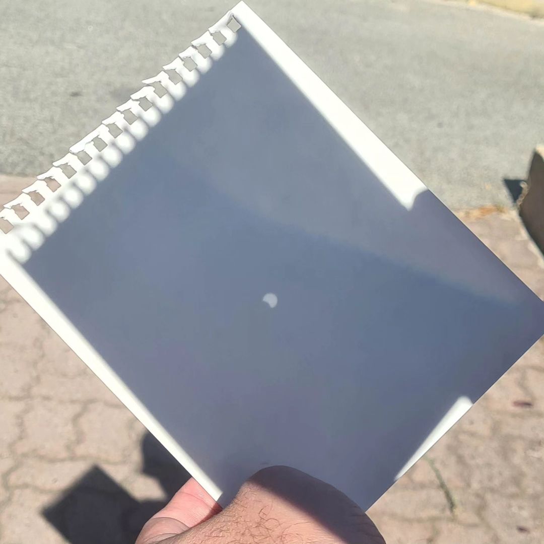
Image: View of Thursday’s partial solar eclipse through a pinhole projector, from Perth. Source: @dardsagainsthumanity / Instagram

Latest news

Satisfy your weather obsession with these news headlines from around the nation, and the world.

Another burst of heat looming for southeastern Australia

The first week of summer is set to arrive with a bang, with hot and humid conditions expected for at least five states and territories next week.   A blocking high pressure system in the Tasman Sea will direct hot northerly winds across southeastern Australia for much of next week.   This slow pattern will […]

Stormy start to summer looms for Australia

A volatile weather pattern is set to cause widespread thunderstorm activity over Australia throughout the first week of summer, with severe storms likely to hit multiple states and territories. The last week of spring is featuring prolific rain and thunderstorm activity over large areas of northern and eastern Australia. This wet and stormy weather will […]

Tropical Cyclone Robyn forms in Australian region

Tropical Cyclone Robyn has formed inside Australia’s area of responsibility, becoming the first named cyclone of the 2024-25 season. Robyn became a category one tropical cyclone over the eastern Indian Ocean on Thursday afternoon, forming roughly 740 km to the west southwest of the Cocos (Keeling) Islands at about 2pm AWST. Image: Visible satellite images […]

Colossal conveyor belt of tropical moisture

A vast area of northern and eastern Australia is set to see persistent rainfall and thunderstorm activity in coming days, with the potential for flooding in many areas. If you want to understand why, the image at the top of this story explains all. The image shows the amount of “precipitable water” in the atmosphere, […]