
Two tropical cyclones spinning off Australia’s east coast are about to play an epic game of follow-the-leader that could last for several days and cover a distance of close to 5000 km.
The satellite animation below shows tropical cyclones Judy and Kevin located over the Soutwest Pacific Ocean on Thursday morning, just over 1500 km off Queensland’s east coast.
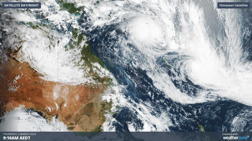
The southeastern-most system is Tropical Cyclone Judy, which was classified as a category 4 tropical cyclone with sustained 10-minute wind speeds of 167 km/h at 6am on Thursday Fiji time (5am AEDT). Judy is moving over open water and is not expected to cause severe weather in land in the next few days.
The other system, located to the northwest of Judy, is tropical cyclone Kevin. This system was first named as a category one tropical cyclone at 9am Fiji time (8am AEDT) on Thursday, when it was producing sustained wind speeds of around 74 km/h near its centre.
Tropical Cyclone Kevin will impact parts of Vanuatu during the next 48 hours, likely causing heavy rain, flooding, damaging to destructive winds, large surf and a storm surge. Unfortunately, this burst of severe weather comes just days after Cyclone Judy battered eastern and southern part of Vanuatu.
While Kevin and Judy have followed different paths to get to their current positions, their future track is going to be very similar.
Video: Forecast track for Tropical Cyclones Kevin and Judy over the next few days, according to the ECMWF-HRES model.
Both tropical cyclones are expected to follow the same general path towards the southeast over the next few days, with Kevin following Judy. Most forecast models suggest the two cyclones will remain about 1400 to 1500 km apart until at least Saturday, which should be far enough to prevent them from directly influencing each other.
However, the distance between the two systems should start to close from Sunday into Monday as they run into a blocking high pressure system located over the South Pacific Ocean. This may allow Kevin to approach Judy and possibly cause a brief period of Fujiwhara interaction, where the two cyclones start to move around each other.
While there is uncertainty around what will happen beyond Sunday, one of these ex-tropical cyclones may absorb the other in what would be a grim end to a colossal game of follow-the-leader.
How Weatherzone can help you prepare for Tropical Cyclones
DTN APAC has a suite of tropical cyclones services we provide to deliver our clients with as much forewarning of tropical cyclones as we can. We have 4 levels of forecasts timeframes:
- Tropical cyclone seasonal outlooks
- Weekly tropical update
- Daily 7-day tropical cyclone forecast
- Detailed tropical cyclone impacts (issued every 1-6 hours aligning with the BoM’s offical advisories)
Through these products you can have as much preparation as possible for tropical cyclones and their impacts. To find out more, please email us at apac.sales@dtn.com.


