Prosper in a dynamic world
Search

Extreme heatwave intensifying in southern Australia

Parts of southern Australia, including Adelaide, are in the grip of the worst February heatwave in years, with temperatures set to get even hotter over the coming days.

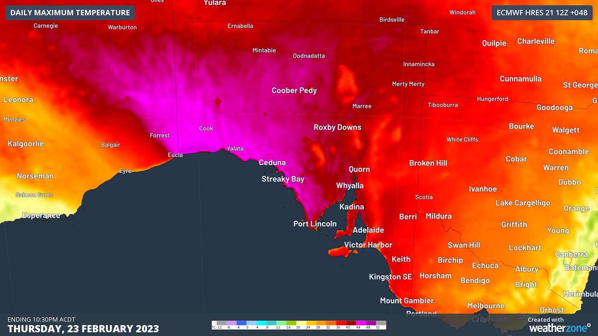
A hot air mass that built up over northwestern Australia in the past week is now spilling into southern Australia ahead of a cold front and associated low pressure trough. This heat can be clearly seen on the three maps below, which show the eastward progression of hot air across southern Australia during the next three days.

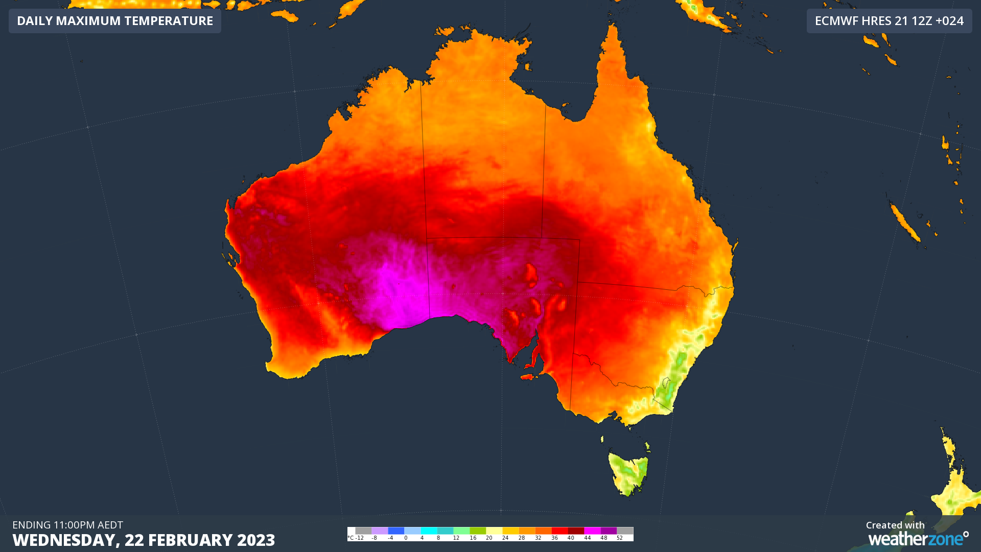
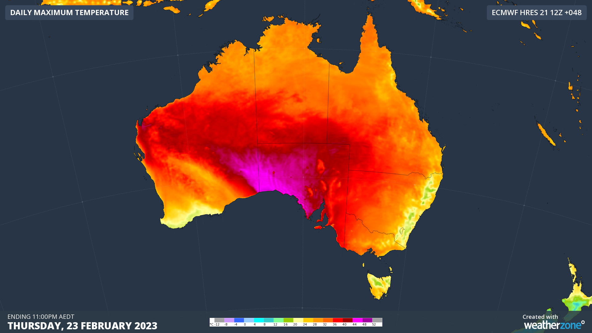
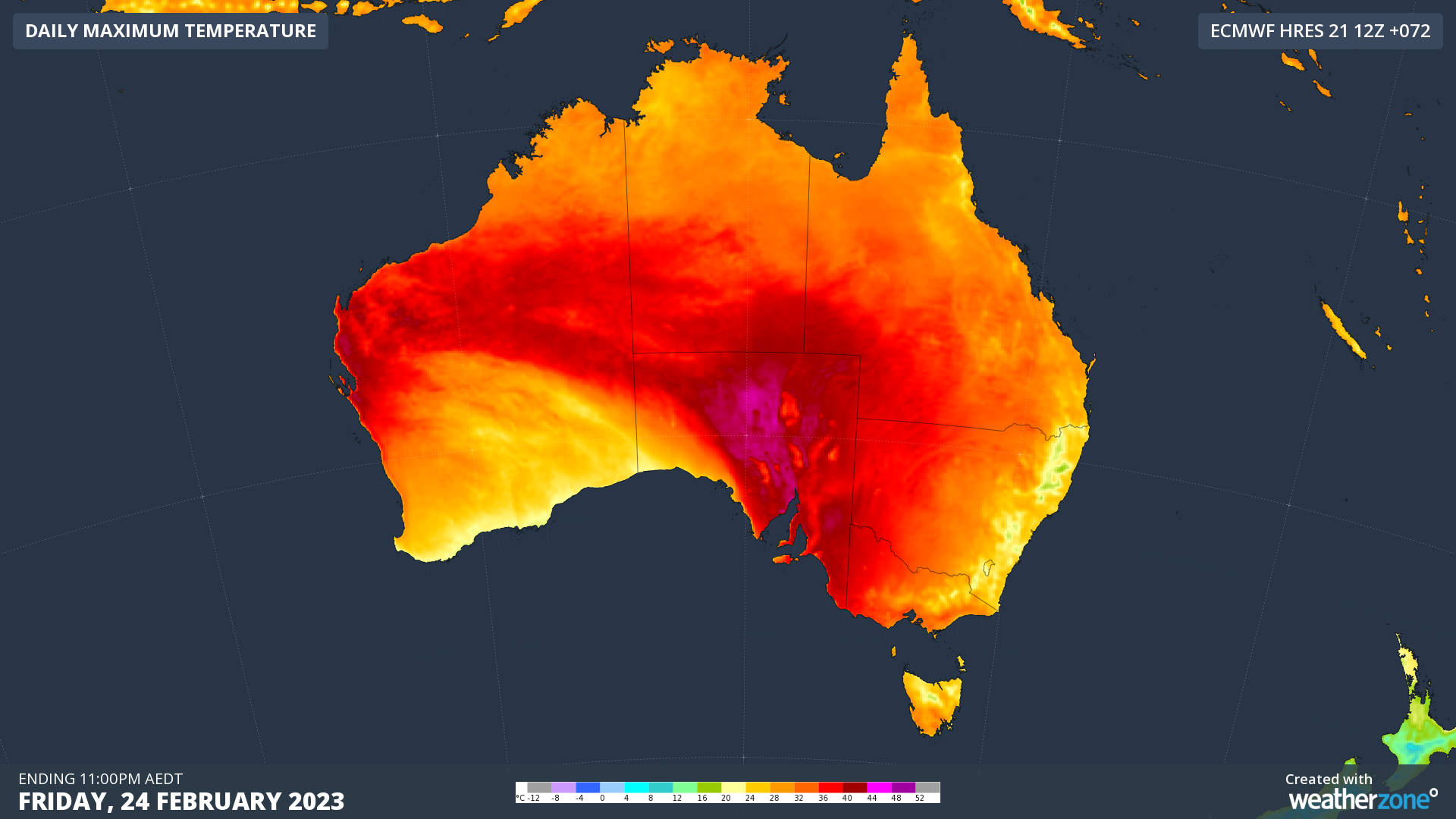
Image: Forecast daily maximum temperatures on Wednesday (top), Thursday (middle) and Friday (bottom), according to the ECMWF-HRES model.

On Wednesday, temperatures soared to 46.8ºC at Eucla in the far southeast corner of WA, which is an incredible 20ºC above average for this time of year. This was the equal highest February temperature observed anywhere in Australia for four years, and Eucla’s hottest February day since 2015.

Across the border in SA, Nullarbor hit 44.9ºC, also its hottest February day in eight years, while Adelaide rose to 38.7ºC, a five-year high for the month.

Temperatures will remain at hazardous levels in and around SA during the next two days and nights, qualifying for a Severe to Extreme heatwave on the Bureau of Meteorology’s scale.

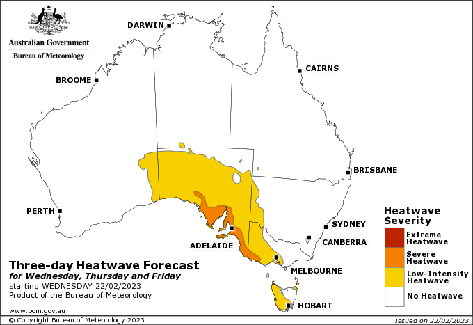
Image: Heatwave forecast for the three-day period from Wednesday to Friday this week. Source: Bureau of Meteorology

In Adelaide, minimum temperatures should be up around 26 to 27ºC on Thursday and Friday mornings, while daytime temperatures should rise to about 39 to 40ºC as well. This would be Adelaide’s hottest run of February days in about five years.

This week’s heatwave will also spread into parts of Vic and Tas during the second half of this week.

You can check which areas of Australia are likely to be impacted by this heatwave here, and the latest heatwave warnings are available here.

To find out about Weatherzones temperature and heatwave forecasts, visit our website or email us at apac.sales@dtn.com.

Latest news

Satisfy your weather obsession with these news headlines from around the nation, and the world.

How El Niño will shape Australian port operations in winter-spring 2026

Australian ports and marine pilots can expect a season of shifting wind and swell patterns through winter and spring 2026, as a developing El Niño brings the likelihood of drier conditions and more variable operating windows across the country’s coastline.  Will El Niño develop in 2026?  There are clear signs that an El Niño pattern is becoming […]

From Kimberley to northern NSW: Bushfire outlook flags risk for resources sector this winter

Bushfire risk doesn’t usually make headlines in June, but AFAC’s winter seasonal outlook is putting mining and resources operators on alert from the Kimberley to the NSW.  Australia’s official seasonal bushfire outlook for winter 2026 was released by AFAC on Thursday, May 28. The outlook predicts increased fire risk across the northern parts of the Great Sandy Desert and surrounds […]

The signal was there weeks earlier: forecasting one of the year’s biggest wind events

In mid-May 2026, DTN APAC meteorologists flagged a strengthening Southern Ocean pattern in model guidance, signalling an extended run of record-challenging wind conditions across the NEM.  Nearly three weeks later, NEM wind generation climbed from around 1.5GW to more than 9GW, supplying roughly one-third of the grid and coming within 1GW of the all-time generation record.  The event highlighted […]

The 2026 Indian Southwest Monsoon onset is expected in the next two weeks

The Indian Southwest Monsoon will reach India in the next two weeks, but a developing El Niño could signal a drier than normal monsoon for businesses and major industries across the country. Southwest monsoon onset over southern India in the next two weeks The Indian Meteorological Department (IMD) is responsible for tracking the advance and […]