
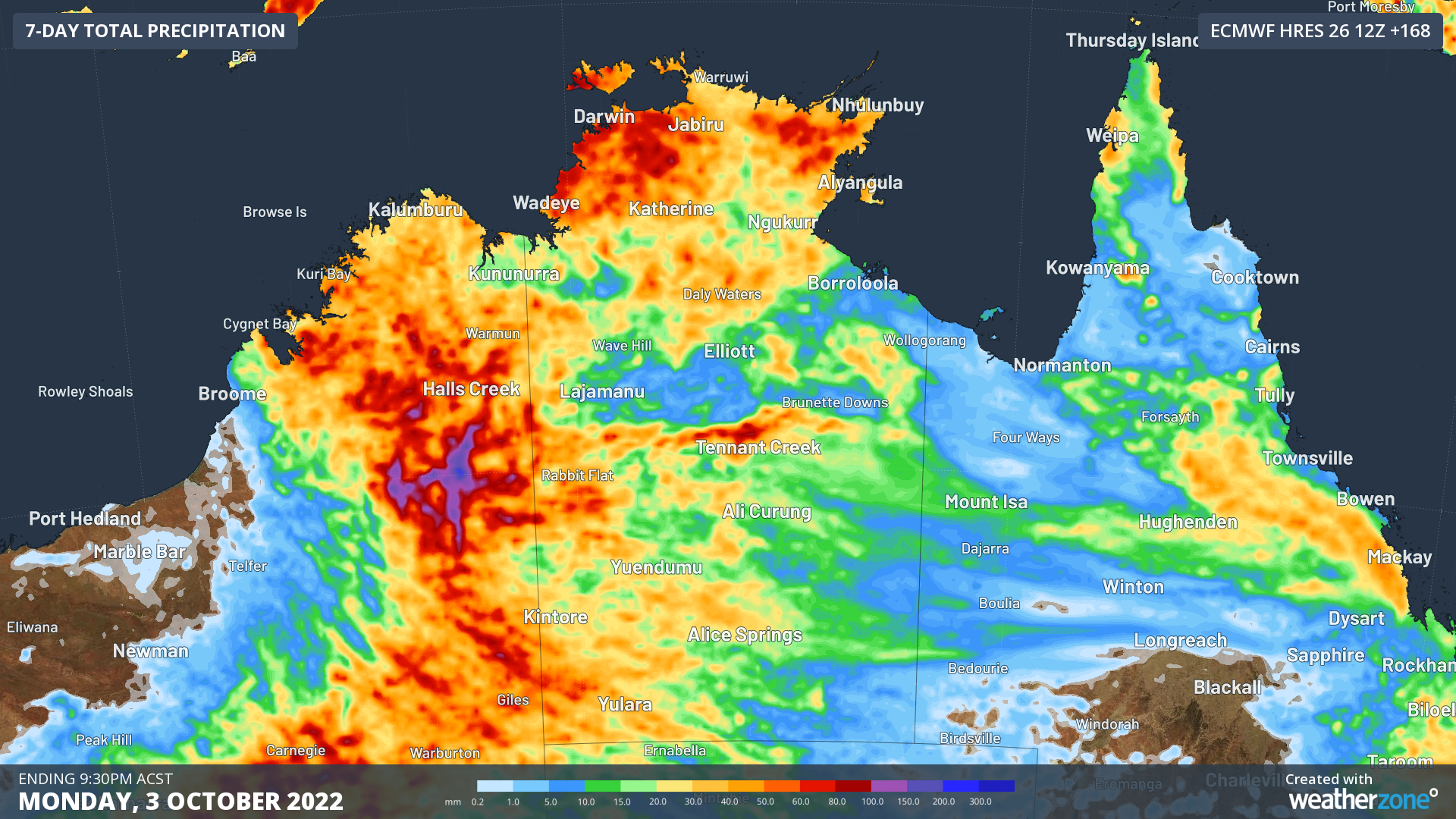
The build-up is well and truly underway in northern Australia, with showers and thunderstorms on the forecast for Darwin on most days in the coming week.
Northern Australia is currently coming out of its dry season and has entered the build-up, a time of year that is characterised by rising humidity and increasing rain and thunderstorms in the tropics.
The first rainfall of the season that is sufficient to stimulate plant growth is referred to as the ‘northern rainfall onset’. This is defined as the date when 50 mm or more rainfall has accumulated after September 1.
In a normal year, the northern rainfall onset typically occurs in parts of coastal Qld and the NT’s Western Top End around late October or early November, before spreading to other areas of Australia’s tropics in the following weeks.
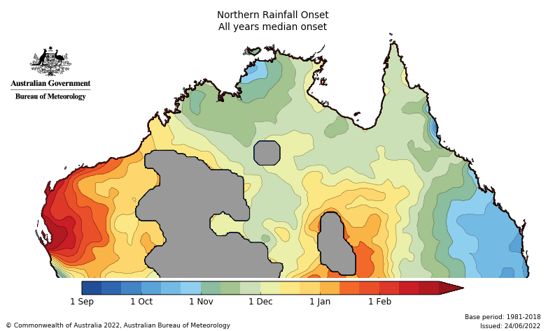
Image: Average northern rainfall onset dates. Source: Bureau of Meteorology
However, during La Niña periods, the rainfall onset usually comes a bit earlier than usual, typically around early-to-mid October for large areas of the NT, QLD and far northern WA.
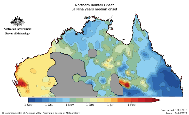
Image: Average northern rainfall onset dates during La Niña years. Source: Bureau of Meteorology
With La Niña currently in place in the Pacific Ocean, we are now entering the time of year that the northern rainfall onset typically occurs in.
And right on cue, forecast models show that rain and thunderstorm activity is likely to increase from later this week and persist into the opening days of October. The map below shows how much rain one forecast model is predicting across Australia’s northern tropics during the next seven days.
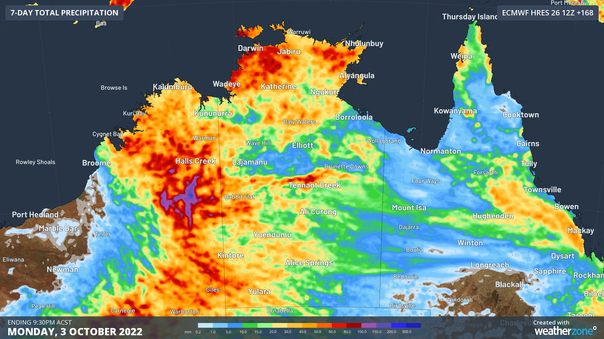
Image: Forecast accumulated rain between today (Tuesday) and Monday next week, according to the ECMWF-HRES model.
The heaviest rain over the tropics during the next week is likely to occur over WA’s North Interior and the NT’s Western Top End. Some inland areas of WA could receive 100 to 200 mm of rain over the next seven days, causing an abrupt end to the dry season.
For more information on the northern wet season and tropical cyclone forecast, please contact us at apac.sales@dtn.com.




