Prosper in a dynamic world
Search

Severe weather striking SA today


A cold front crossing South Australia today will produce a dangerous mix of damaging winds, rain and potentially severe thunderstorms.

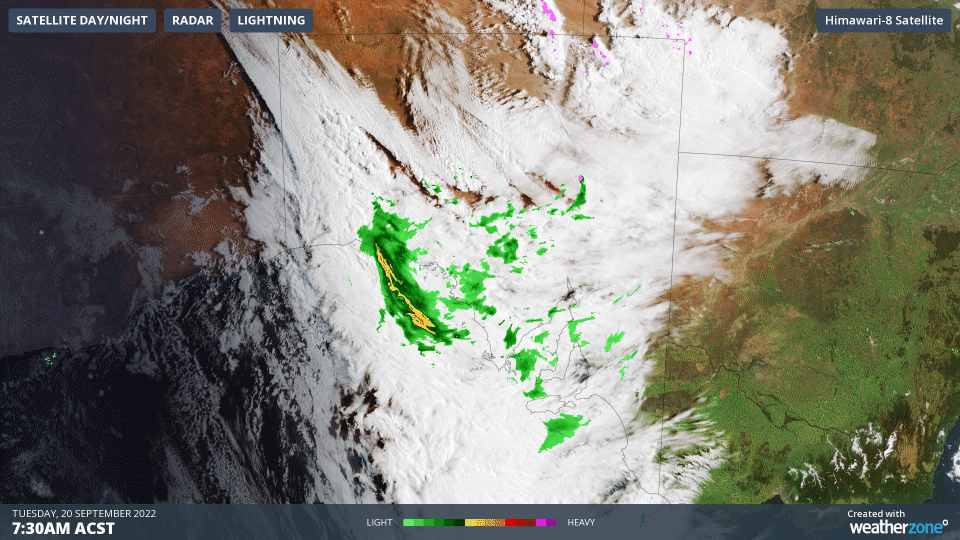
The animation below shows thick cloud passing over SA on Tuesday morning, causing rain and thunderstorms to spread over central and western parts of the state. This rain and thunderstorm activity is being caused by a cold front that is sweeping over the state from west to east.

Tuesday’s wet and stormy weather will affect most of SA before contracting to the state’s south and southeast on Wednesday morning, and then clearing into the afternoon.

Thunderstorms will mainly occur over the north and northeast of SA on Tuesday, with severe storms possible in the northeast during the afternoon and early evening.

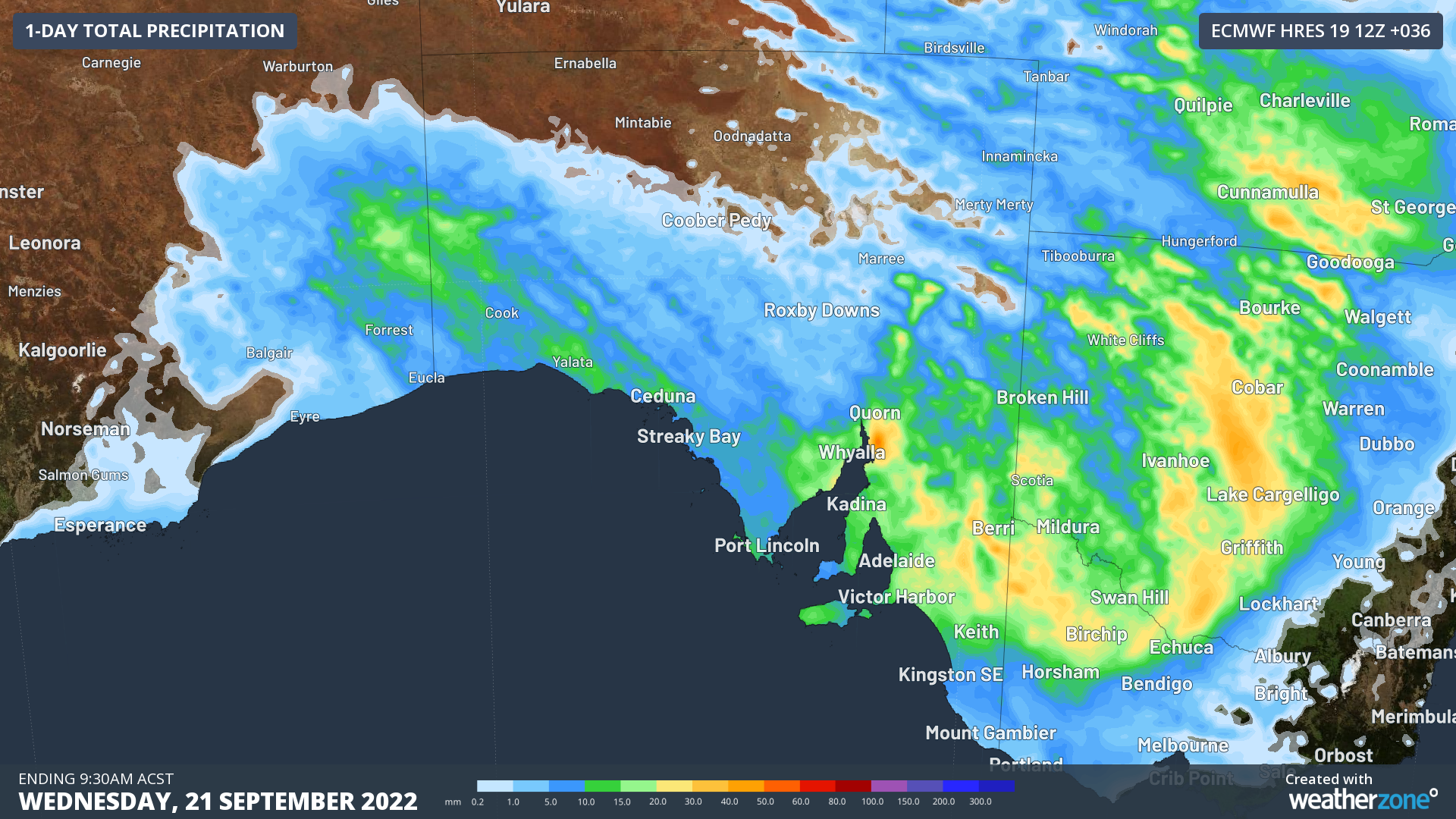
Parts of every district in SA should see about 5 to 15 mm of rain from this system, with higher isolated totals possible from the Flinders Ranges across to the Riverland and Murraylands districts.

Image: Forecast accumulated rain during the 36 hours ending at 9:30am ACST on Wednesday, September 21.

In addition to causing widespread rain and some thunderstorms, most of the state will also see blustery winds developing as the front sweeps across the state on Tuesday. The strongest winds are likely to occur over the northern interior, north of about Port Augusta, where a severe weather warning has been issued for damaging winds.

Calmer weather will return to SA from Wednesday as a high pressure ridge builds in the wake of Tuesday’s cold front. Weatherzone can help this severe thundertorm season with our thunderstorm forecasts, tracking and alerting, for more information, please contact us at apac.sales@dtn.com.

Latest news

Satisfy your weather obsession with these news headlines from around the nation, and the world.

Perth sets rainfall streak not seen in 18 years as water storage levels fall

For four months in a row, Perth has exceeded its average monthly rainfall – the first time this has happened in the traditionally wet winter and spring period since 2007. Perth reached its September average of 79.3mm during light showers on Tuesday and Wednesday. Another 13.2mm of rain then fell in the 24 hours to […]

DTN remote sensing captures rain and thunderstorms lashing Solomon Islands

Aviation, mining and shipping industries in the Solomon Islands and other South Pacific nations are often unable to use traditional radar to warn of incoming storms that disrupt operations and put workers in harm’s way. DTN APAC offers a suite of remote sensing weather solutions that give businesses and industries in remote areas around the […]

Negative Indian Ocean Dipole officially underway – here’s what it means for Australian businesses and industries

A negative Indian Ocean Dipole (IOD) event is now underway, increasing the likelihood of above average rain over large parts of Australia in the coming months. What is the Indian Ocean Dipole (IOD)? The IOD is an index used to monitor sea surface temperatures across the tropical Indian Ocean. It’s an important index for the […]

La Niña more likely this year after BoM switches to new index – what does this mean for Australian businesses?

The likelihood of La Niña occurring in 2025 has increased due to a change in the way the Bureau of Meteorology calculates sea surface temperature anomalies in the tropical Pacific Ocean. What is La Niña? La Niña refers to a distinct pattern of sea surface temperatures across the tropical Pacific Ocean. When La Niña is […]