
A confluence of wet-phase climate drivers will reduce the risk of bushfires across large areas of Australia this spring, although grassfires could still be prolific in some parts of the country.
The Australasian Fire and Emergency Service Authorities Council (AFAC) has today released Australia’s official Seasonal Bushfire Outlook for spring. The outlook brings together advice and information from AFAC, the Bureau of Meteorology and Australia’s state and territory fire authorities.
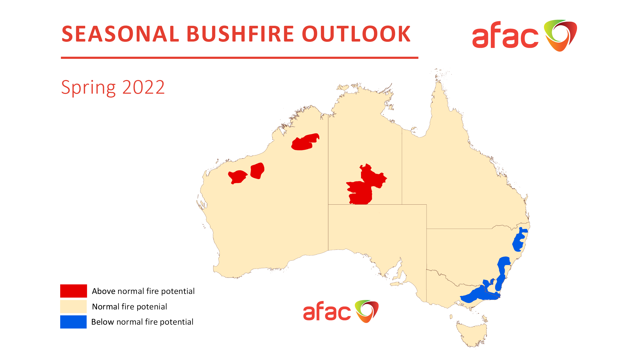
According to the outlook, most of Australia is expected to see near-normal fire potential this spring. However, as the map below shows, lower-than-average fire potential is predicted in parts of eastern NSW, Victoria and the ACT, while above-normal fire potential is forecast for parts of central and northwestern Australia.
This outlook is being influenced by several factors:
- Above average rainfall observed over large areas of northwestern, central and eastern Australia so far this year.
- This has resulted in above-average soil moisture over large areas of Australia at the end of winter.
- An ongoing negative Indian Ocean Dipole, predominantly positive Southern Annular Mode (SAM) and developing La Niña pattern will influence Australia’s weather in the coming months.
- These climate drivers are likely to cause an abnormally wet and cool spring for much of eastern Australia, and a warm and dry spring in large areas of Western Australia.
The blue shading on the map above shows where fire potential is lower-than-normal this spring. This includes areas of bushland that are still recovering from the 2018/19 and 2019/20 bushfire season. This recovering vegetation, combined with above-average soil moisture and rainfall, is likely to suppress the potential for large and uncontrollable forest fires in the coming months.
The red shading on the map above shows where fire potential is expected to be higher-than-average this spring. Rainfall in recent months has enhanced vegetation growth across these parts areas, which is now drying out and providing fuel for fires in the months ahead. For more information on Weatherzone’s seasonal forecasts, which include bushfire risk, please contact us at apac.sales@dtn.com.


