Prosper in a dynamic world
Search

Flooding rain imminent in WA

Heavy rain and thunderstorms will sweep over WA during the next 24 to 48 hours, with some areas likely to see enough rain to cause flooding.

A deep stream of tropical moisture interacting with a cold front will cause a rainband to move over the southwestern half of WA from late Monday and on Tuesday.

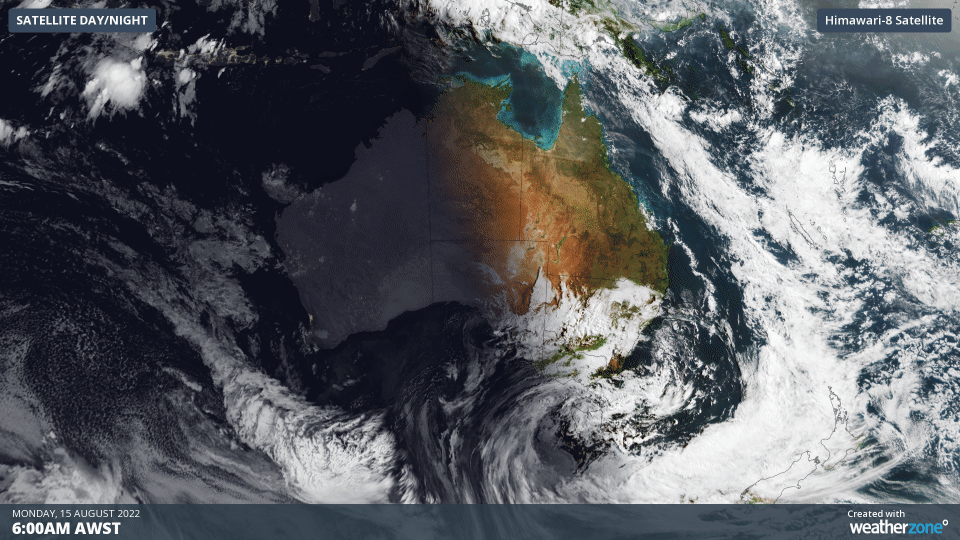
The satellite images below show the band of cloud and rain developing to the west of WA on Monday morning.

Rain will start to increase over the west coast of WA from Monday afternoon, becoming heavier and more widespread on Monday night.

By Tuesday morning, widespread rain with locally heavy falls will have extended inland towards the Central Wheat Belt and southern Goldfields Districts. Rain will then continue to progress further south and east during Tuesday, affecting parts of the inland Gascoyne, Goldfields and western Eucla Districts.

The map below shows how much rain one forecast model predicts during the 48-hour period ending at 8pm AWST on Tuesday.

Image: Forecast accumulated rainfall during the 48 hours ending at 8pm AWST on Tuesday, August 16, according to the ECMWF-HRES model.

The rainband will start to break down on Wednesday as it gets further away from the Indian Ocean and contracts towards the southeast corner of WA.

However, a separate low pressure system will deliver another burst of showers, thunderstorms and powerful winds across the state’s western and southwestern districts on Wednesday. This system is likely to cause small hail and blustery thunderstorms in some areas, with damaging winds a risk.

Areas of localised flooding and damaging winds are possible over a broad area of WA during the next three days, so be sure to stay up to date with the latest warnings in your area.

For more information about Weatherzone’s heavy rainfall and damaging wind forecasts, please contact us at apac.sales@dtn.com.

Latest news

Satisfy your weather obsession with these news headlines from around the nation, and the world.

High tropical cyclone risk near northern Australia this week

A tropical low currently developing over the Timor Sea has a high chance of becoming a tropical cyclone later this week, with a possibility of landfall somewhere in the Northern Territory or Western Australia. Key industries could be impacted including Ports, Mining, Transport, and Agriculture. The satellite images below show cloud circulating around the developing […]

Madden-Julian Oscillation increasing tropical cyclone potential for northern Australia industries

Sea surface temperatures exceeding 31°C off the coast of northern Australia and an active phase of the Madden-Julian Oscillation (MJO) are increasing the likelihood of early-season tropical cyclone activity, with hints of the season’s first tropical cyclone coming as early as next week. Tropical cyclones require sea surface temperature of 26.5°C or warmer to develop, […]

Tropical cyclone season begins with warm oceans surrounding northern Australia

The 2025-26 tropical cyclone season has begun with abnormally warm oceans surrounding northern Australia, signalling an increased risk for severe tropical cyclones in the coming months. The Australian tropical cyclone season runs from November 1 to April 30. During this six-month period, there are usually about 9 to 10 tropical cyclones in the Australian region, […]

7.8 million lightning pulses detected by DTN’s Total Lightning Network over Australia in one week

A barrage of thunderstorms battered large areas of eastern and northern Australia over the past week, producing close to 8 million lightning pulses across the country and more than 4 million over Queensland alone. DTN’s Total Lightning Network (TLN) detected around 7.79 million lightning pulses above Australia last week. This lightning was observed over every […]