Prosper in a dynamic world
Search

Already Sydney’s 8th wettest July and 9th wettest year on record


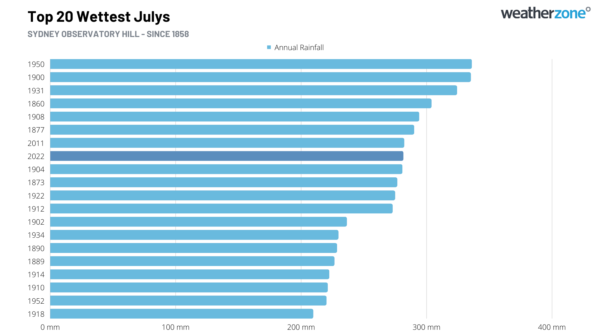
Sydney is now having its 8th wettest July and 9th wettest year in more than 160 years of records after picking up close to four months’ worth of rain in the opening week of July.

Sydney’s Observatory Hill weather station registered 281.4 mm of rain during the seven days ending at 9am on Thursday, July 7th. This one-week deluge is close to four times the city’s monthly average for July, and already its 8th highest July total in records dating back to 1858.

This incredibly wet start to July would have been newsworthy on its own. But the fact that it followed Sydney’s wettest first half of a year on record is phenomenal.

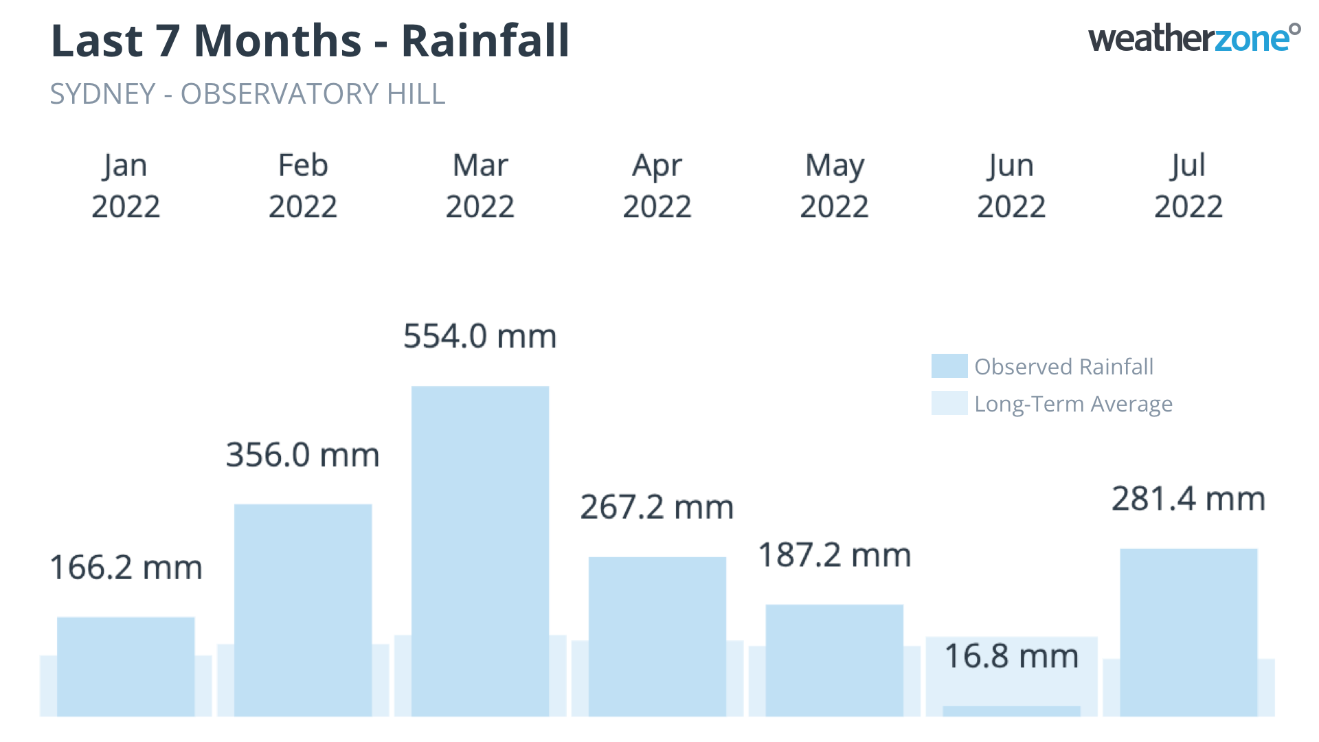
As of 9am on Friday, July 8th, Sydney had received about 1828.8 mm of rain since the beginning of 2022. This is around 615 mm above Sydney’s long-term annual average, and already the city’s 9th highest annual total in records dating back to 1859.

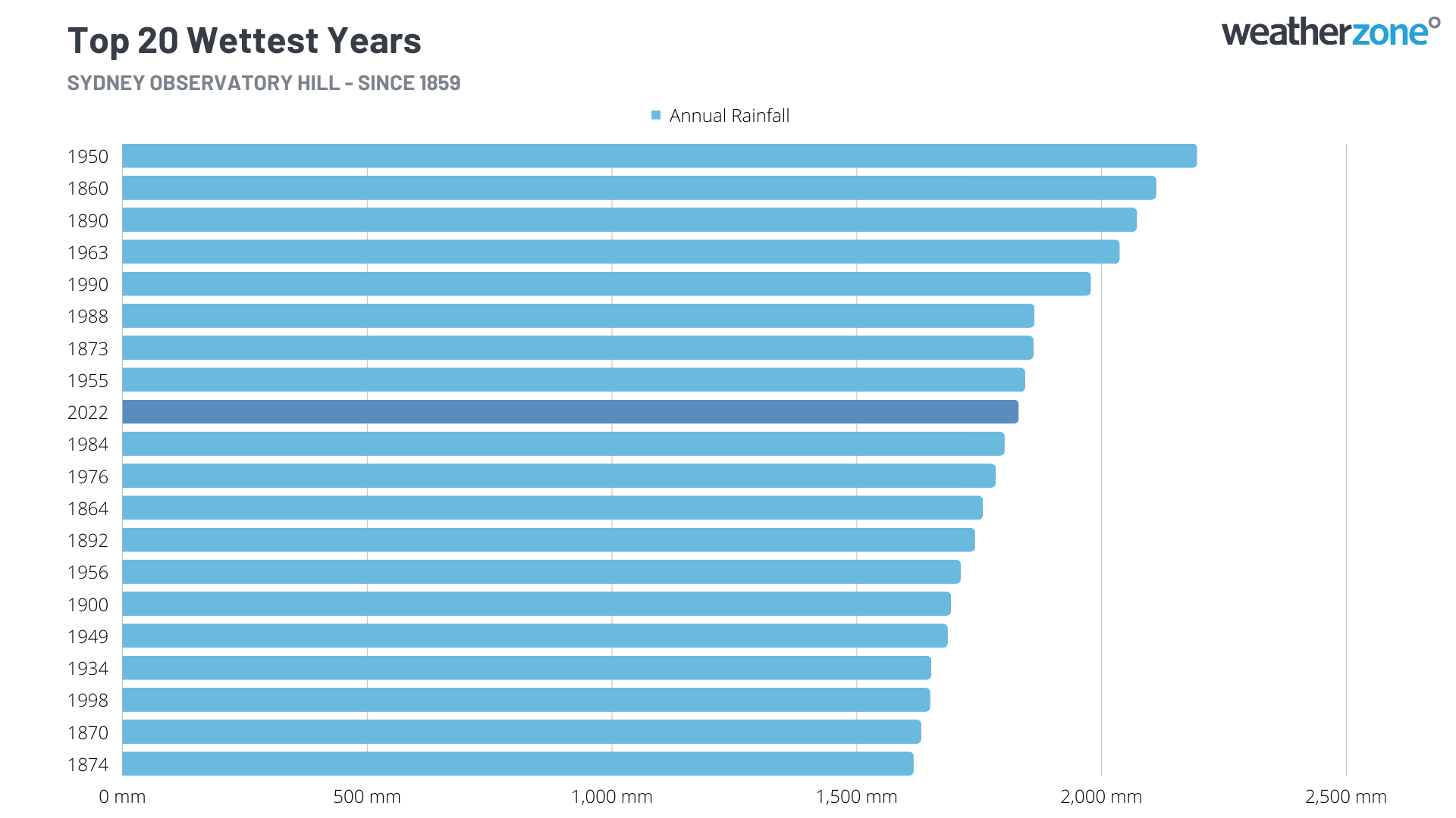
The graph below shows how extreme this year’s rainfall has been in Sydney. The current year-to-date rainfall total of 1828.8 mm, up to July 8th, is 249.7 mm higher than the previous record of 1579.1 mm to the same date in 1890.

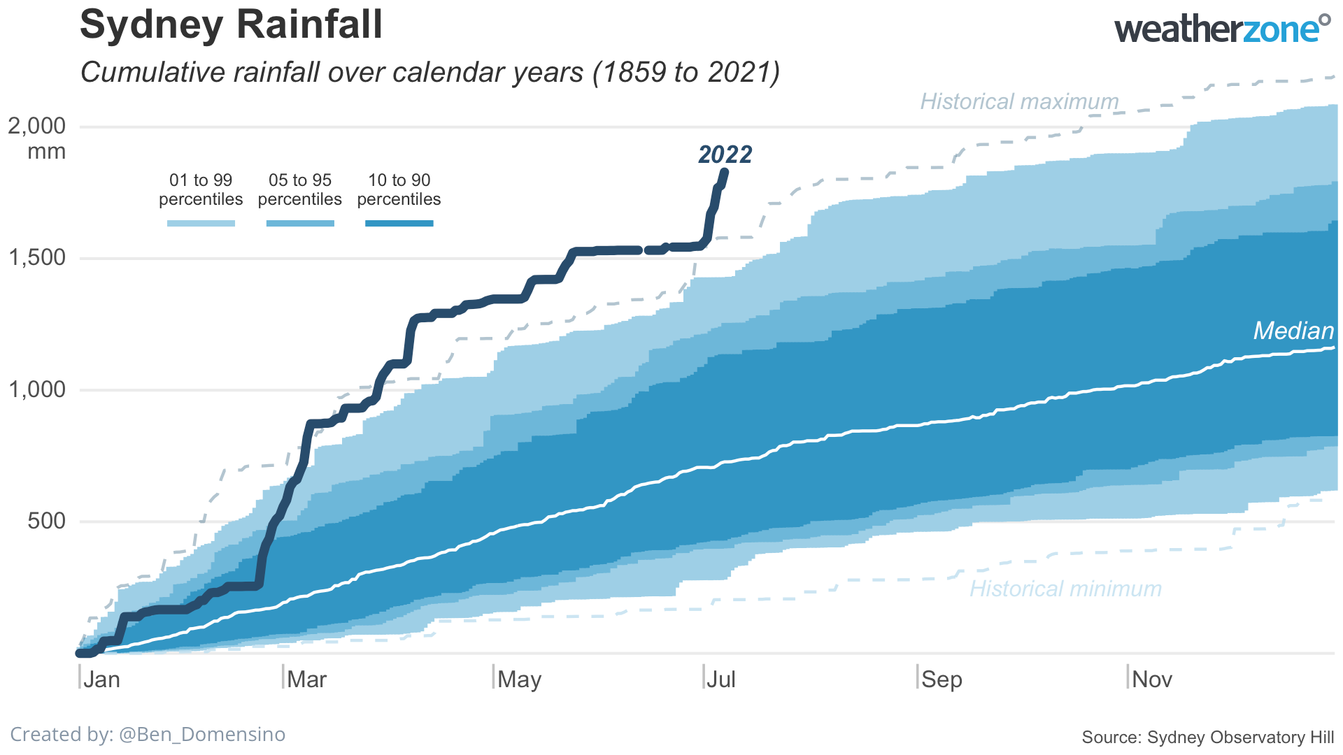
Sydney only needs to see another 55 mm of rain to make this month its wettest July on record, while another 365.3 mm before the end of 2022 would make this the city’s wettest year on record. Sydney’s long-term average rainfall between July 8th and December 31st is around 450mm, so 2022 is in with a fair chance of becoming the city’s wettest year in history. For more information on Weatherzone’s seasonal forecasts out to six months, please contact us at apac.sales@dtn.com.

Latest news

Satisfy your weather obsession with these news headlines from around the nation, and the world.

El Niño Is Here: What a Potential Record Event Means for Southeast Asia and Australia

  El Niño was officially declared in June 2026, raising the prospect of widespread impacts across Southeast Asia, from extreme heat and water shortages to higher energy demand and agricultural stress.   The World Meteorological Organization has warned countries to “prepare for it to be severe”, while several global forecast models suggest the event could rank among […]

How El Niño will shape Australian port operations in winter-spring 2026

Australian ports and marine pilots can expect a season of shifting wind and swell patterns through winter and spring 2026, as a developing El Niño brings the likelihood of drier conditions and more variable operating windows across the country’s coastline.  Will El Niño develop in 2026?  There are clear signs that an El Niño pattern is becoming […]

From Kimberley to northern NSW: Bushfire outlook flags risk for resources sector this winter

Bushfire risk doesn’t usually make headlines in June, but AFAC’s winter seasonal outlook is putting mining and resources operators on alert from the Kimberley to the NSW.  Australia’s official seasonal bushfire outlook for winter 2026 was released by AFAC on Thursday, May 28. The outlook predicts increased fire risk across the northern parts of the Great Sandy Desert and surrounds […]

The signal was there weeks earlier: forecasting one of the year’s biggest wind events

In mid-May 2026, DTN APAC meteorologists flagged a strengthening Southern Ocean pattern in model guidance, signalling an extended run of record-challenging wind conditions across the NEM.  Nearly three weeks later, NEM wind generation climbed from around 1.5GW to more than 9GW, supplying roughly one-third of the grid and coming within 1GW of the all-time generation record.  The event highlighted […]