Prosper in a dynamic world
Search

Decent snow for Tassie Hydro


Snow is already on the ground on Tasmania’s highest parts, ahead of two-to-three days of pretty decent late autumn snowfalls which should reach as low as 700 metres above sea level at times.

Up to 20 cm of snow could fall in total at higher levels of Tasmania’s Central Plateau and Western forecast districts, with lighter falls in the state’s eastern half in places like kunanyi/Mt Wellington above Hobart and the Ben Lomond Plateau near Launceston. This snowfall should provide decent hydro power for Tasmania as several cold fronts move across the region.

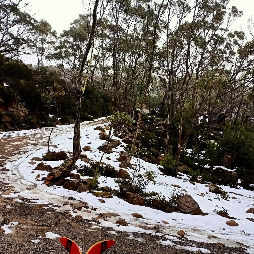
One Tassie local snapped a little snow on Monday morning on the dirt road up to Mt Mawson, about an hour-and-a-half from Hobart.

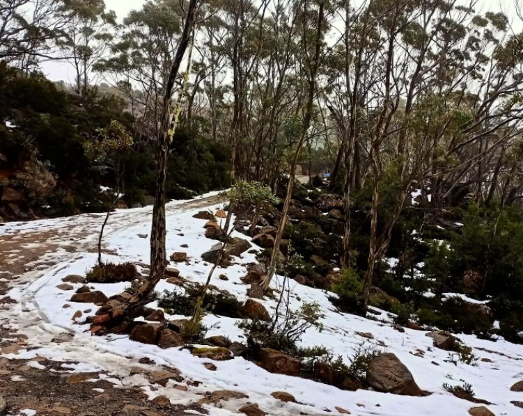
Image: Winter is coming. Source: @dailydoseofTassie via Instagram.

Meanwhile, if you look closely at the live snow cam image a little higher up the hill at the tiny club-run skifield of Mt Mawson (captured while we were writing this story around 10 am on Monday morning), you can actually make out a few flakes falling.

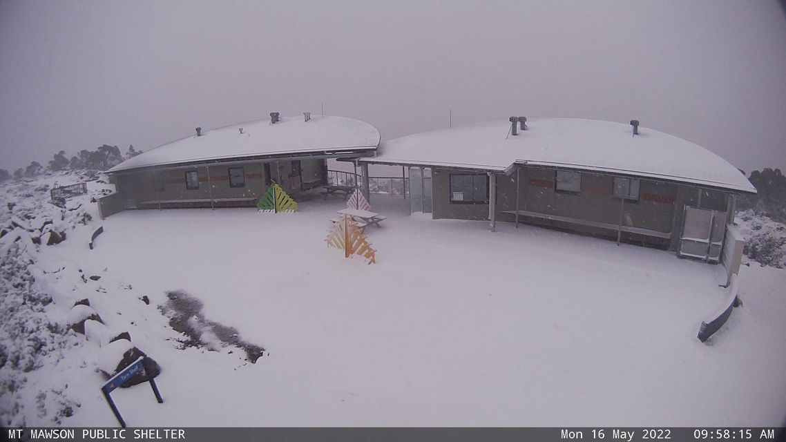
Image: OK, who else really feels like a snow trip now? Source: Mt Mawson.

This weather system is what some snow enthusiasts call a “clipper”, as in, a cold front that clips the very southern tip of mainland Australia – a set-up which is illustrated well on this morning’s synoptic chart.

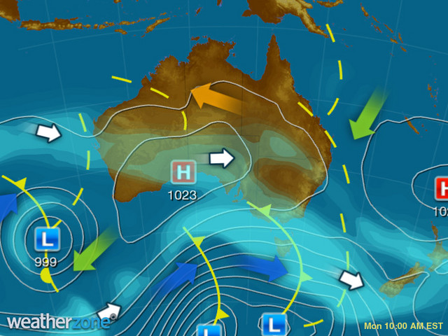
As you can also see on the chart, a second front (currently south of the Bight) is due within the next 24 hours. Like the first front, it will also have a much stronger impact on Tasmania than the mainland.

So while there’s not much love in these two fronts for mainland hydro facilities, it’s at least the sort of westerly weather system which provides the hope of greater things ahead as winter approaches.

Meanwhile Hobart is in for a chilly and showery week as you’d expect. While rain totals likely won’t add up to more than a few millimetres, maximum temps should stay below 15°C until at least Friday. For more information on Weatherzone’s short term and seasonal snow and precipitation forecasting, please contact us at apac.sales@dtn.com.

Latest news

Satisfy your weather obsession with these news headlines from around the nation, and the world.

How does DTN help businesses monitor bushfire induced pyrocumulonimbus thunderstorms that ignite more fires?

Intense heat from bushfires during elevated fire danger days can trigger fire-induced pyrocumulonimbus thunderstorms that ignite additional fires. In early January 2026, an extreme heatwave sweeping over southeastern Australia brought catastrophic fire danger to Victoria. Intensely hot bush and grass fires spread erratically and quickly in hot, dry and gusty winds, with pyrocumulonimbus generating lightning, […]

Active seas to the north and east of Australia disrupting port and maritime operations

Seas to the north and east of Australia are experiencing periods of increased activity this week, leading to disruptions to port, maritime and offshore operations. Intense and hazardous Tasman Sea Ocean conditions across NSW’s South Coast rapidly deteriorated last Friday as a deep feed of easterly winds whipped up large and dangerous seas. The Batemans […]

Transport, emergency and energy industries flooded across Greater Sydney with weekend deluges

Transport, emergency, energy and port industries in eastern NSW and Sydney were impacted by significant flash flooding with intense and heavy rainfall this weekend. Rainfall rates between 80 and 140mm in one to three hours were registered across parts of Sydney’s Northern Beaches and Central Coast on Saturday afternoon and evening. In some areas, these […]

DTN Dangerous Thunderstorm Alerts in action with severe thunderstorms disrupting Perth industries

Severe thunderstorms impacted southwest WA and the Perth region on Sunday, December 14, 2025, triggering Dangerous Thunderstorm Alerts (DTA) by DTN for industries and businesses in the region. DTN operates Dangerous Thunderstorm Alerts (DTA) which alert businesses and industries to thunderstorms based on intensity and movement. These alerts provide advanced notice of thunderstorms moving into […]