Prosper in a dynamic world
Search

Indian Ocean cloudband soaking the Pilbara


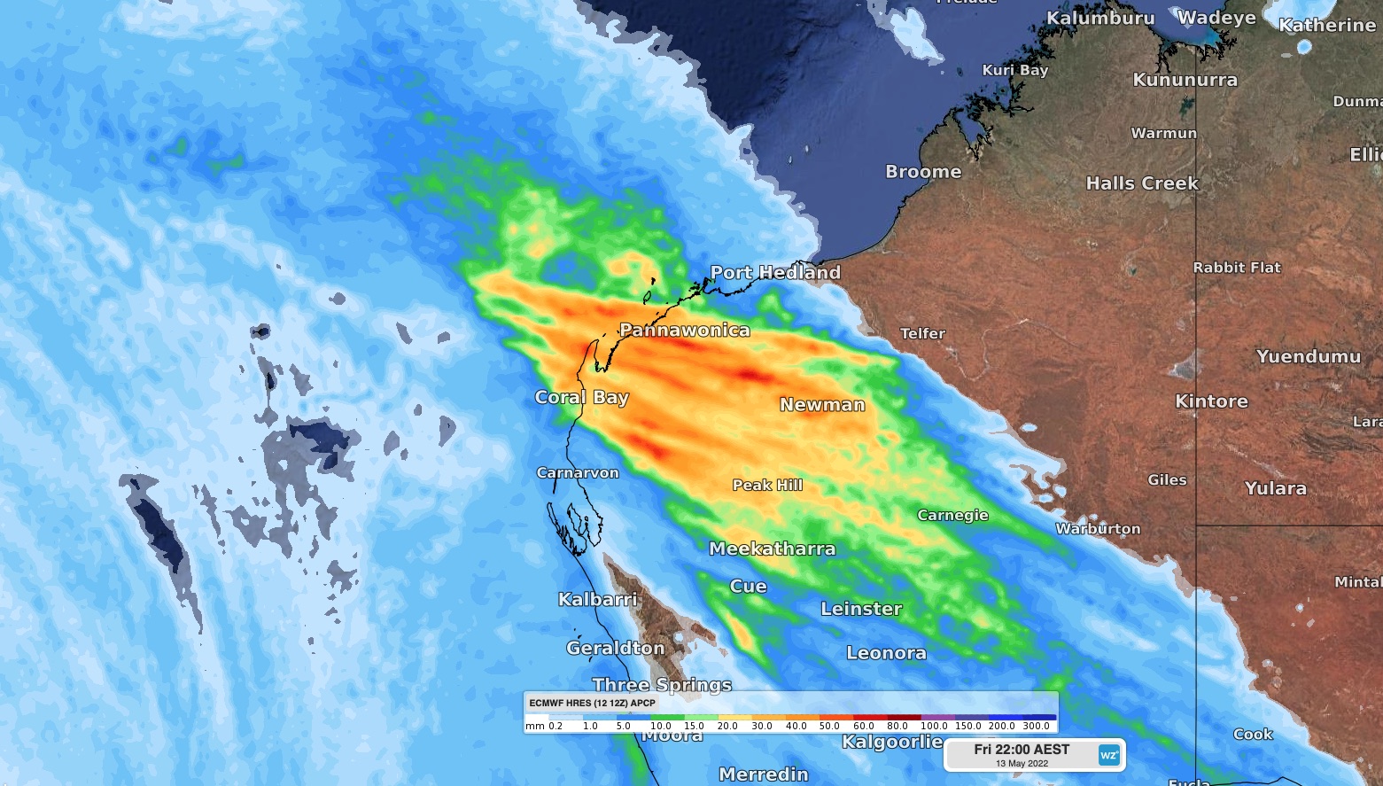
A month’s worth of rain has fallen in parts of the west Pilbara during the last 24 hours as a rainband from the Indian Ocean sweeps over northwestern Australia.

Moisture from Ex-Tropical Cyclone Karim interacting with a strong cold front caused a thuck band of rain-bearing cloud to drift over the Gascoyne and western Pilbara districts of WA on Thursday into Friday morning.

Onslow in the Pilbara saw 49.8 mm of rain in the 24 hours to 9am on Friday, which is roughly equal to the site’s May monthly average and its highest daily total in a year. Nearby, Thevenard Island observed 43.2 mm and Learmonth, to the south of Exmouth, saw 31.6mm in the same period.

A damaging wind gust was also observed this morning at Varanus Island, with the station recording a 113 km/h gust at 7:10am WST.

The band of rain and thunderstorms will continue to spread from west to east over the Pilbara, eastern Gascoyne and Interior on Friday. A severe weather warning has been issued for heavy rain and damaging winds in parts of the Pilbara, where six hourly rainfall rates of 60 to 120 mm and wind gusts of 90 km/h are possible, particularly with thunderstorms.

Conditions will rapidly ease behind the band of rain and storms and calmer weather will return to the north of WA from Saturday. Weatherzone provides our mining clients with heavy rain, damaging wind and thunderstorm risk analysis out to seven days, for more information please contact us at apac.sales@dtn.com.

Latest news

Satisfy your weather obsession with these news headlines from around the nation, and the world.

Perth sets rainfall streak not seen in 18 years as water storage levels fall

For four months in a row, Perth has exceeded its average monthly rainfall – the first time this has happened in the traditionally wet winter and spring period since 2007. Perth reached its September average of 79.3mm during light showers on Tuesday and Wednesday. Another 13.2mm of rain then fell in the 24 hours to […]

DTN remote sensing captures rain and thunderstorms lashing Solomon Islands

Aviation, mining and shipping industries in the Solomon Islands and other South Pacific nations are often unable to use traditional radar to warn of incoming storms that disrupt operations and put workers in harm’s way. DTN APAC offers a suite of remote sensing weather solutions that give businesses and industries in remote areas around the […]

Negative Indian Ocean Dipole officially underway – here’s what it means for Australian businesses and industries

A negative Indian Ocean Dipole (IOD) event is now underway, increasing the likelihood of above average rain over large parts of Australia in the coming months. What is the Indian Ocean Dipole (IOD)? The IOD is an index used to monitor sea surface temperatures across the tropical Indian Ocean. It’s an important index for the […]

La Niña more likely this year after BoM switches to new index – what does this mean for Australian businesses?

The likelihood of La Niña occurring in 2025 has increased due to a change in the way the Bureau of Meteorology calculates sea surface temperature anomalies in the tropical Pacific Ocean. What is La Niña? La Niña refers to a distinct pattern of sea surface temperatures across the tropical Pacific Ocean. When La Niña is […]