Tropical cyclone Charlotte may move closer to Australia’s west as it weakens this weekend, potentially bringing damaging winds and rain to some western parts of WA.
While Charlotte deepened rapidly on Tuesday to a category four severe tropical cyclone, it is now weakening and was downgraded to category two system early on Thursday morning.
At 6am AWST on Thursday, Charlotte spinning around 500km to the northwest of Coral Bay and moving slowly towards the southwest.

Image: Enhanced infrared satellite image showing Tropical Cyclone Charlotte off the northwest coast of WA at 6:10am AWST on Thursday, March 24.
Charlotte is expected to weaken further during the next 24 to 48 hours as it tracks towards the south, most likely dropping below tropical cyclone strength on Thursday night or early Friday morning. However, gale force winds and heavy rain should persist near the center of the weakening cyclone for the next few days.
There is a large amount of uncertainty around Charlotte’s future track. Computer models agree that the system will weaken below tropical cyclone strength and move further south from Friday into the weekend. However, it is unknown whether the ex-tropical cyclone will remain offshore or approach the coast. 

Images: Comparison of the predicted location of ex-tropical cyclone Charlotte at 5am AWST on Sunday, March 27. These images show forecast 24-hour accumulated rain and mean sea level pressure from the ECMWF (top) and GFS (bottom) models.
Given this model uncertainty, there is potential for ex-tropical cyclone Charlotte to impact the west coast of WA anywhere between Carnarvon and Lancelin from this weekend into early next week.
If it does approach the coast, damaging winds and heavy rain could develop. However, the system may also remain offshore and spare WA from any severe weather impacts.
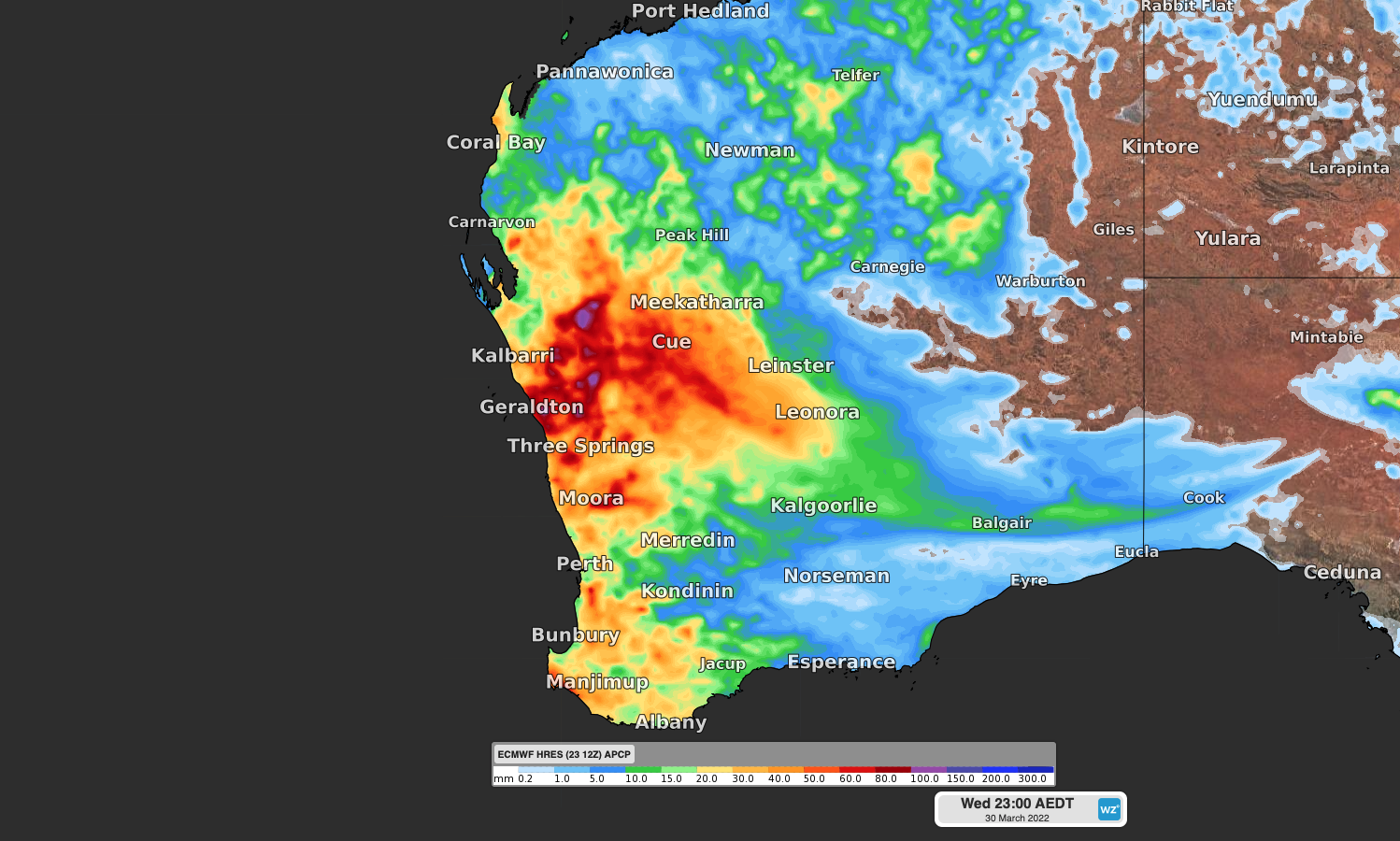
Regardless of whether Charlotte approaches the coast or remains offshore tropical moisture being dragged south by this system should bring some much needed rain to dry WA.

Image: Forecast accumulated rain over the next week (7 days ending on Wednesday, March 30), according to the ECMWF model.
More reliable model information should become available during the next 48 hours, giving us a better idea about if, and how, Charlotte will affect WA. For more information, please contact us at apac.sales@dtn.com.


