An overnight deluge has kicked off what is going to be a very wet four days in southeast Queensland and northeast NSW, with major flooding already occurring and likely to become more widespread in the coming days.
A deep layer of moisture-laden air feeding into a low-pressure trough caused heavy rain and thunderstorms to develop over southeast QLD on Tuesday night.
The animation below shows the onset of this rain after a relatively dry day on Tuesday, with thunderstorms also visible further inland across Queensland’s southern inland.
Video: Composite radar and satellite showing rain and thunderstorms developing over southeast Queensland.
Most rain gauges between Gympie and Caboolture received more than 100mm of rain during the 24 hours to 9am on Wednesday, with most of this falling overnight.
The heaviest rain fell near Gympie, where Mount Wolvi collected 388mm in the nine hours ending at 3am, which contributed to a total of 424mm up to 9am. Nearby, 419mm fell at Beenham Valley Road during the 24 hours to 9am on Wednesday. This was more than twice its monthly average and its heaviest daily rain in 30 years.

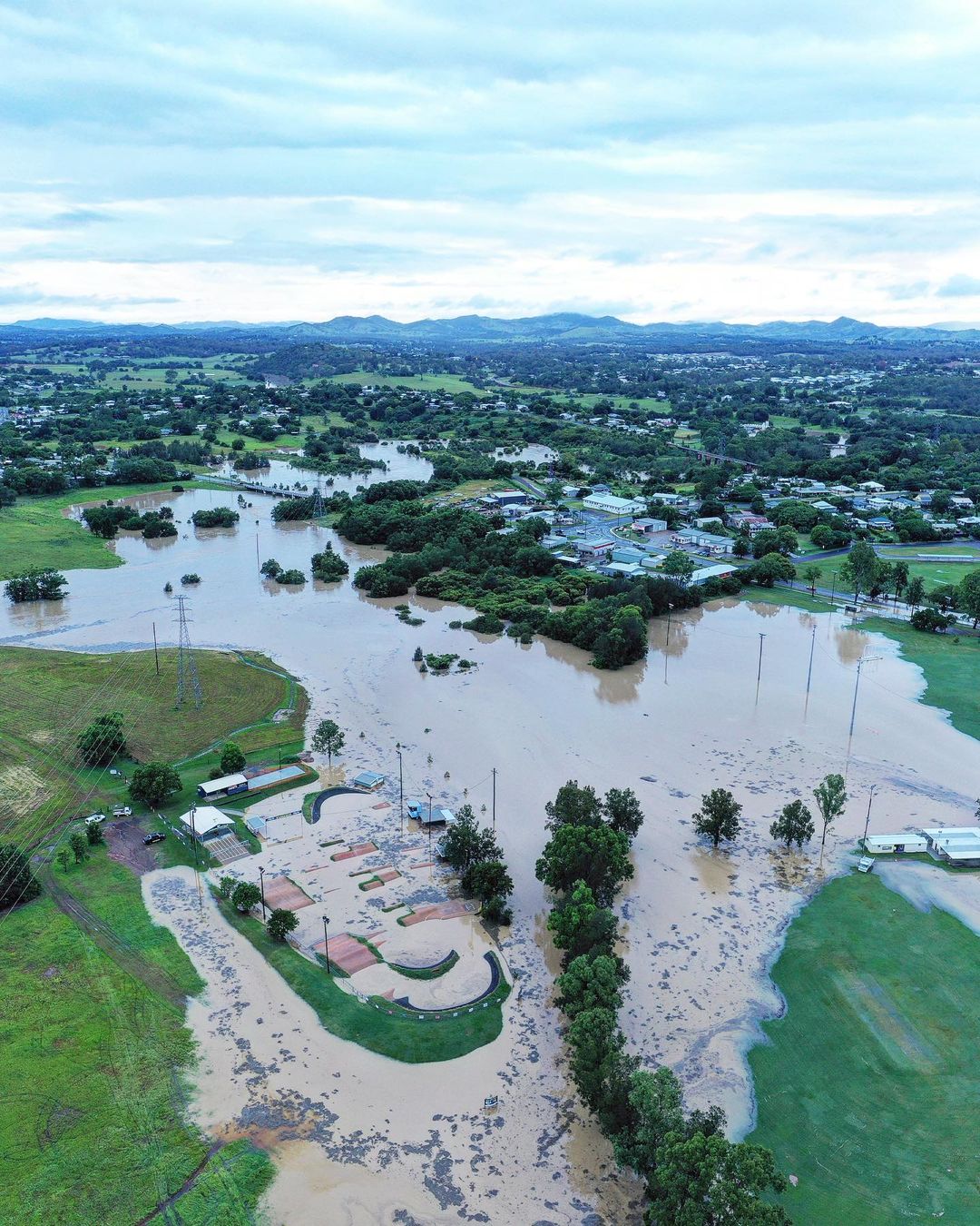
Image: Gympie on Wednesday morning. Source: @gympie_weather_and_floods / Instagram
Unsurprisingly, this overnight deluge caused creeks and rivers to bulge, with major flooding still occurring in some areas this morning. The Tinana Creek and Tagigan Road rose by seven metres in seven hours overnight, covering the bridge with more than four metres of water. Moderate flooding is also expected to occur at Gympie on Wednesday afternoon.
Rain and embedded thunderstorms will continue to affect southeast Queensland and far northeast NSW on Wednesday, with rain rates intensifying from the afternoon as the low pressure trough deepens further.
Forecast models suggest that this wet and stormy weather will persist into Thursday, Friday and possibly Saturday across southeast QLD and northeast NSW as an upper-level trough passes over the region.
Accumulated multi-day rainfall totals of 200-500mm are likely from this event, with localised falls of around one metre a risk in some areas.
The maps below show how much rain three different computer models are predicting during the next four days.

Image: Forecast model comparison of predicted accumulated rainfall between Thursday and Saturday.
This much rain will cause both flash and riverine flooding, so be sure to check the latest flood and weather warnings in your area.
For more information on Weatherzone’s heavy rainfall alerts, please contact us at apac.sales@dtn.com.


