Prosper in a dynamic world
Search

Temporary heat relief imminent for Perth


Perth’s summer temperature see-saw will continue this week, with temperatures about to drop in the city before another round of heat returns later in the week.

Perth has had a notably hot start to summer, with the city late last month registering four consecutive days over 40°C for only the third time on record.

This month, Perth has already had five days in the mid-to-high thirties and the mercury should reach around 36°C again on Wednesday afternoon.

Fortunately for those that don’t like the summer heat in Perth, this latest bout of warm weather won’t last much longer.

Cooler west to southwesterly winds should keep daytime maximum temperatures under 30°C in Perth from Thursday until at least Saturday, a few degrees below average for this time of year.

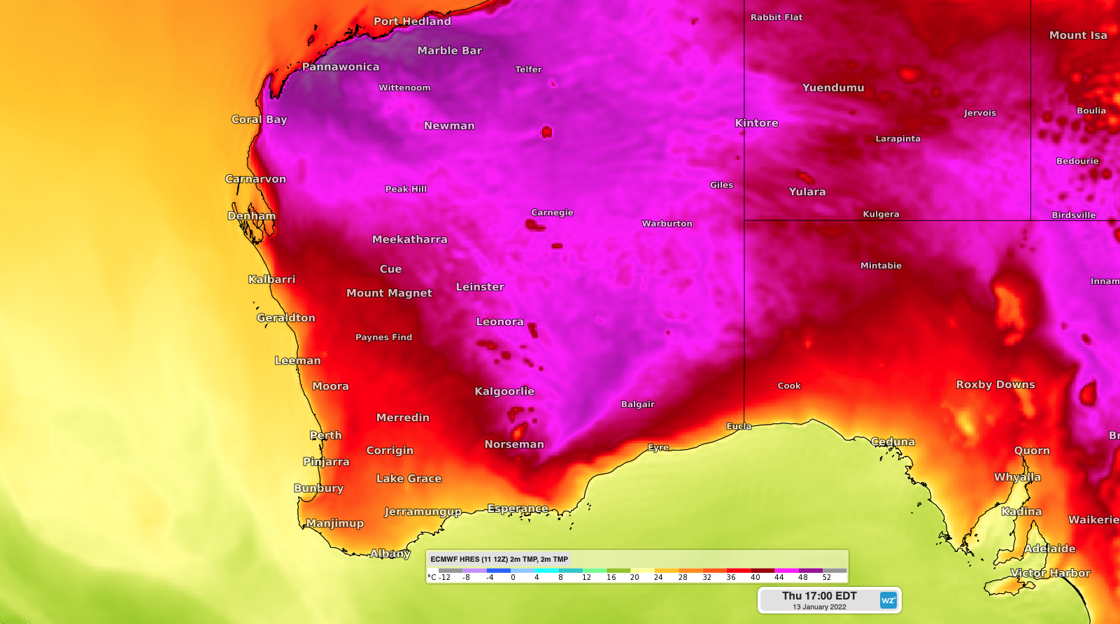
Image: Forecast surface air temperature on Thursday afternoon, January 13, 2022, according to the ECMWF-HRES model.

However, another burst of warm weather is already looming on the horizon, with temperature set to rebound to the high-thirties and possibly low-forties early next week. There are early signs that most days next week could reach around 38 to 40°C.

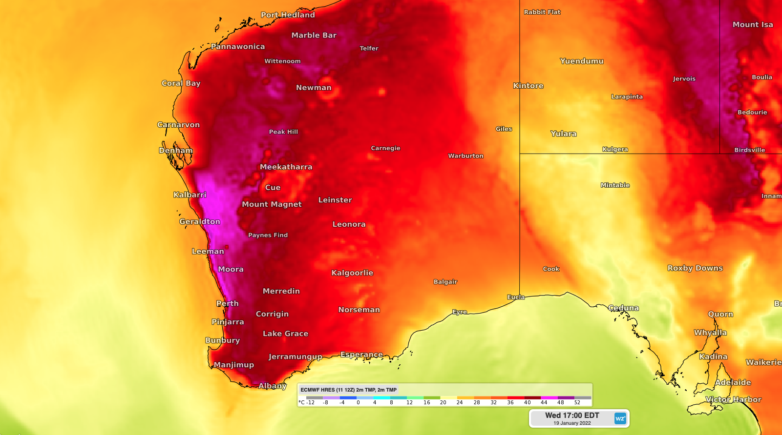
Image: Forecast surface air temperature on Wednesday afternoon, January 19, 2022, according to the ECMWF-HRES model.

Up until the start of this week, Perth was the only capital city in Australia to have seen a 40°C day so far this summer. However Adelaide joined the club on Tuesday with a top of 40.3°C.

Dangerous heat is also affecting other parts of WA this week, with a Severe to Extreme heatwave predicted for some northern and interior parts of the state.

Unfortunately, this intense heat will contribute to Extreme to Catastrophic fire danger ratings in the coming days. For more information on Weatherzone’s energy forecasts, please contact us at apac.sales@dtn.com.

Latest news

Satisfy your weather obsession with these news headlines from around the nation, and the world.

NSW faces low energy reserves amid scorching heat

A sweltering inland air mass will filter across NSW on Sunday, bringing scorching autumn heat that could cause challenges across the energy market. This heat will be drawn from the Australian interior by a broad low pressure trough and cold front crossing the country’s southeast, leading to increasingly hot temperatures into the weekend. The hottest […]

Why Thailand’s main airports have no cross runways

Nearly all of Thailand’s airports either have single or parallel runways, so how do monsoonal bursts affect the airport operations and why do they rarely need cross runways?  Like most countries in the tropics, a seasonal reversal in the winds occurs with the shift in the monsoon. This makes infrastructure planning during an airport’s construction […]

Ex-Tropical Cyclone Alfred leaves nearly half a million without power in southeast Queensland and northeast NSW

Ex-Tropical Cyclone Alfred brought intense rainfall and strong winds over the weekend, leaving about 450,000 homes across southeast Queensland and northeast NSW without power.  The video below shows heavy rainfall impacting southeast Queensland and northeast NSW on Sunday evening as the remnants of Tropical Cyclone Alfred moved inland.  Image: Six-hour radar and satellite loop to […]

NSW businesses to feel the aftermath of Alfred this weekend

While southeast Qld is bracing for dangerous weather from Tropical Cyclone Alfred, heavy rain that may cause flooding in the coming days will likely impact transport operations in the coming days across NSW. The video below shows Alfred crossing the coast near or to the south of Brisbane and rapidly weakening over land to a […]