Amid our planet’s fourth warmest November in 142 years of records, Antarctica’s sea ice extent dipped to its second smallest November level in the satellite era.
Despite the cooling effect of La Niña, the global surface temperature in November 2021 was 0.91ºC warmer than the 20th century average, according to data released by the U.S. National Oceanic and Atmospheric Administration (NOAA). This is Earth’s fourth warmest November in records dating back to 1880, beaten only by 2015 (+1.01ºC), 2020 (+0.96ºC) and 2019 (+0.92ºC).

Image: Global mean land and ocean November surface temperature anomalies. Source: NOAA
Last month’s heat was unevenly distributed across the globe, with Africa registering its warmest November on record and Australia having its coolest November in 22 years. But when averaged out, the planet’s surface temperature last month was almost a degree warmer than it was during Novembers in the 20th century.
A large portion of the Pacific Ocean was also kept cooler than-average by La Niña last month. However, this local cooling paled in comparison to the immense amount of heat being stored in our oceans in response to our warming atmosphere.
OCEAN HEAT CONTENT UPDATE: Global Ocean Heat Content (OHC) for July-September 2021 is the highest July-September OHC on record, which extends back to 1955. https://t.co/tBc97013aA pic.twitter.com/FkPhf4sHiY
— NOAA NCEI (@NOAANCEI) December 14, 2021
According to the NOAA National Centres for Environmental Information, global ocean heat content in the top 700 metres of the ocean during July-to-September 2021 was the highest on record for July-to-September period.
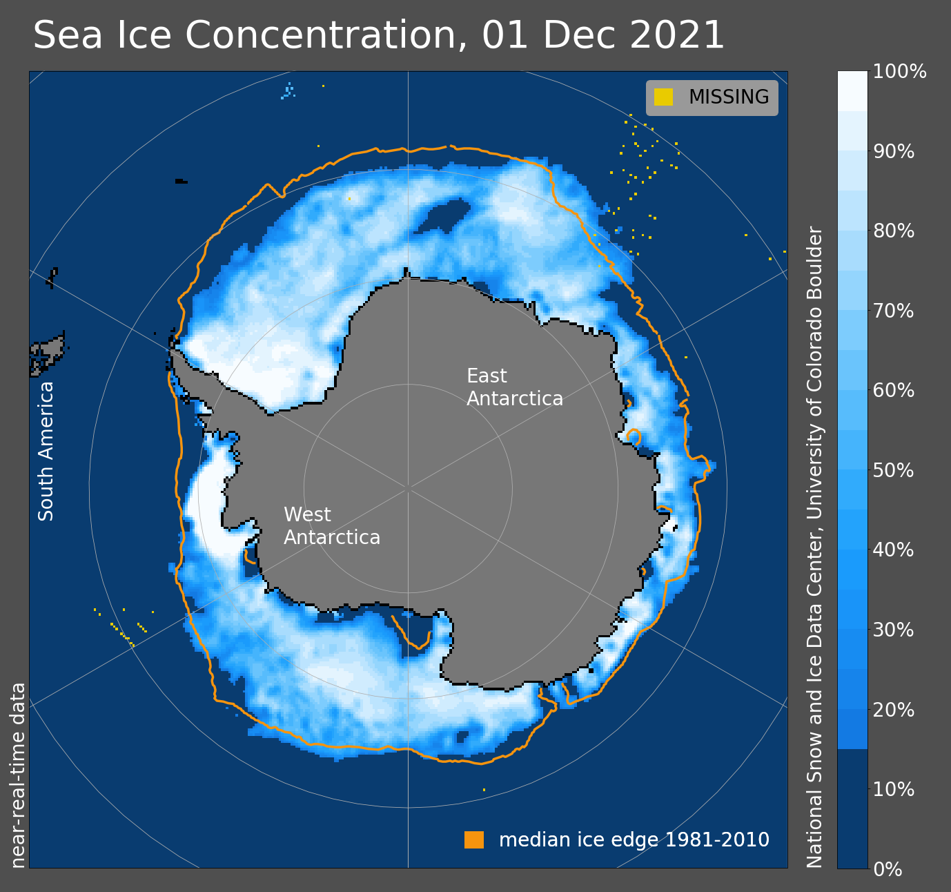
Sea ice around Antarctica also declined rapidly in spring, and by the end of November, it had reached its second smallest level for November in 43 years of satellite records.

Image: Antarctic sea ice extent at the beginning of December, 2021. Source: National Snow and Ice Data Center, University of Colorado, Boulder.
With only one month left to go, 2021 is on track to be one of Earth’s ten hottest years in just over 14 decades of data. For more information, please contact us at apac.sales@dtn.com.


