
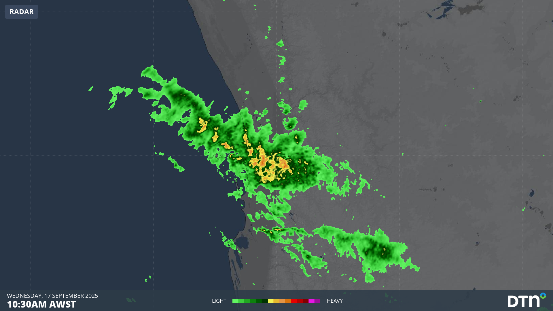
For four months in a row, Perth has exceeded its average monthly rainfall – the first time this has happened in the traditionally wet winter and spring period since 2007.
Perth reached its September average of 79.3mm during light showers on Tuesday and Wednesday. Another 13.2mm of rain then fell in the 24 hours to 9am Thursday – most of it in a brief burst before midday yesterday – bringing this month’s running total to a healthy 93.8mm.
That means that over the last four months, Perth has received:
- June: 129.8mm (average 127.2mm)
- July: 174.4mm (average 147.8mm)
- August: 203.8mm (average 122.7mm)
- September: 93.8mm and counting (average 79.3mm)
Video: The combined radar and satellite loop for the four hours to midday (AWST) on Wednesday, September 17, 2025, shows how a fast-moving band of moisture scored a direct hit on the Perth metro area.
Perth’s recent rainy streak is obviously a good news story. The city receives the vast majority of its rainfall in the period from late autumn to early spring, so this is when locals hope for all the rain they can get.
READ MORE: Perth approaching winter rainfall streak not seen in 3 decades
But it’s worth remembering that the previous seven months from November 2024 to May 2025 all saw below-average rainfall totals. Indeed, most of WA’s South West Land Division has experienced ongoing rainfall deficits in recent years.
That’s illustrated dramatically in the image below, which shows rainfall deciles in Western Australia over the four-year period from the start of September 2021 to the end of August 2025.
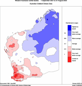
Image: The southwest corner of WA has been much drier than average of the last four years, despite this year’s relatively wet winter. Source: BoM.
As you can see, most of WA’s South West Land Division is experiencing ongoing rainfall deficits, including Perth. That helps explain why the city’s combined water storage was just 48.1% of capacity as of this Tuesday, September 16.
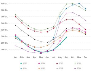
Image: Perth’s water storage levels for 2025 continue to trend below recent years despite solid winter and early spring rainfall in 2025. Source: WA Water Corporation.
If rainfall deficiencies and low water storage levels extend into summer, drought conditions, increased bushfire risk and water constraints could affect many WA businesses and industries, including agriculture, forestry, emergency services and transport.
Meanwhile Perth can expect dry weather for at least the next week or so, with a good chance of the first 30-degree day of the season next Wednesday.
How DTN APAC’s Stormtracker can help your business
Embedded in DTN APAC’s industry interfaces, the system gives you a time advantage when monitoring conditions developing over your infrastructure and location.
Stormtracker is our Global Information System (GIS) tracking tool, providing multiple weather layers and zoom controls overlaid on a map of your location and infrastructure. You can choose a snapshot or full screen view, depending on your requirements. The maps allow you to monitor all weather, and specifically any systems likely to cause risk for your business. You also have the capacity to observe:
- real time lightning and thunderstorm alerts
- localised lightning strike frequency
- official warnings for storm, cyclone, wind, flood and fire
- sentinel hotspot fires and fire agency current incidents
Stormtracker’s radar imagery updates every 5 minutes, so you are always able to respond rapidly to changing conditions. You can customise alerting to notify you when your staff or infrastructure are under threat. With increased situational awareness, your ability to make informed decisions quickly is optimised.
DTN APAC’ experience and intelligence gives you a clear path through complex situations. Let us assist you, offering actionable insight when extreme weather poses risk to your business.
Learn more about our large range of industry leading products and services or email us at sales.apac@dtn.com




