
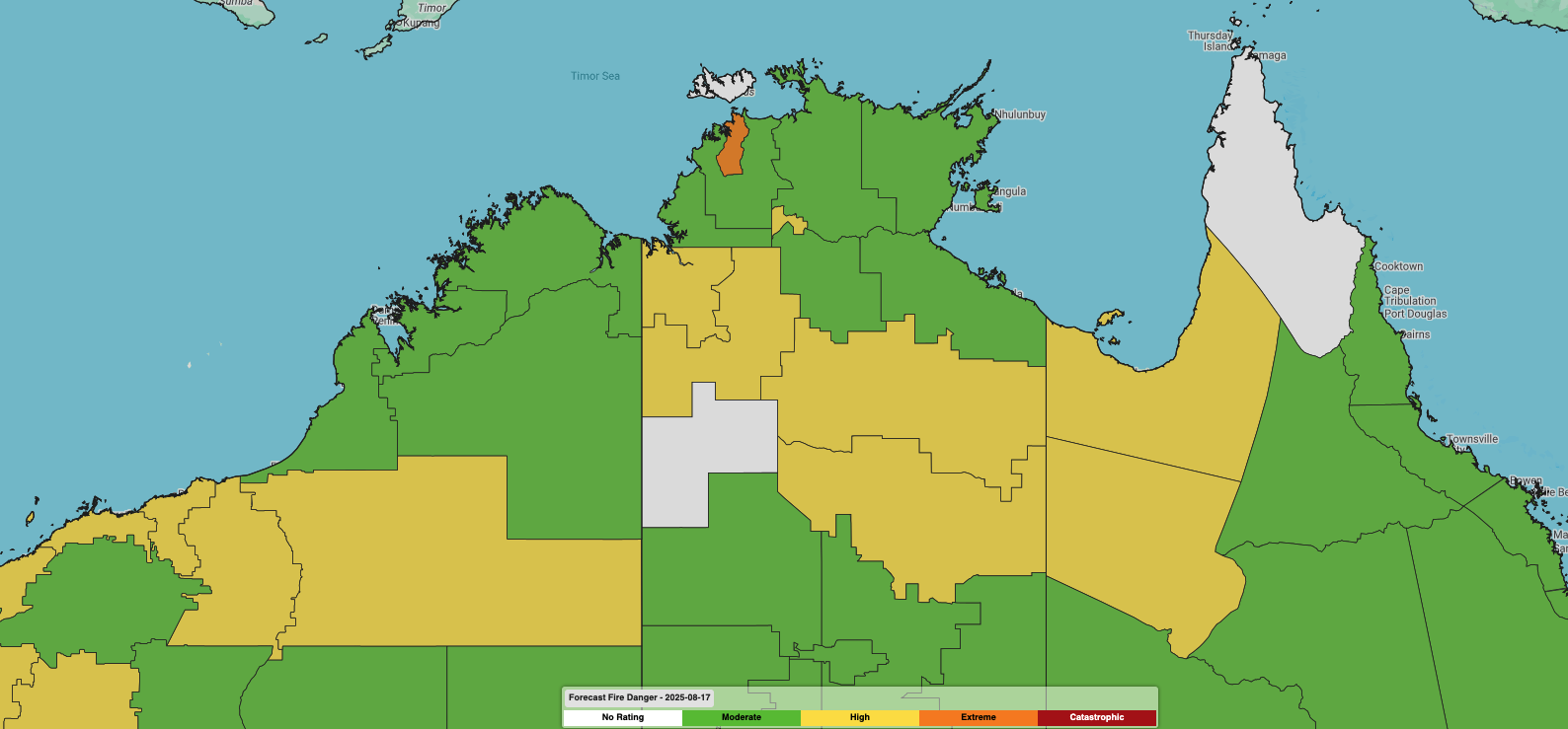
Increased fire danger across parts of northern Australia, including Darwin, comes with a surge of hot and dry winds from the interior.
75 days without rain
The dry season is living up to its name for Darwin and the Northern Territory, with over 75 days since the last rain recorded in Darwin. This allows the vegetation across northern Australia to dry out and cure – priming it to ignite into a blaze at the smallest of flames.
Hot and dry conditions over the past 10 days have led to multiple bushfires raging across the landscape. One blaze near Katherine, at the intersection of the Victoria and Stuart Highways about a three and a half hours’ drive southeast of Darwin, has been active over the past two weeks.
Video: Bushfire smoke plumes can be seen streaking across the Top End on Tuesday, August 12, 2025.
This bushfire area now spans about 2,250 km2 and is currently in a “Being Controlled” status by the NT Fire Service. An expansive plume of smoke can be seen propagating in the east-to-southeast trade winds on Friday.
Image: Widespread smoke extending west of a bushfire near Katherine on Friday morning, August 15, 2025.
Extreme Fire Danger on the way for Darwin
A surge of hot, dry and gusty southeasterly winds will move over northern Australia this weekend, bringing dangerous bushfire conditions. Darwin is currently forecast to experience its first Extreme Fire Danger Rating of the season on Sunday, with parts of the Barkly fire district possibly coming close to the Extreme rating as well.
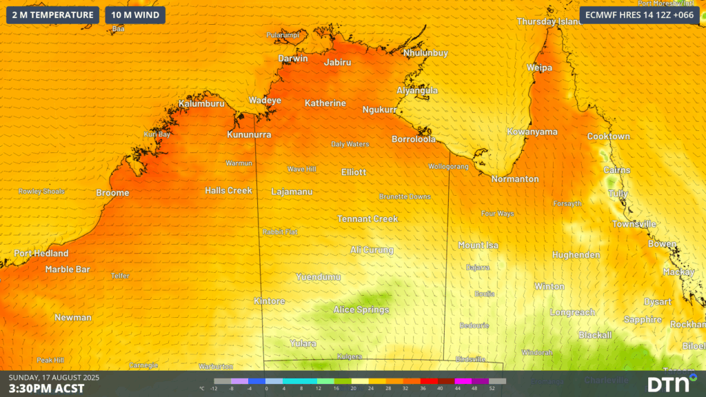
Image: Hot, dry and gusty southeasterly winds will move over northern Australia on Sunday, August 17, 2025.
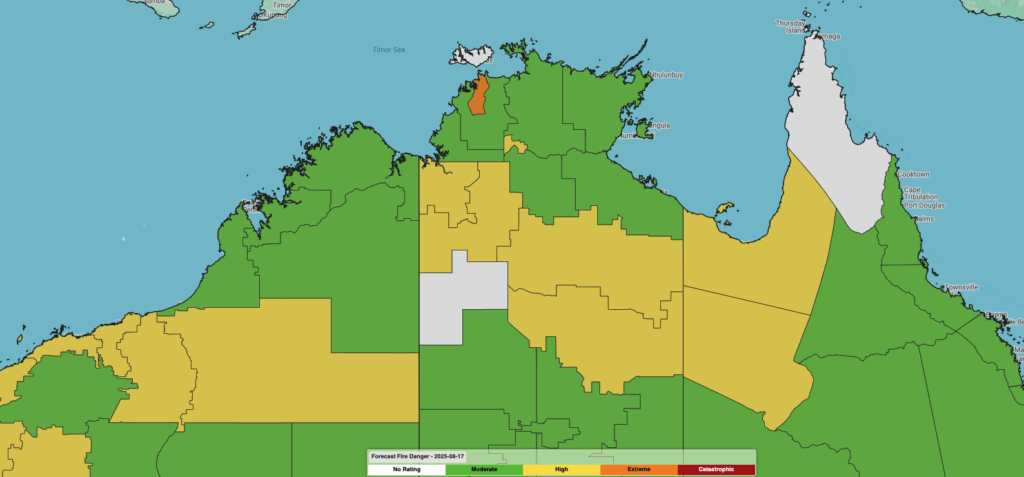
Image: DTN’s Stormtracker dashboard showing high to extreme fire danger ratings across many northern Australian fire districts on Sunday, August 17, 2025.
In 2024, the Darwin and Adelaide River fire district (which includes Darwin) experienced nine days of Extreme Fire Danger Ratings between September 2nd and 14th, so this Sunday’s first Extreme day comes about two weeks ahead of last year.
A busy northern Australia fire season underway
As seen in our spring outlook, parts of northern Australia could experience a particularly hot and dry start to spring, leading to an active and busy bushfire season.
Read more: Australia’s spring outlook
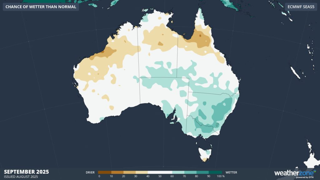
Image: Probability of exceeding median rainfall during September 2025, according to the ECMWF SEAS5 model.
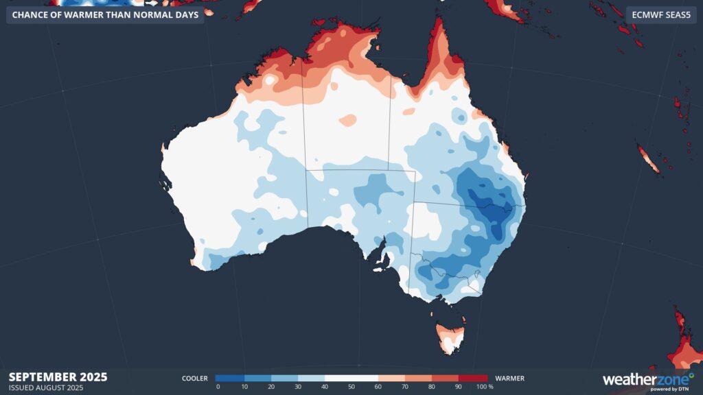
Image: Probability of exceeding median maximum temperature during September 2025, according to the ECMWF SEAS5 model.
How DTN APAC services the Forestry and Emergency sectors
Working in often severe conditions in the high-risk fields of forestry and emergency, our consolidated weather services can ensure full situational awareness for you and your team.
DTN APAC serves the forestry and emergency sectors, delivering trusted weather data and severe weather alerting to maintain safety, protect your assets and underpin your planning.
Reinforce your prevention, preparedness, response and recovery (PPRR) efforts with our tailored services.
Prevention: utilise our seasonal outlooks and daily forecasting to identify and implement prevention measures. Understand the climate risks. Calculate when to plant and harvest, and schedule clean-ups.
Preparedness: gain an understanding of bushfire risk in the days, weeks and months leading up to the season. Use DTN APAC’s seasonal outlooks and 14 day forecasting to plan training, equipment maintenance and back burning operations.
Response: we deliver fire danger forecasts and provide nowcasting and forecasting of severe weather events, including thunderstorm/lightning detection and alerting, to give you full situational awareness of the emergency events likely to impact your operations.
Recovery: assess the risk that weather poses on post-event recovery and rebuild processes. Utilise post-event reports to process insurance claims and perform detailed analysis on operational response.
We work to bring you full situational awareness so you can mitigate risk and maximise your productivity and planning.

DTN APAC will be returning to AFAC 2025, hosted this year at the Perth Conference & Exhibition Centre on 26-29 August. 👋 Be sure to visit our Exhibition Stand (📍491) to meet our team of experts.
Learn more about our large range of industry leading products and services or email us at sales.apac@dtn.com




