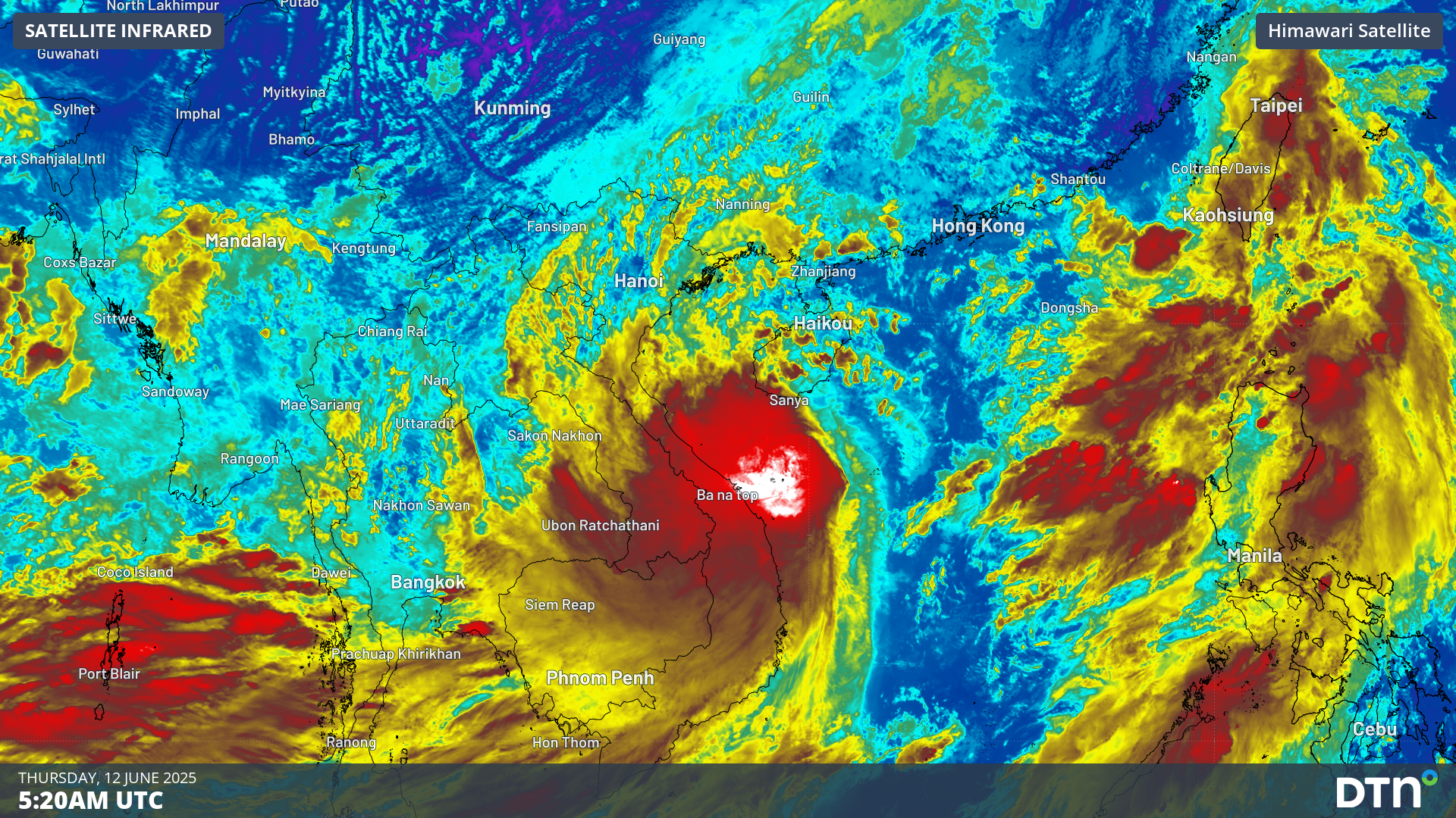
Gusty winds and heavy rain are impacting parts of Vietnam and southern China as the first tropical storm of the season, named Wutip, closes in on Hainan Island.
The satellite loop below shows Tropical Storm Wutip, which translates to “butterfly” in Cantonese, spinning to the east of Da Nang, Vietnam.
Video: Satellite loop of Tropical Storm Wutip on Thursday, June 12.
Deep convective cloud can be seen on the southwestern flank of the storm over Vietnam, delivering areas of intense rainfall. However, remaining sectors of the storm are mostly devoid of this thick convection, indicating the storm is poorly developed and not expected to reach typhoon strength.
The latest forecast track map (as of 12pm CST) from the Joint Typhoon Warning Center (JTWC), as seen below, has Wutip making landfall over the southern coast of Hainan Island on the morning of Friday, June 13.
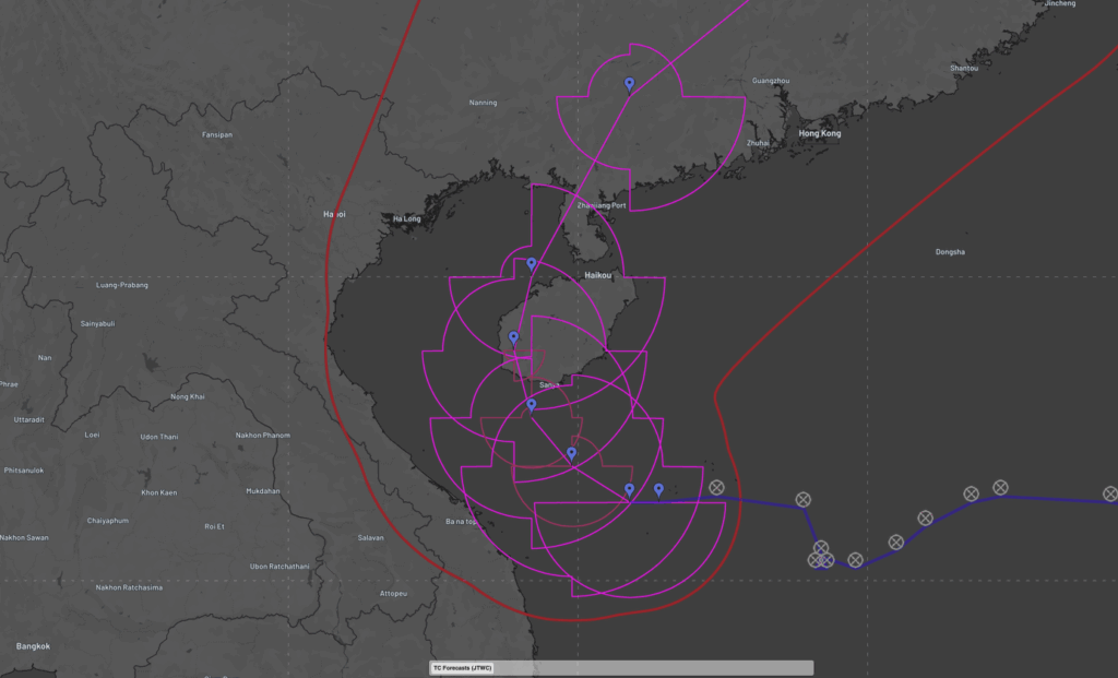
Image: latest forecast track map of Tropical Storm Wutip, as of 12pm CST on Thursday, June 12.
The most intense rainfall is expected on the western side of the storm, with rainfall accumulations reaching 200-300mm over 24-36 hours as the system tracks northwest, north and then northeast. Some more localized areas could also receive up to 500-600mm.
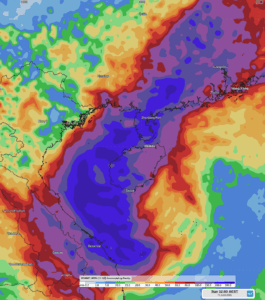
Image: Accumulated rainfall to 8pm CST on Sunday, June 15, over Vietnam, the Beibu Gulf, Hainan Island, Guangxi and Guangdong.
Flash flooding has already impacted parts of northern Vietnam earlier this week, leading to one death and evacuation of hundreds of people as houses and infrastructure experienced damage.
The video below shows gale-to-storm force winds blowing over the region, with Wutip making its way over Hainan Island, and then crossing into Guangxi either late on Friday, June 13, or early on Saturday, June 14.
Video: 10m wind over the South China Sea between Wednesday, June 11 and Saturday, June 14.
Intense rainfall brought by typhoons and monsoonal rain brings widespread flooding that bring death, displaces thousands of people, and disrupt agricultural, transport, aviation and mining businesses, costing millions of dollars in destruction and delays.
How DTN APAC can help
DTN APAC specialises in industry-leading forecast, alerting and threat analysis of tropical cyclones across Australia and Asia, offering you expert, customised solutions when the weather turns wild.
Providing rapid-update forecast information, we alert you to any low-pressure system gaining power within your region and, unlike other providers, can track its development out to 7 days. This gives you the time to prepare and safeguard your staff, sites and assets.
You will have the most precise weather intelligence charting rainfall, wind speeds and potential storm surges to help you make critical decisions quickly. Whether it’s adjusting key work schedules, protecting your staff or securing your site, we have the alerting capability to keep you steps ahead of the storm.
As the climate delivers increasingly severe weather events, their potential to impact your business operations grows.
Whether it’s preparing for the coming season’s tropical storm potential, or rapid-response forecasting with a typhoon approaching, or simply ensuring your operations team is equipped to confidently make decisions ahead of severe weather, our weather Risk Communicators are here for you.
Our weather risk communicators deliver short- to long- term guidance from:
- hourly-event weather monitoring (alerting you of impending destructive winds and heavy rain ahead of a tropical cyclone).
- week to month operational planning based on likely timing of increased monsoonal rain or periods of reduced cyclone activity.
- seasonal long term planning based on climate drivers and the likely trends across the coming months.
We deliver clear and comprehensive weather data, personalised risk assessments and briefings to you and your team, so that your critical decisions can be made with confidence.
We are available 365 days a year, so you always have the timely guidance you require, especially when severe conditions hit.
You have our insights to rely on to see you through complex situations, minimising potential loss of profit and maximising the safety of your staff and assets.
Learn more about our large range of industry leading products and services or email us at sales.apac@dtn.com


