An intense heatwave will impact the National Electricity Market from this weekend, with Melbourne and Adelaide set to see the mercury rise into the high 30s or low 40s for several days.
The relentless run of heat will be caused by a slow-moving high pressure system in the Tasman Sea, which will directing hot northerly winds over Australia’s southern states in the coming days.
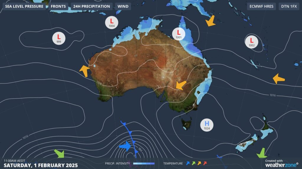
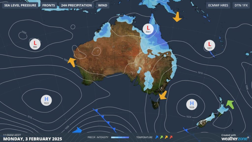
Image: Mean Sea Level Pressure (MSLP) for Saturday, February 1 (top) and Monday, February 3 (bottom), showing the high remaining in the Tasman for several days.
The extreme heat will impact the country’s southern states this weekend into early next week:
- Melbourne could see its hottest three-day spell in 11 years, with three consecutive days at or above 37°C forecast from Sunday.
- Adelaide is forecast to see four consecutive days at or above 37°C from Saturday for the first time this summer.
- Hobart should see four consecutive days at or above 27°C from Saturday.
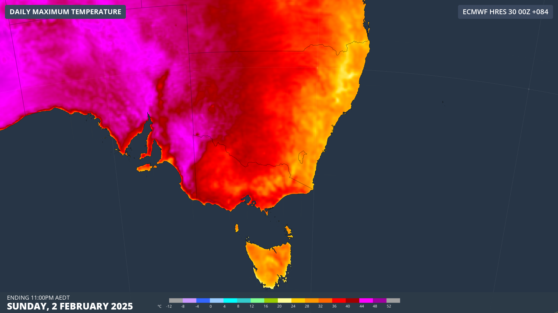
On Monday, Australia’s southern states will see the heat peak, with the concurrent heat across three states likely to cause stress on the energy grid.
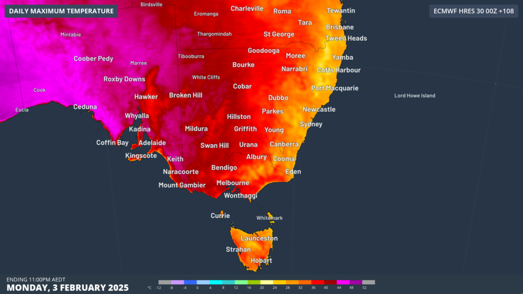
Image: Maximum temperature forecast for Monday, February 3, according to ECMWF
As you can see in the image above the heat intensity peaks in SA on Monday, with temperatures likely remaining in the high 30s or early 40s in the early evening.
Adelaide’s temperature at 6pm local Monday night is forecast to be around 38°C, with the temperature finally dropping to below 30°C after 9pm.

Image: DTN’s Opticast temperature forecast for the next four days in Adelaide.
Adelaide’s temperature will remain in the high 20’s for most of the night, with the minimum forecast to drop to 27°C in the early hours of Tuesday morning. Monday night will also be a sweaty one for Melbourne with the temperature only dropping to about 25°C.
Looking further ahead, a cold front and associated cool change will bring some relief to the country’s southern states on Tuesday afternoon or evening, with Tuesday night likely to be much more comfortable.
DTN APAC supplies precise weather intelligence to over 75% of the National Energy Market (NEM); and is the trusted provider for the Australian Energy Market Operator (AEMO).
Weatherzone’s next-generation nowcasting and forecasting system, OpticastTM, is independently proven to outperform other industry models, allowing energy traders to respond rapidly to changing conditions. From 14 day forecasting to seasonal outlooks, you have access to complete and powerful weather intelligence giving you the confidence to make the best call.
Meeting the needs of the changing market, Weatherzone utilises high-resolution modelling and local knowledge to provide 5-min granularity observations and forecasts, optimising your market bidding and maximising your profits. These, coupled with briefings from our energy meteorologists, give you full awareness of the associated risk.
Benefit from specialised indices such as apparent temperature, Cooling/Heating Degree Days (CDD/HDD) and Effective Degree Days (EDD) to help accurately predict demand. You can get a clear picture of forecast conditions across the market and quickly assess heat/heatwave potential from 14 days out to 12 months
No matter where your energy trading focus lies, we have the power generation and weather insights to inform your critical decisions, keeping you ahead of the curve. For more information contact us at sales.apac@dtn.com


