An unseasonably hot airmass will linger across parts of southern Australia next week, with temperatures set to reach the 40s across Australia’s interior and the low 30s in some capital cities.
Heat has been building over northern Australia during the opening weeks of spring, with severe heatwave conditions impacting those living in the north during the past week. This heat is likely to spread south later this week into next as northerly winds ahead of a cold front transport it over the southern states.
Temperatures across the interior of WA, SA and the NT should reach around 8 to 10°C above average for several days from Sunday, with Adelaide and Melbourne set to see a run of days 5 to 10°C above average.
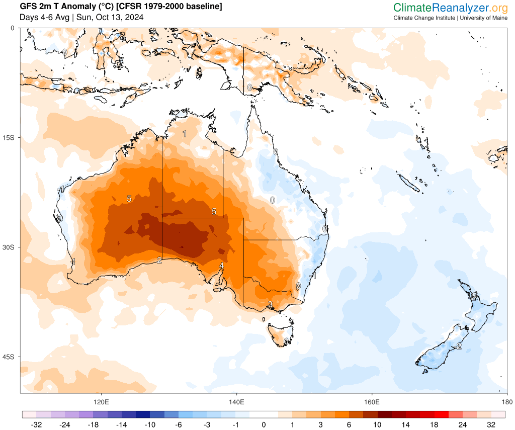
Image: 2m temperature anomaly (°C) for three days beginning on Sunday, October 13, according to GFS. Source:ClimateReanalyzer
While the peak of the heat will be confined to the interior of the states, Adelaide, Melbourne and Hobart will see a run of warm spring-like days:
- Adelaide should see around 5 to 6 days above 24°C starting Sunday, October 13, with temperatures peaking at around 30 to 31°C on Tuesday.
- Melbourne should peak at 25°C on Sunday before a cold front cools temperatures on Monday. Temperatures will increase again on Tuesday and Wednesday to around 24 to 26°C.
- Hobart will also see some temperature swings this week, with temperatures peaking at around 22 to 23°C Sunday.
- Sydney and Brisbane should see temperatures rise from Thursday, October 17.
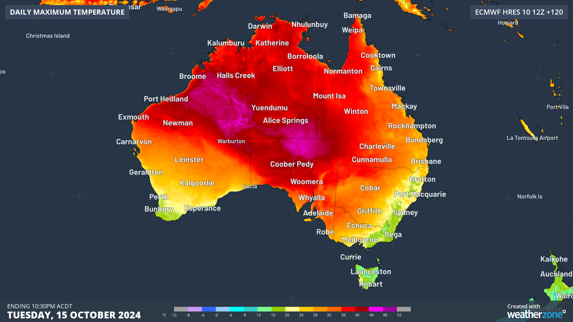
The map below shows the maximum temperature forecast for Tuesday, October 15 with temperatures reaching the 40s through the interior of Australia.
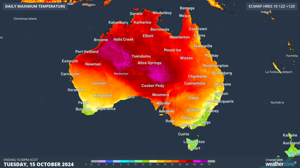
Image: Maximum temperature forecasts for Tuesday, October 15, according to ECMWF
Looking ahead, temperatures will cool slightly in the south as a low pressure system approaches SA from Thursday.
Models suggest that this low pressure system could cause a widespread thunderstorm outbreak across southeastern Australia from late next week.
The map below shows that while the south cools, eastern Australia will begin to see temperatures warm up later next week.
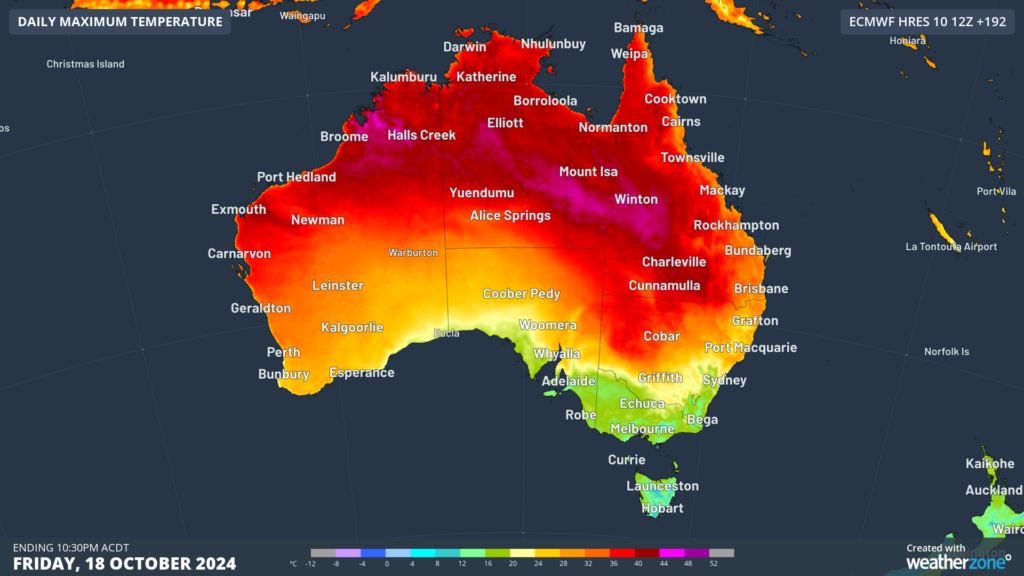
Image: Maximum temperature forecast for Friday, October 18, according to ECMWF.
You can see in the map above that the peak once again peaks through Qld and NSW’s interior, meanwhile Sydney and Brisbane’s temperatures reaching the high 20s.
Weatherzone Business has grown to become the outright leader within the Australian energy market, serving wind, solar, hydro, trading, utilities and network companies.
You can’t control the weather, but you can gain precision insights to optimise your response. What lights us up is providing your energy business with tailored weather information to reduce your risk and keep you moving ahead of the curve.
Our services cover all aspects – from wind and solar generation to demand forecasts, wholesale markets to retail so, no matter where your company sits, we have solutions for you. We have worked closely with market participants to create products that meet the evolving needs of the sector, aiming to increase safety and profitability for our customers.
Benefit from the timely delivery of accurate weather information, allowing informed and effective decision-making. For more information, please visit our website or email us at apac.sales@dtn.com.


