
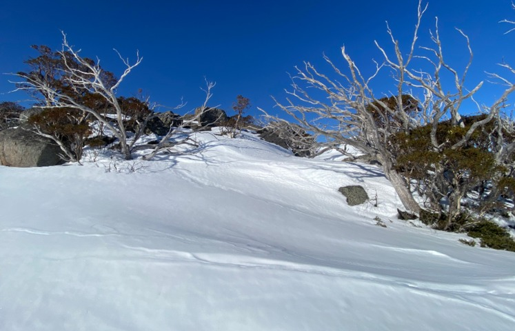
Approximately halfway through the Australian hydropower season, the good news is that we’ve got a decent season on our hands after heavy snowfalls on each of the last two weekends.
In raw statistical terms, season 2024 is still short of the historical average in terms of peak depth. But with decent a base, and with six weeks ahead that historically have been productive for snowfalls, there’s every chance this will become a good or even excellent season.
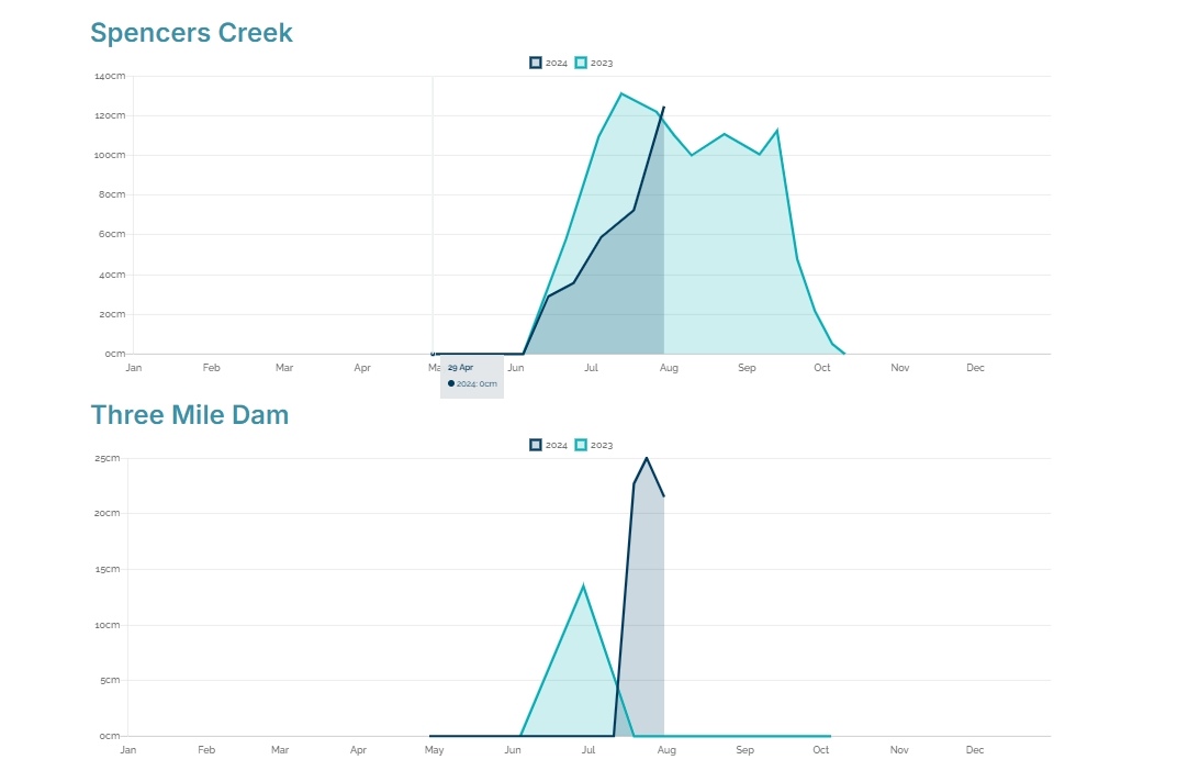
This week, Snowy Hydro measured a depth of 124.6 cm at Spencers Creek, at an elevation of 1830m roughly halfway between the NSW ski resorts of Perisher and Thredbo.
Snowy Hydro has been measuring snow there since 1954, and the long-term average peak season depth for the site is just under two metres, so as mentioned, season 2024 has a way to go.
But any time you crack the magic metre mark, it means there is usually pretty good snow coverage for snow sports across the mountains.
A few points worth making regarding the above graphs:
- The first is that season 2023 (the light blue line) peaked early at Spencers Creek on July 13. Indeed, that the was the earliest peak season depth on record. That’s because August and September were warm and mostly dry in 2023.
- This year, there are still indications that August and early September could be a productive period for snowfalls. One such indicator is the negative Southern Annular Mode (SAM).
- So even though the running 2024 peak depth is still a few centimetres below last year’s, it seems likely that 2024 will overtake last year.
- A final point worth mentioning relates to the second graph, which shows snow depth at Three Mile Dam.
As the lowest of Snowy Hydro’s three snow depth measuring sites, Three Mile Dam has struggled to amass any significant depth in recent seasons.
And while snow was hardly deep at the site at the most recent reading (25 cm on July 24), that was still a greater depth than at any time in 2023.
And as you can see on the video above which was taken recently, cross-country ski conditions at Three Mile Dam haven’t been too bad lately.
So all in all, the Aussie hydro season is in reasonable shape. Check the snow reports for Thredbo, Perisher, Charlotte Pass, Selwyn Snow Resort, Mt Buller, Falls Creek, Mt Hotham, Mt Baw Baw and Ben Lomond in Tasmania for more.
The only downside at present is that we’ve seen a snow-free week since last Saturday, and another dry week looms on the horizon next week.
Temperatures have been cold so not much melting has occurred, but unfortunately, there’s no major snow-bearing system on the current charts either – although early indications suggest the pattern is likely to change by mid-August.
Using Opticast’s nowcasting and forecasting capabilities, you will have long-term outlook covering rainfall and extreme heat events out to 12 months. This can significantly improve your planning as you integrate the data with site-specific hydrological parameters.
With renewables making up more of Australia’s energy mix every year, we want to support your business to make informed critical decisions and improve your overall generation and safety. To find out more, please visit our contact page or email us at apac.sales@dtn.com.




