The coming weeks’ weather will be a mixed bag of severe weather and mild wintry weather, in response to a shift in the jetstream.
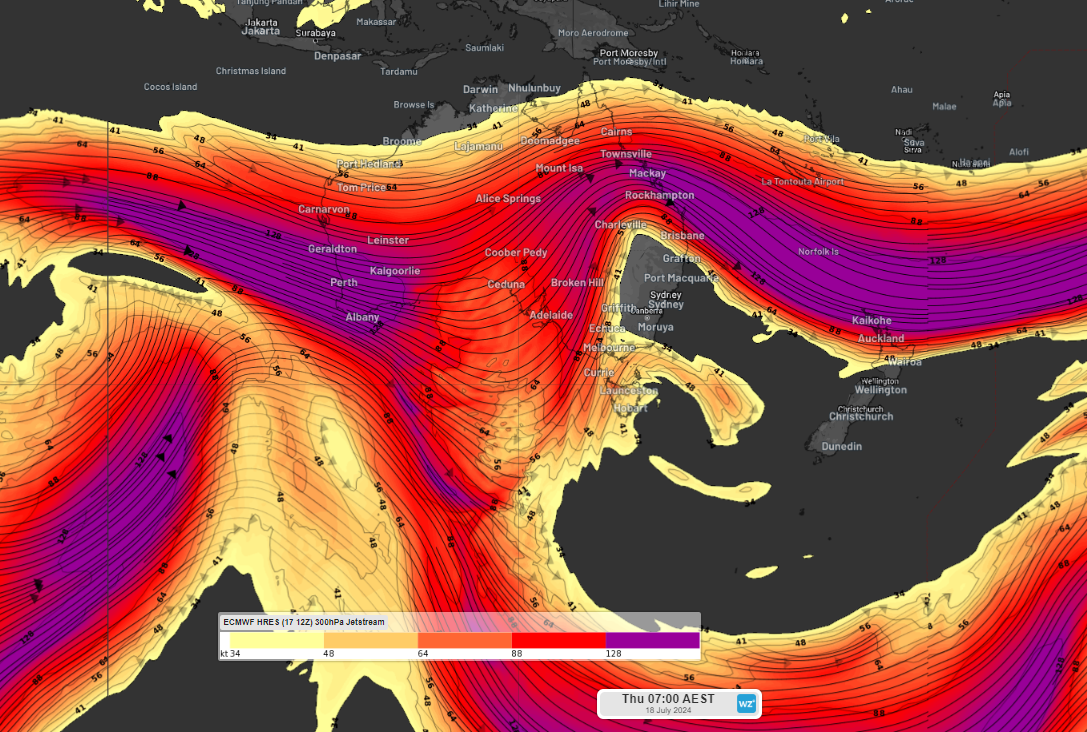
Our planet’s jetstreams are bands of fast-moving air that sit about 10km above the surface. They typically flow from west to east and lie between regions of contrasting temperature. You can see in the image below that a portion of the jetstream is bending on Thursday and flowing in more of a north-south orientation, this is called a meridional pattern.
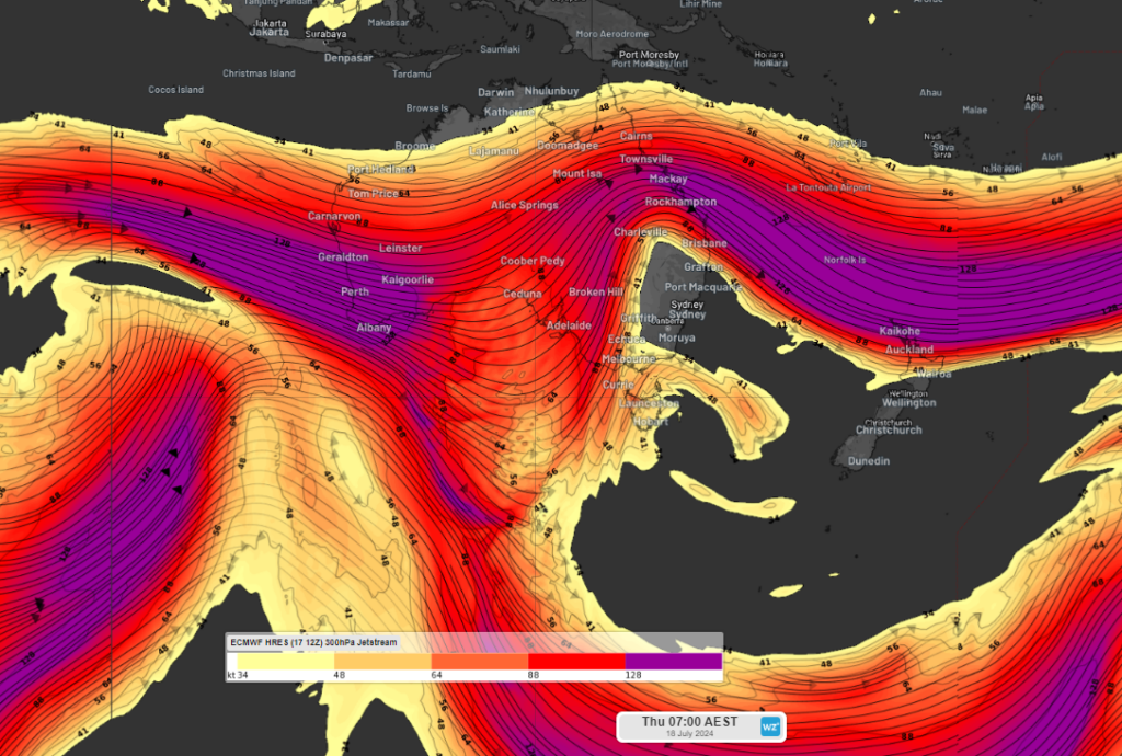
Image: ECMWF forecast model showing the jet streams flowing over Australia at the 300hPa level on Thursday, July 18.
This bend in one of our planet’s jetstreams will see a strong meridional pattern over Australia between Thursday and Saturday. In a meridional flow weather systems usually become more stagnant and often more intense. A meridional jetstream orientation is usually associated with periods of unusually hot or cold weather.
As a result, damaging winds are likely to impact parts of southeastern Australia on Friday into the weekend. This includes parts of SA, with damaging winds forecast to develop along the Mount Lofty Ranges and parts of the coast from Friday morning as a cold front sweeps across the state.
The image below shows the strong wind gusts forecast across parts of SA, Vic, NSW and the ACT on Friday evening.
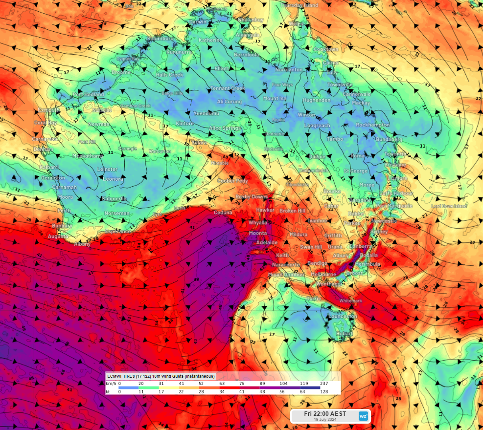
Image: Instantaneous wind gust forecast at 10pm on Friday, July 10, according to ECMWF
This meridional pattern is set to shift from Saturday into a zonal pattern, which is good news for southern Australia as these tend to be less severe.
When a jetstream flows from west to east, which is called a zonal pattern, weather systems tend to be more transient. You can see the jetstream is moving in a west to east direction on Saturday in the image below, this is a more typical winter pattern for southern Australia.
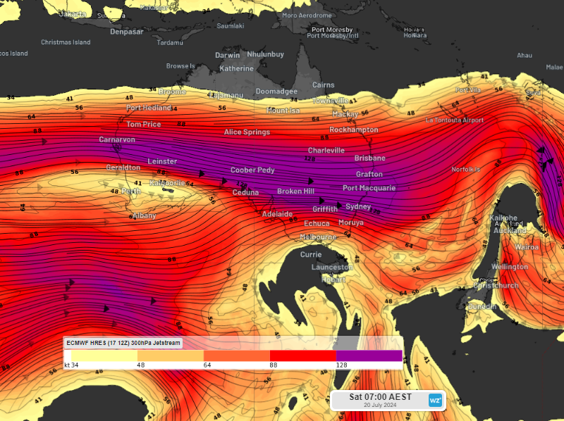
Image: ECMWF forecast model showing the jetstreams flowing over Australia at the 300hPa level on Sunday July 21
During a zonal flow, surface level storm systems and associated cold fronts move very fast from west to east, but often don’t extend to more northern parts of Australia.
The image below shows this zonal pattern over southern Australia between Saturday and Tuesday, before a meridional pattern returns.
Images: Mean Sea Level pressure (MSLP)
Between Saturday and Tuesday this zonal pattern will cause contrasting weather across Australia:
- Southern Australia will be windy, cloudy and cold during the day and slightly warmer at night
- Northern Australia should be dry and hot with gusty southeasterly winds
- Central Australia will be under high pressure promoting sunny days, cold nights and settled weather.
During the middle of next week, this pattern is likely to shift back into a more meridional pattern. To find out more, please visit our contact page or email us at apac.sales@dtn.com.


