
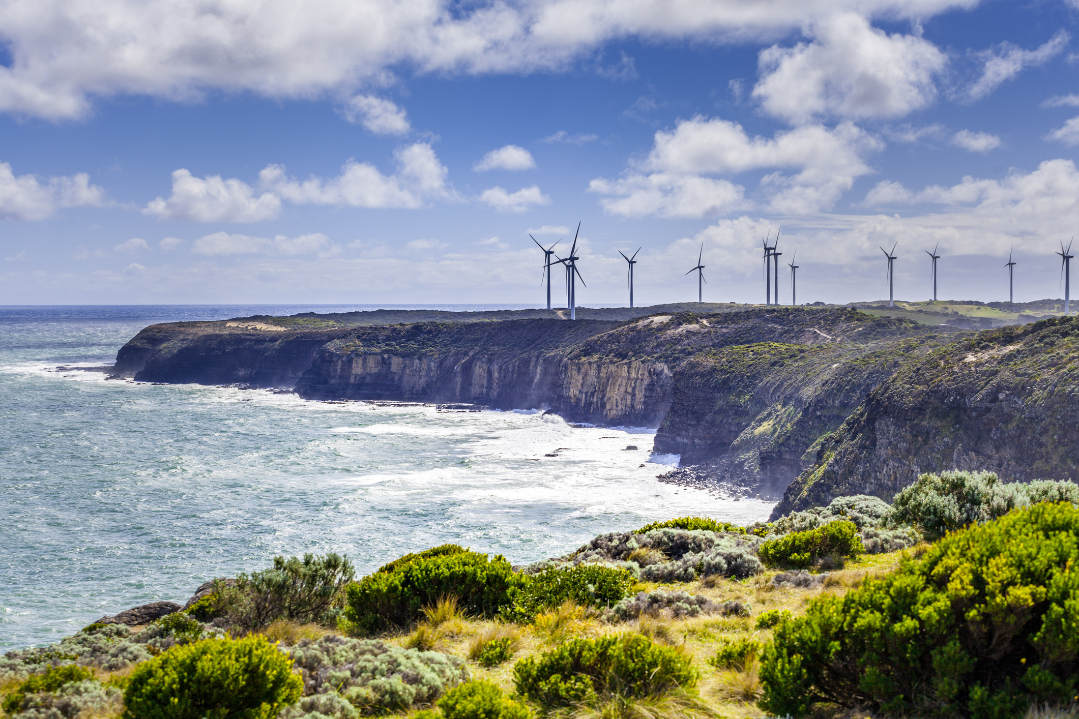
A prolonged period of low wind will impact the National Electricity Market (NEM) this week, which is coinciding with bitterly cold weather driving up energy demand in the southeast.
The weather systems appear to be stuck, with record challenging high-pressure expected to sit over Tas for an extended period.
The images below show this stubborn high-pressure system sitting over Tas or the Bight for at least 6 to 7 days.
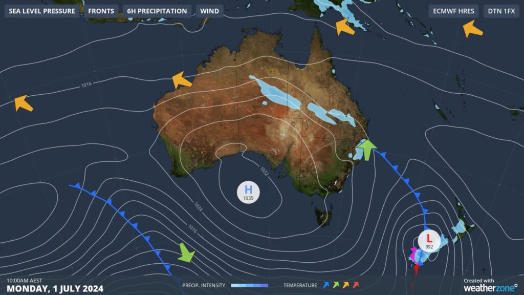
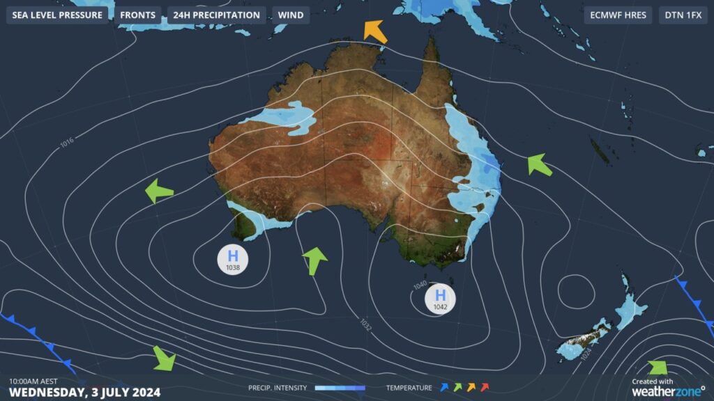
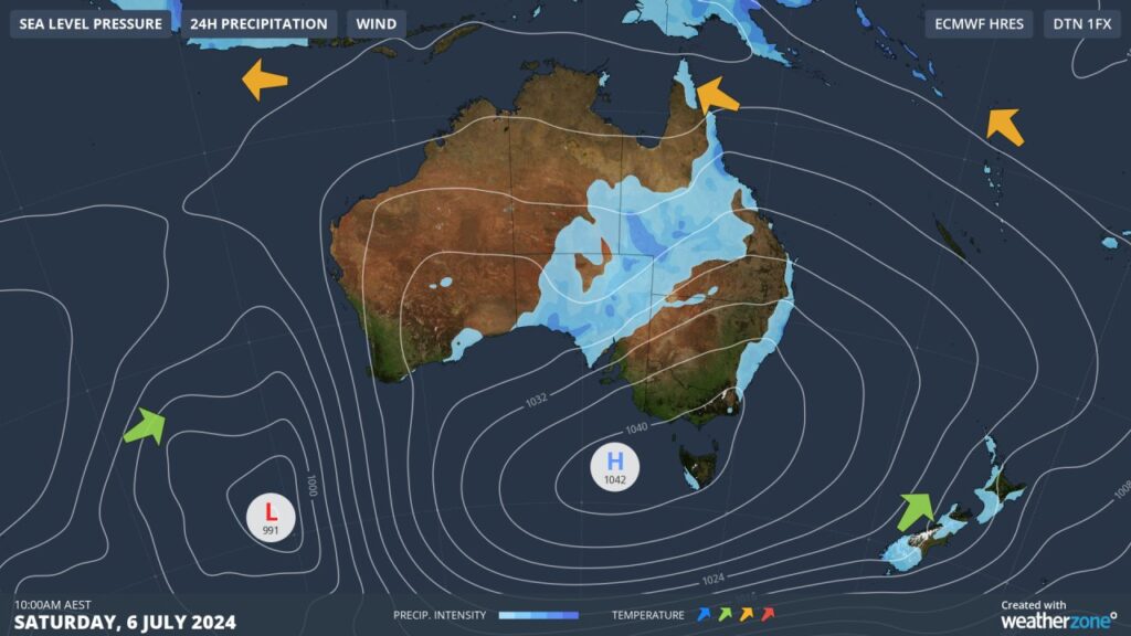
Images: Mean Sea Level Pressure (MSLP) on Monday, July 1 (top), Wednesday, July 3 (middle) and Saturday, July 6 (bottom).
This high-pressure system should prevent fronts or fierce winds from crossing southern Australia this week, bringing a prolonged period of light wind for the NEM.
The impact of the high pressure is already being felt in the market, with wind power only contributing 656MW or 2.2% to generation at 10:30am Monday, July 1.
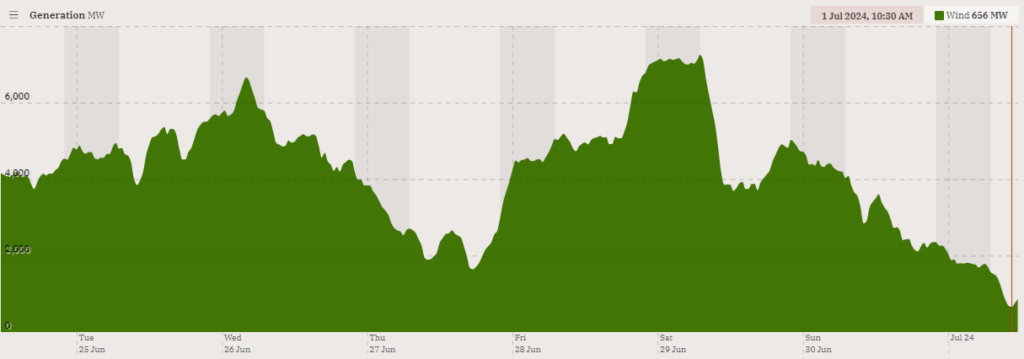
Image: Wind power contribution to generation for 7 days leading up to Monday, July 1. Source: OpenNEM
You can see in the image above that this lull in wind power comes after a windy week, which was caused by several cold fronts crossing the region.
The light winds are set to continue for most of the week for the NEM, especially in the wind generation areas in Vic and Tas, which are closest to the central high pressure.
Unfortunately, this will coincide with extremely cold nighttime temperatures across Vic and Tas, with Melbourne set to see a run of 5 to 6 mornings below 4°C from Tuesday night.
Some good news is that for SA, Qld, NSW and the ACT wind generation areas, winds should pick up later in the week as a surge of easterly winds feeds into a cut off low in SA.
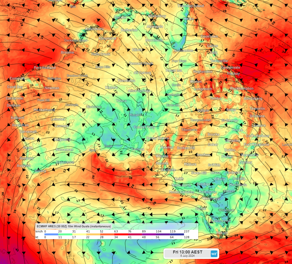
Image: Instantaneous wind gusts at 1pm on Friday, July 5, according to ECMWF
This is in response to a rare ‘northeast cloudband’ which should cause thick cloud to stretch from the Coral Sea down to SA later this week. The cloudband should reduce solar output across parts of QLD, NSW and SA and bring significant rain totals to these areas.
Looking ahead, wind should remain light across Vic and Tas for at least the next 7 days. The models are suggesting that a strong cold front and decent wind could pass across southeastern Australia mid- next week.
Weatherzone Business, a DTN company, supplies precise weather intelligence to over 75% of the National Energy Market (NEM) participants and is the trusted provider for Australia’s Market Operator.
We offer weather data and analytics to support all aspects of your renewables business, with a wide range of specialised services covering energy generation and weather forecasting, to site-specific severe weather alerting and historical reporting.
OpticastTM
Weatherzone operates Opticast, an ultra-local forecasting system, independently proven to be the best performing of its type in Australia. Providing an unprecedented level of accuracy and precision, Opticast rapidly updates every 10 minutes, intelligently adapting to local observations, and corrects forecasts based on historical evidence. Wherever you are based, we can provide you with the most accurate nowcasting and forecasting data out to 14 days so that you can mitigate operational and safety risks, and plan to make the most of severe weather windows.
Solar Forecasting and Generation
Weatherzone partners with Solcast – the world leader in real-time actuals and rapid-update solar forecasts.
Utilising Solcast’s satellite fleet, sky-imagers and the SCADA data collected from your solar farm, you will acquire not only forecasting capability, but a precise picture of your actual yield and PR. Specifically built to ensure you meet the requirements of the AEMO and reduce your exposure to costly penalties.
Wind
Utilising Opticast’s data, we provide wind power generation, operational and severe weather forecasting to improve your planning and protect your valuable staff and assets. Utilise generation forecasts for individual wind farms, state level and the NEM at daily and hourly resolution.
Weatherzone’ Total Lightning Network ensures your wind farm is protected from severe storms by an alerting system that can be configured to your exact requirements, aligning with local site needs, procedures and legislation. To find out more, please contact us at apac.sales@dtn.com.




