

Perth just registered its sunniest and driest October-to-April period on record despite a welcome burst of rain on Tuesday.
Summer and the surrounding months are typically the sunniest and driest time of year in Perth as cold fronts shift further south and rain-shielding high pressure systems become the dominant synoptic feature over southwestern Australia.
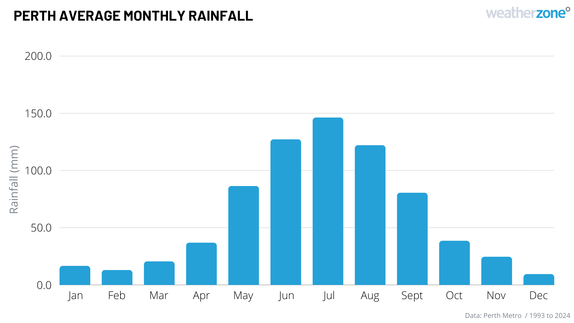
Image: Perth’s average monthly rainfall throughout the year.
However, even by Perth’s dry season standards, the last seven months have seen exceptionally low rainfall.
The lack of rainfall and cloud in the last seven months has boosted rooftop solar output, with Perth recording the sunniest period between October 2023 and April 2024 on record for the current site. The city averaged 10 hours and 53 minutes of sunshine a day during this period, which beat the previous record set between 2013 and 2014 by seven minutes.
The graph below shows that the increased sunshine hours during the past seven months caused the highest rooftop solar to reach new heights in the South West Interconnected System (SWIS).
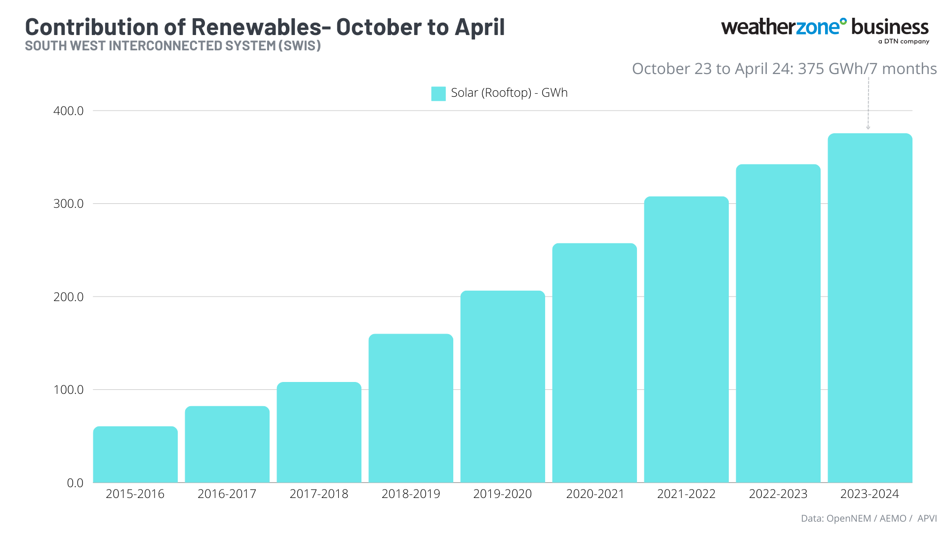
Rooftop solar reached an average of 375 GWh between October 2023 and April 2024, beating previous years. This graph also shows that total solar generation has been increasing year-on-year since 2015, driven by a boom in solar installations across WA.
The solar boom is not a surprise given that in an average pair of years, Perth would receive around 160 mm of rain between October and April. But over the last seven months, the city has only collected 23 mm, which is less than 15 % of the long-term average.
The past seven months have easily been Perth’s driest October-to-April period on record, beating the previous record of 48.8 mm from 2000-01, with data available back to 1880.
Perth’s official rainfall total for the last seven months includes any rain that reached the city’s gauge between 9am on September 30, 2023, and 9am on April 30, 2024. This is because a meteorological rain day includes all rainfall recorded during the 24 hours up to 9am each day.
So, while Perth received some very welcome rain on Tuesday as weakening thunderstorms drifted south over the city, it all fell after 9am and was therefore officially counted as May’s rainfall.
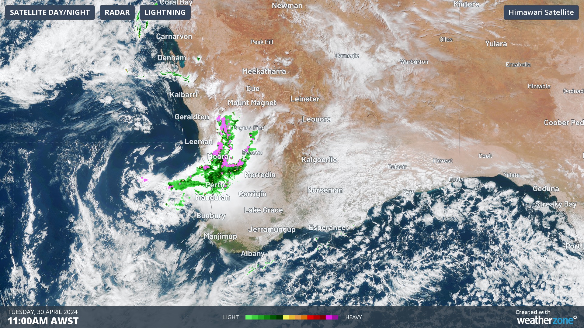
Image: Rain and thunderstorms over southwestern Australia, including Perth, on Tuesday, April 30.
In the 24 hours leading up to 9am AWST on Wednesday, Perth had received 8.4 mm of rain, which was the city’s best daily rainfall in six months. More rainfall is on the forecast for Perth during the next few days, breaking this record dry and sunny spell.
Weatherzone Business and Solcast are a market-leading partnership delivering highly specialised solar data to the Australian renewable energy industry.
Designed for utility scale solar sites, we offer you a globally proven solution.
With low upfront CAPEX and powerful cloud-based information systems, you can access a complete suite of irradiance and weather data to ensure forecast accuracy and improve site efficiency.
Solcast is the world leader in real-time actuals and rapid-update solar forecasts. This solution utilises Solcast’s centralised Amazon Web Services’ (AWS) cloud infrastructure for all complex algorithmic processes and data plumbing. You will gain the power of AWS to interpret and deliver your data at top speed, providing real-time, historical and forecasting estimates direct to your API.
Receive monitoring and support from the Weatherzone and Solcast teams, 24/7. For more information, please contact us at apac.sales@dtn.com.




