
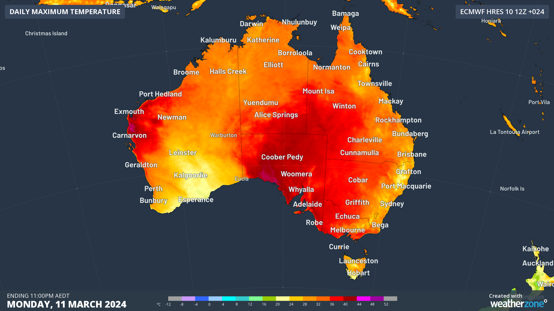
It’s a public holiday in three states and one territory this Monday, but the heatwave forgot to take the day off.
The early autumn heatwave which has baked large parts of southern Australia for several days already is working double-time on the public holiday in at least part of each state and territory where most people are trying to chill in every sense of the word.
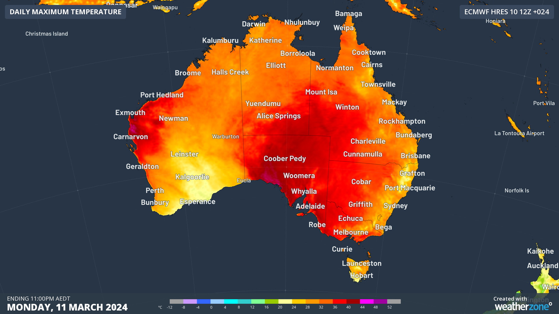
In South Australia it is Adelaide Cup Day, and Adelaide is tipped to reach 38°C after a run of maximums that reached 37°C, 40°C, and 39°C from Friday through to Sunday.
In Victoria it is Labour Day, and Melbourne is expected to reach 37°C after tops of 38°C and 37°C on the weekend, as well as a run of uncomfortably sweaty nights. https://www.weatherzone.com.au/news/sweaty-night-in-vic-and-sa/1843780
In the ACT it is Canberra Day, which celebrates the founding of our national capital in 1913, and while Canberra is well known for its chilly winter weather, did you know that it has significantly hotter average maximums in all three summer months than both Sydney and Melbourne?
Canberra hasn’t had any extreme heat from the current hot spell, but it has seen consistent above-average temps through the first 10 days of March 2024, with daytime maximums around four degrees above average. The city should reach 30°C today and 34°C on Tuesday.
In Tasmania it is Eight Hours Day, which is what locals call Labour Day, in celebration of the achievement of a standard eight-hour day for workers. Things have cooled down in Hobart since the 33.8°C scorcher on Saturday, with a top of 24°C on the cards for Monday.
But as you can see from the BoM Heatwave map below, a tiny portion of the state’s north remains in the low intensity heatwave zone, which is reflected in the forecasts of maximums in the low 30s on Monday in Launceston and nearby areas.
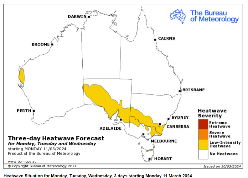
Source: BoM.
Temperatures are set to moderate in coming days in the areas which have experienced the recent run of autumn heat, but with no strong cold front coming through, temperatures won’t plummet in any of the areas mentioned as they sometimes do after prolonged heat events.
That said, Melbourne folk are definitely in for some relief, with a spell of top temps in the low-to-mid-twenties in store from Tuesday through to the end of the week.
You can’t control the weather, but you can gain precision insights to optimise your response. What lights us up is providing your energy business with tailored weather information to reduce your risk and keep you moving ahead of the curve.
Our services cover all aspects – from wind and solar generation to demand forecasts, wholesale markets to retail so, no matter where your company sits, we have solutions for you. We have worked closely with market participants to create products that meet the evolving needs of the sector, aiming to increase safety and profitability for our customers.
Benefit from the timely delivery of accurate weather information, allowing informed and effective decision-making. For more information, please contact us at apac.sales@dtn.com.




