Prosper in a dynamic world
Search

Another day, another Perth sizzler

Be grateful if you’re lucky enough to be working indoors in air conditioning for the rest of the working week in Perth, as temps are set to keep sizzling until the weekend.

This Wednesday is day two of a four-day heatwave in western and southwestern WA, with Perth heading for a top of 39°C this Wednesday, followed by 40°C on Thursday, then 37°C on Friday, before a southwesterly change cools things down a little by Saturday afternoon.

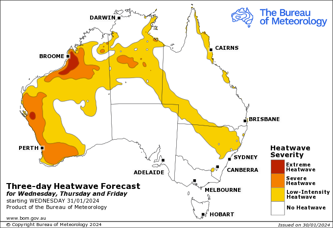
Image: That heat will start spreading east in coming days. Source: BoM.

Even before the current heatwave, Perth was having a hot summer with max temps in both December and January averaging around half a degree above the long-term average.

Perth in Jan: More than five degrees of difference

Eastern states readers may be unaware that Perth’s average maximum temperatures are already much hotter than the eastern capitals in summer. For example:

  • Sydney’s average Jan max is 26°C
  • Melbourne’s average Jan max is 25.9°C
  • Perth’s average Jan max is 31.4°C

Partly this reflects the lack of genuinely cool days in Perth, when a strong southerly drops temps dramatically.

For example, Perth’s lowest maximum in January 2024 was 26.8°C while Sydney, Melbourne, Adelaide and Canberra all had days when the max was restricted to the low 20s.

Perth also tends to get several days of heat back-to-back more frequently than cities like Sydney or Melbourne, where a spell of one or two extreme heat days is more common than a longer stretch.

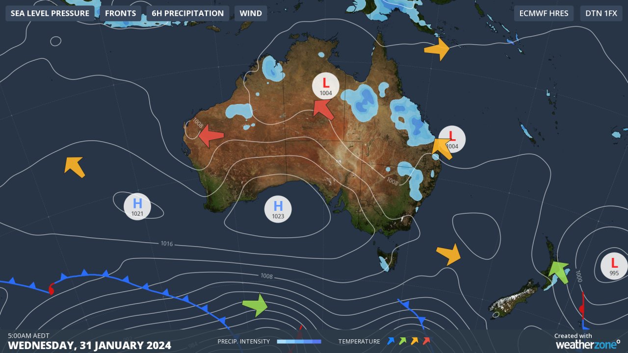
Perth heatwaves typically happen when a high parks itself over the Bight and the classic pattern of summer easterly winds sets in, dragging hot air from the interior to southwest WA.

That’s the pattern you can see on today’s synoptic chart.

Be sure to check the latest fire danger info at Emergency WA and of course remember to check the latest weather warnings on the Weatherzone warnings page.

Latest news

Satisfy your weather obsession with these news headlines from around the nation, and the world.

El Niño Is Here: What a Potential Record Event Means for Southeast Asia and Australia

  El Niño was officially declared in June 2026, raising the prospect of widespread impacts across Southeast Asia, from extreme heat and water shortages to higher energy demand and agricultural stress.   The World Meteorological Organization has warned countries to “prepare for it to be severe”, while several global forecast models suggest the event could rank among […]

How El Niño will shape Australian port operations in winter-spring 2026

Australian ports and marine pilots can expect a season of shifting wind and swell patterns through winter and spring 2026, as a developing El Niño brings the likelihood of drier conditions and more variable operating windows across the country’s coastline.  Will El Niño develop in 2026?  There are clear signs that an El Niño pattern is becoming […]

From Kimberley to northern NSW: Bushfire outlook flags risk for resources sector this winter

Bushfire risk doesn’t usually make headlines in June, but AFAC’s winter seasonal outlook is putting mining and resources operators on alert from the Kimberley to the NSW.  Australia’s official seasonal bushfire outlook for winter 2026 was released by AFAC on Thursday, May 28. The outlook predicts increased fire risk across the northern parts of the Great Sandy Desert and surrounds […]

The signal was there weeks earlier: forecasting one of the year’s biggest wind events

In mid-May 2026, DTN APAC meteorologists flagged a strengthening Southern Ocean pattern in model guidance, signalling an extended run of record-challenging wind conditions across the NEM.  Nearly three weeks later, NEM wind generation climbed from around 1.5GW to more than 9GW, supplying roughly one-third of the grid and coming within 1GW of the all-time generation record.  The event highlighted […]