

Was it really only yesterday that we were wondering where summer had gone in Melbourne?
On Monday morning, we published a story about Melbourne’s relatively mild summer of 2023/2034 to date, in which we noted that:
- Average Melbourne maximums had been around half a degree below the long-term average in both December and January, although minimums had been significantly warmer
- There had been very little extreme heat with a hottest day of 34°C in December and 33.4°C in January
Towards the end of that story, we mentioned that Sunday was forecast to reach 31°C but Melbourne now looks likely to be much warmer than that, with an updated forecast maximum of 38°C.
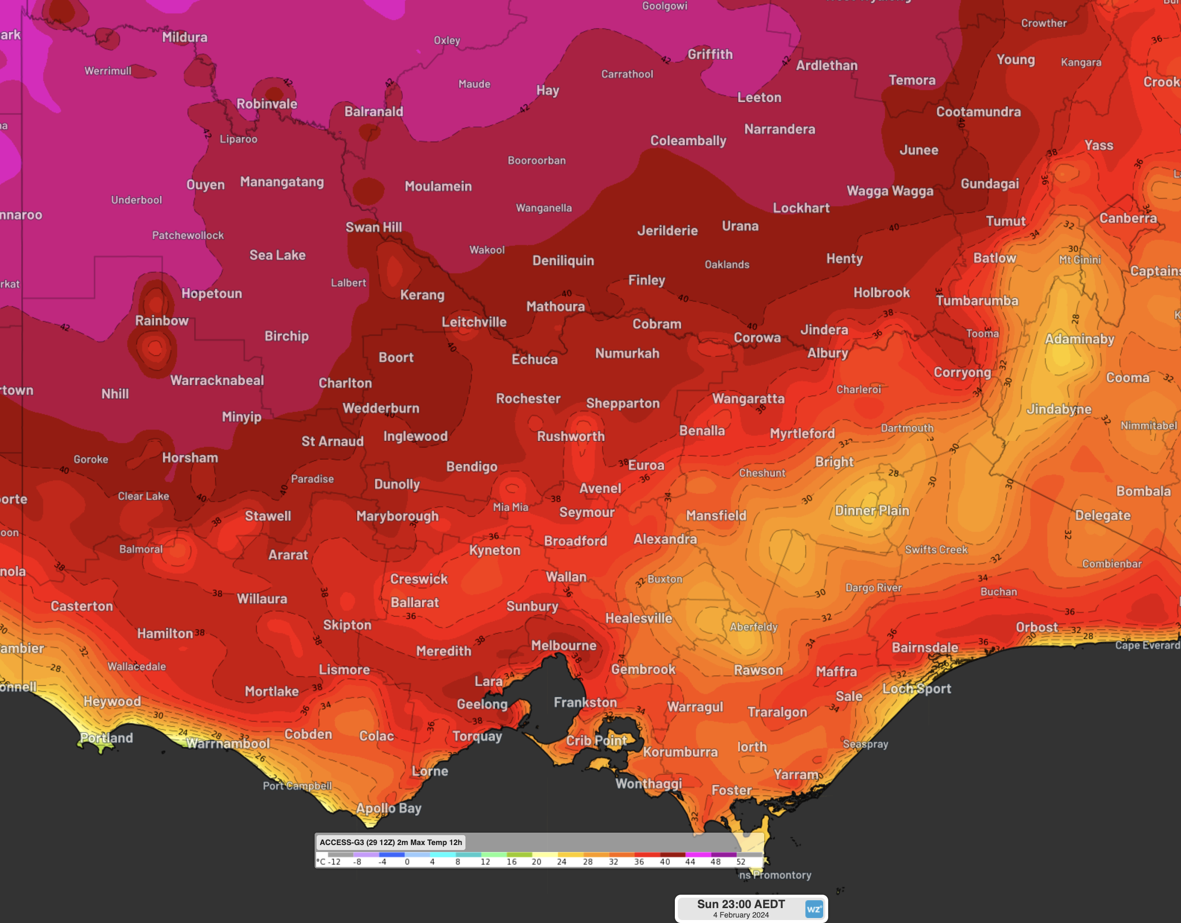
As you can see on the chart above, Sunday’s sizzling temps will be felt not just in Melbourne but across most of Victoria.
- Mildura in the Mallee district of Victoria’s northwest corner is heading for 43°C
- Bairnsdale in East Gippsland in the state’s southeast is heading for 38°C
- Only coastal towns in the state’s far southwest corner will avoid the burst of early February heat, although Warrnambool will still be warmer than its recent run of maximums in the low-20s with a Sunday top of 28°C
Hot weather is also coming to New South Wales over the weekend and into the new week with Penrith in outer western Sydney expected to reach 41°C on Sunday, while temps should reach 42°C that day across the Riverina district and as high as 44°C in the Lower Western forecast district.
The source of the hot burst is the classic set-up of northerly winds circulating around a high pressure system centred over the Tasman Sea, as you can see on our synoptic chart for Sunday.
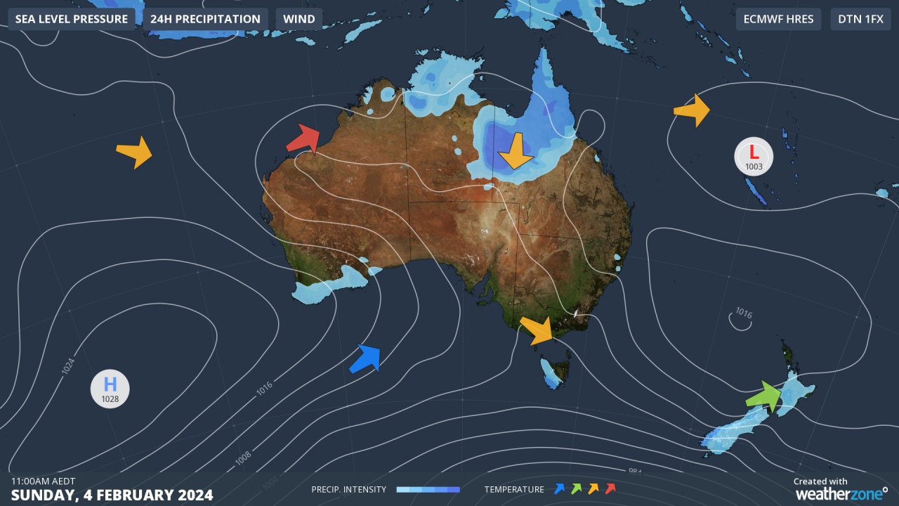
We haven’t seen too many charts like that so far this summer. As we wrote on Monday, the positive Southern Annular Mode, or SAM, (full explainer here) has made this sort of set-up a rarity.
But our mate SAM has just returned to a neutral phase, which opens the window for heat to push through from the west and interior of the country all the way to our eastern and southern coastlines.
A lack of humidity with the airmass tracking towards eastern Australia is another factor behind the build-up of heat which will take place this week.
Could Melbourne possibly even reach 40°C for the first time this summer on Sunday (it hit 40°C once last summer)? We’ll keep you posted if Sunday’s temperature forecast upgrades again.
Your business can benefit from the timely delivery of accurate weather information, allowing informed and effective decision-making. For more information, please contact us at apac.sales@dtn.com.




