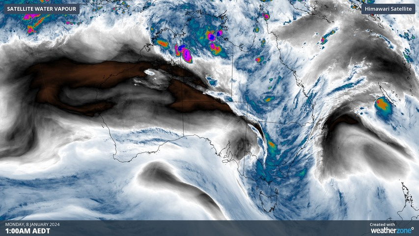
A band of heavy rain and thunderstorms being fuelled by tropical moisture has caused record-breaking rain and flooding in parts of Victoria.
A broad low pressure trough drawing moisture-laden air towards an upper-level low pressure system has produced widespread rain and thunderstorms across southeastern Australia during the last couple of days.
An unusually high concentration of atmospheric moisture has allowed this system to deliver record-breaking rain in parts of Victoria.
The heaviest rain during the 24 hours to 9am on Monday was 181 mm at Wild Duck Creek near Heathcote, with several other gauges also exceeding 100 mm during this period.
Heathcote’s 154 mm during the 24 hours to 9am on Monday was its heaviest January rain on record and it second wettest day in records dating back to 1882. Lake Eildon’s 84 mm was also a January record, with data there dating back to 1887.
Bendigo copped 91.8 mm during the 24 hours to 9am on Monday, setting a new daily rainfall record for a town that has been collecting observations since 1863.
Falls of 50 to 90 mm were also recorded to the east of Melbourne on Sunday into Monday morning, with Scoresby collecting 50.8 mm up to 9am Monday, its highest 24-hour rainfall total during January since 1970.
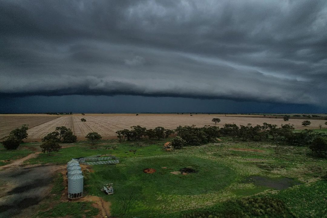
Image: A shelf cloud precedes a thunderstorm near Lake Hindmarsh, Vic on Sunday, January 7. Source: @hindmarsh_drone_91 / Instagram
Major flooding was occurring on Monday morning on the Campaspe River at Barnadown and Sunday Creek at the Yea River at Devlins Bridge. According to flood warnings issued by the Bureau of Meteorology, major flooding is also likely to occur along parts of the Goulburn River on Monday, with flooding also likely in other catchments today or tomorrow.
Heavy rain also soaked western, central and southern NSW during the last couple of days, with Mount Hope picking up 102 mm and Bourke collecting 93.2 mm during the 24 hours to 9am on Monday. This was Bourke’s heaviest rain since 2009 and its heaviest for January since 1995.
Rain and embedded thunderstorms will continue to spread over central and eastern Vic and large areas of NSW and Qld on Monday. This rain could be heavy enough to cause more flooding in eastern Vic on Monday afternoon, while severe thunderstorms are also possible in parts of Vic, NSW and Qld on Monday.
Be sure to check the latest weather, flood and thunderstorm warnings for the most up-to-date information. Also remember that it is never safe to enter floodwater.
Stormtracker is a severe weather solution that can assist you in observing, in real-time, any storm or event that has the potential to impact your business. For more information, please contact us at apac.sales@dtn.com.


