
Tropical Cyclone Jasper continues to gain strength over the Coral Sea and could soon be bearing down on the Qld’s North Tropical Coast.
Jasper became a category 4 tropical cyclone on Friday morning, becoming the earliest category four system in Australian waters since 2005.
At 10am AEST on Friday, Jasper was located 1,200 km east-northeast of Cairns with sustained winds of 195 km/h and gusts reaching 270 km/h near its core.
As Jasper strengthened on Friday, it has formed a clear eye, which can be seen on the satellite images below.
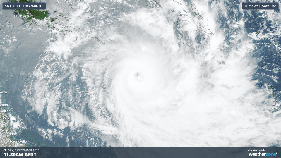
Image: Visible true-colour satellite images of Severe Tropical Cyclone Jasper on Friday.
While Jasper may strengthen a bit more into Friday evening, the system is expected to start weakening into the weekend as it moves further west and encounters increasing wind shear (change of wind speed and direction with height) and an intrusion of dry air.
The Bureau of Meteorology predicts Jasper to have weakened to a category two system by Monday morning as it continues to drift towards the west.
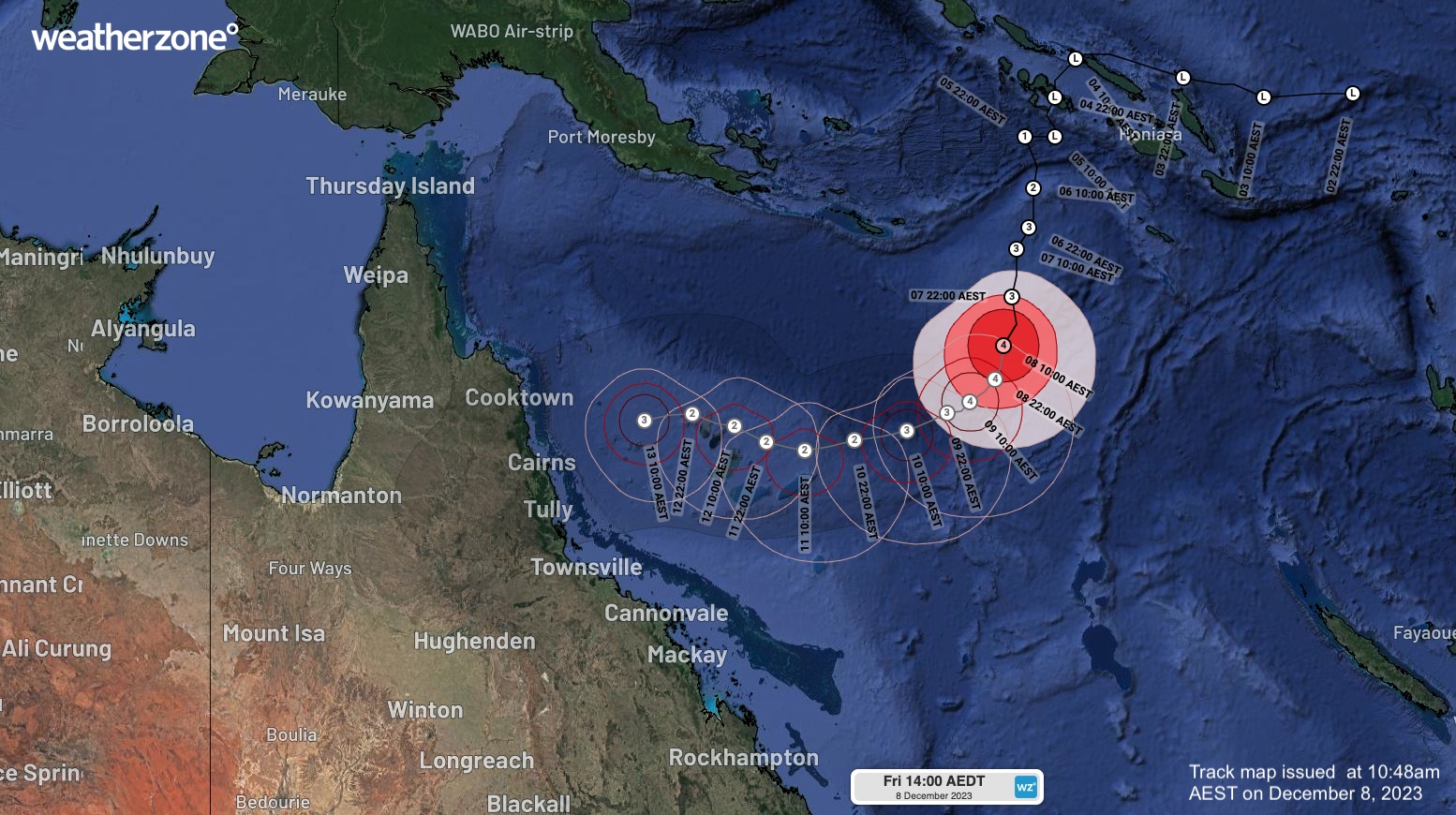
Image: Track map for Tropical Cyclone Jasper, issued at 10:48am AEST on Friday, December 8.
There is now growing consensus between forecast models that Jasper will continue on a westerly track next week and make landfall in northeast Qld. Some models also suggest that Jasper could restrengthen as it approaches the coast, which means landfall as a severe tropical cyclone can’t be ruled out at this stage.
The most likely area and time for landfall is between Townsville and Cooktown, including Cairns, around Wednesday or Thursday. However, there is still some uncertainty around Jasper’s future track, so these details may change in the coming days.
If you will be in northern Qld next week, be sure to check the latest tropical cyclone advisories for the latest updates on Jasper and its associated severe weather.
DTN APAC, specialises in industry-leading forecast, alerting and threat analysis of tropical cyclones, offering you expert, customised solutions when the weather turns wild. For more information, please contact us at apac.sales@dtn.com.


