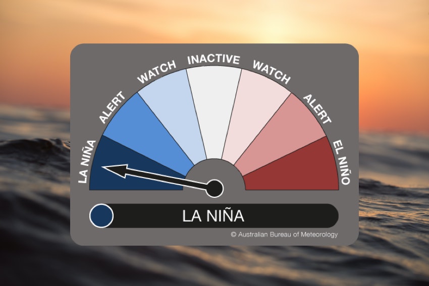
The Bureau of Meteorology has today declared the return of La Niña for a third consecutive season, solidifying the prospect of above-average rain and flooding in parts of Australia during the next few months.
Back in June this year, the Bureau declared the end of the 2021/22 La Niña event that had underpinned widespread rain and flooding over eastern Australia earlier in the year.
Since then, the Pacific Ocean has remained in a La Niña-like state according to the Bureau of Meteorology. However, some other international climate monitoring organisations, including the U.S. CPC and Japan’s JMA, continued to classify the Pacific as being in La Niña through the middle of this year.
Today’s declaration of La Niña bring the Bureau brings Australia into line with the rest of the world in recognising that La Niña is officially underway in the Pacific Ocean.
Three-in-a-row
La Niña has been in place during the last two Southern Hemisphere summers. The first event occurred between late-September 2020 and March 2021, followed by a second La Niña from November 2021 to June 2022.
It is not uncommon to see La Niña occurring over two consecutive seasons. This happened as recently as 2020-22 and 2010-12. However, it is rare to see three consecutive La Niña events, with the U.S. CPC only recognising two such triples in records dating back to 1950 (1973-1976 and 1998-2001). However, the Bureau of Meteorology also classify 1954 to 1957 as a triple-dip La Niña, making it three triple La Niña events since 1950.

Image: The grey lines in this graph show the three-year history of sea surface temperature anomalies in the Niño-3.4 region of the tropical Pacific Ocean for the last eight double-dip La Niña events. The current series of La Niña events (2020 to 2022) is shown by the purple line. Prior to 2020, only two double-dip La Niña episodes went on to La Niña in their third year. Graph is based on monthly Niño-3.4 index data from CPC using ERSSTv5. Source: NOAA CPC / Michelle L’Heureux.
What does this mean for Australia’s weather?
The official return of La Niña this week increases the likelihood of above average rain and flooding over eastern and northern Australia during the rest of spring and early summer. It also reduces the chance of extremely hot days and will likely lessen the intensity of heatwaves, while at the same time suppressing the risk of bushfires in eastern Australia. 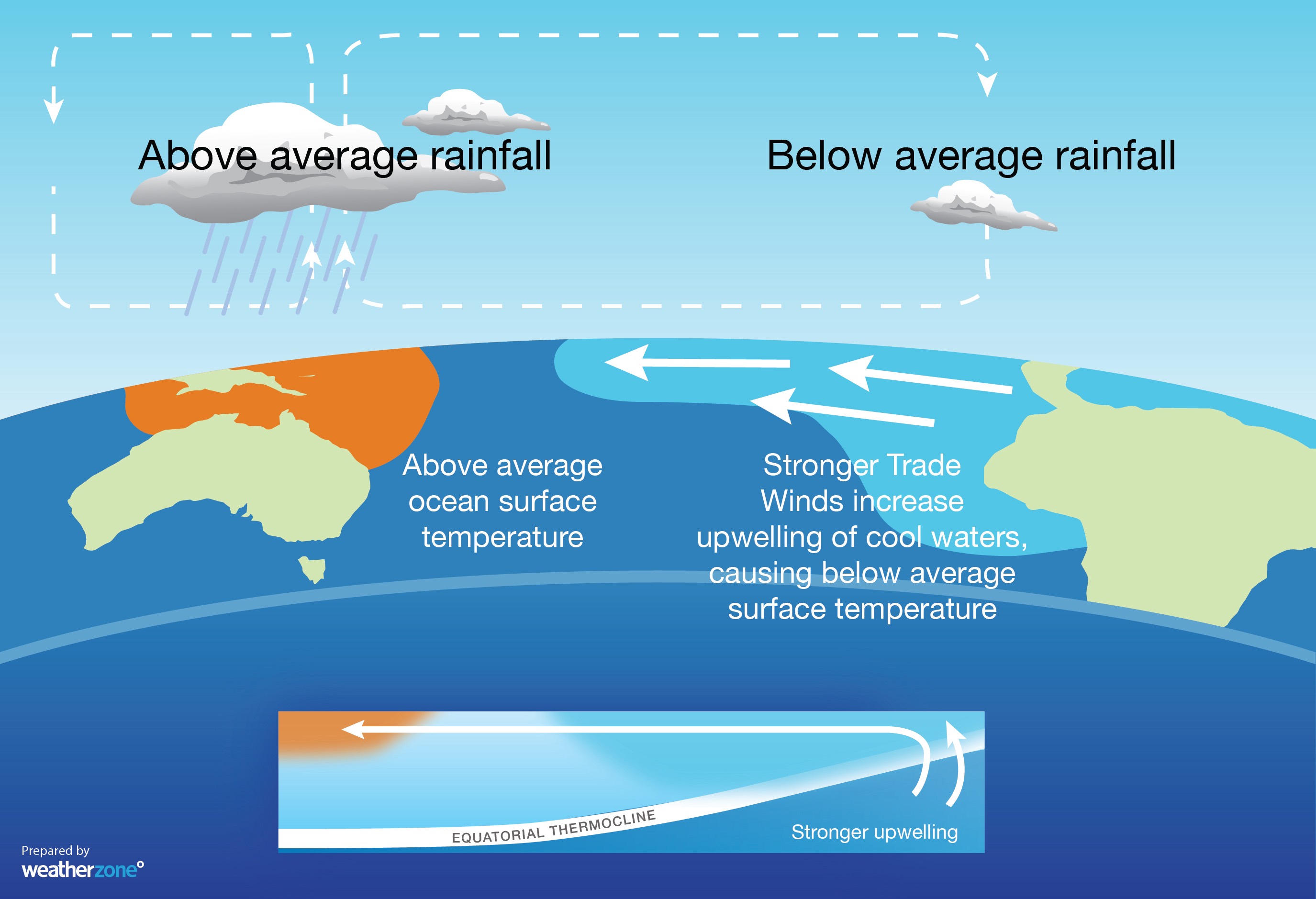
Image: The typical ocean and atmospheric patterns observed during La Niña, with warmer-than-average water and above-average-rain in the western equatorial Pacific Ocean.
Based on current forecasts, this La Niña episode is expected to peak during spring (most likely around November) and then weaken in early-to-mid summer. Most forecast models suggest that the Pacific will return to a neutral state early next year, meaning neither La Niña nor El Niño are occurring.
This outlook suggests that the strongest effects of this current La Niña will be in spring and early summer, before its influence on Australia’s weather starts to wane early in 2023.

Image: Rainfall and maximum temperature outlooks for October to December, according to the BoM’s ACCESS-S2 model. Source: Bureau of Meteorology
It is worth pointing out that no two La Niña events are the same and places that experienced flooding during last season’s La Niña are not guaranteed to see more flooding in the coming months.
However, with La Niña in place and a negative Indian Ocean Dipole (IOD) and positive Southern Annular Mode (SAM) also underway, the risk of flooding will be one of the main concerns for the eastern half of Australia over the coming months. For more information on our seasonal forecasts, please contact us at apac.sales@dtn.com.


