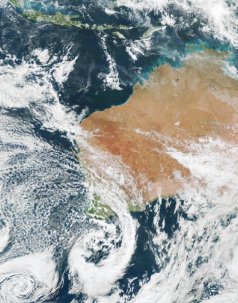
Wild and windy weather has begun in southwestern WA, as a low-pressure system lingers off the southern coastline.
Damaging winds were recorded in the southwest of WA on Monday morning, with gusts reaching 120 km/h at Cape Leeuwin, 96 km/h at Busselton Jetty and 95 km/h at Cape Naturaliste between 1am and 4am.
These strong winds are set to continue throughout Monday, with peak gusts of around 120km/h forecast in the far southwestern corner of WA in showers and thunderstorms.
Are all wind speeds good for wind farms?
Strong winds are usually great news for wind farms in these areas. However, sometimes the winds are too strong. There is a sweet spot when it comes to wind power.
Wind gusts above 90km/h (25m/s) can damage the wind turbines and the propellers if they are spinning.
Wind farms may have to turn the turbines off if the winds reach the ‘cut off’ wind speeds (25m/s) to ensure the strong winds do not damage the turbine.
If the winds are too strong, wind power capacities may be reduced for periods of time when the turbines are turned off.
What’s on the way?
The low-pressure system will extend two more cold fronts across the region on Monday and Tuesday, keeping wind speeds elevated between now and Wednesday.
While conditions will ease a bit on Monday night, damaging winds are possible again in the state’s southwest corner during Tuesday afternoon and evening, before winds finally ease later on Wednesday.
So, is the wind from these fronts good or bad for wind power in WA?
For wind farms near the exposed western or southwestern coasts, there may be periods where the wind exceeds cut-off speeds and operations have to shut down. However, in other areas that aren’t exposed to the strongest winds, we could see several days of high wind power output.
How will this impact solar power?
While wind power is likely to remain high during the next few days, this series of cold fronts will negatively impact solar output by bringing cloud, rain and thunderstorms to southwestern WA.
A sequence of cloud bands and patchy cloud will move over the area during the first half of this week as the low-pressure system extends cold fronts across the region.
The cloud is predicted to impact rooftop solar in the Wholesale Electricity Market (WEM), with large drops in rooftop solar outputs expected between Monday and Wednesday.
Weatherzone provides 14-day wind power and solar outlooks for operators in the WEM. For more information on our wind and solar forecasts please contact us at apac.sales@dtn.com.


