For Sydney residents, the smell and sight was eerily reminiscent of late 2019 when Black Summer bushfires encircled the city. The smoke caused minor disruptions at Sydney Airport Monday morning as the haze dropped visibility to 8300 metres.
Fortunately, the thick smoke haze which descended upon the city overnight was from hazard reduction burns in pockets of bushland in the city’s north and west, not bushfires, even though it was thick enough to trigger smoke alarms.
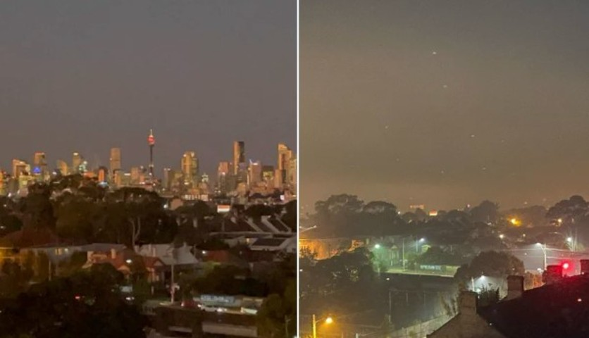
The smoke was so dense on Sunday evening that views of the city skyline were impeded even from relatively close range.
Image: There one night, gone the next. Source: @Dannews on Twitter.
As we write this story before lunchtime on Monday, both the smell and the sight of the smoke have mostly cleared, leaving blue skies on an otherwise very pleasant early spring day.
Smoke from hazard reduction burns conducted yesterday has settled across much of the Sydney overnight. The smoke will start to clear this morning however further burns are scheduled for today so residents of Sydney & Central Coast may continue to see & smell smoke until mid-week pic.twitter.com/svzZoG52tK
— NSW RFS (@NSWRFS) September 10, 2023
For the first time in two years, air quality was poor across the Sydney basin. By mid-morning it had returned to a good rating in all parts of the city except for Penrith, where it was fair. You can check the hourly updated air quality here.
The two-hour loop below shows a pretty interesting phenomenon, with smoke on Sunday afternoon appearing to move in both a westerly and easterly direction at the same time, just before dark.
How was this possible?
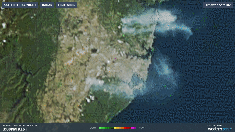
If you look at our Sydney observations for Sunday, you’ll notice that winds over the city were westerly in the morning, easterly for a few hours in the afternoon as the sea breeze kicked in, then westerly again later in the evening.
Smoke was pushed west on the easterly, but as it rose, the upper-level westerlies above the level of the sea breeze pushed it right back out to sea.
Meanwhile the RFS warns that more smoke can be expected in coming nights and mornings this week over the Sydney basin.
Elsewhere in Australia, hazard reduction burns are also taking place. There are numerous prescribed burns currently underway (as they’re called in the NT), where there is much more grass cover than usual in many areas due to unseasonable midyear rain. You can check the map for the latest locations here.
How can DTN APAC help the aviation industry?
DTN APAC delivers a proven aviation weather briefing system, developed in collaboration with the industry, to keep your enterprise performing at peak efficiency.
We meticulously tailor actionable weather intelligence to suit the scope of your company’s work, on the ground and in the air. Accurate and comprehensive international data informs your daily decisions on safety, fuel loads and staffing.
Working alongside our global network of partners and suppliers we collate the data to give you full situational awareness of both en route and port specific conditions. Weatherzone is accredited and adheres to standards for aviation meteorology set by the World Meteorological Organisation (WMO) and the International Civil Aviation Organisation (ICAO). Registered with the ICAO and providing safety critical OPTMET data with permission from Air Services Australia, our aviation services meet the industry’s stringent requirements.
This is weather intelligence delivered in an easy to visualise format. No matter what the weather has in store, we give you clear foresight to make informed decisions. For more information, please contact us at apac.sales@dtn.com.


