
Rain will continue to inundate already flooded eastern NSW for another two to three days as a stubborn low pressure trough lingers near the coast, impacting transport networks and businesses.
A deep layer of moisture-laden winds feeding a slow-moving low pressure trough have been causing persistent and heavy rain over parts of eastern NSW in the last few days. This rain has been enhanced by moisture evaporating from abnormally warm water at the surface of the Tasman Sea.
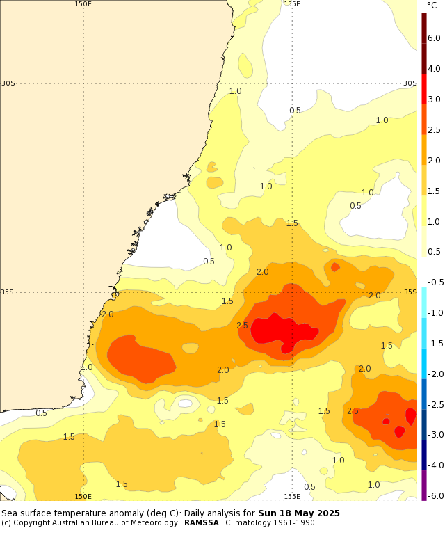
Image: Sea surface temperature anomalies to the east of NSW on Sunday, May 18, showing widespread positive temperature anomalies ranging from 1 to 3°C above average for this time of year. Source: Bureau of Meteorology.
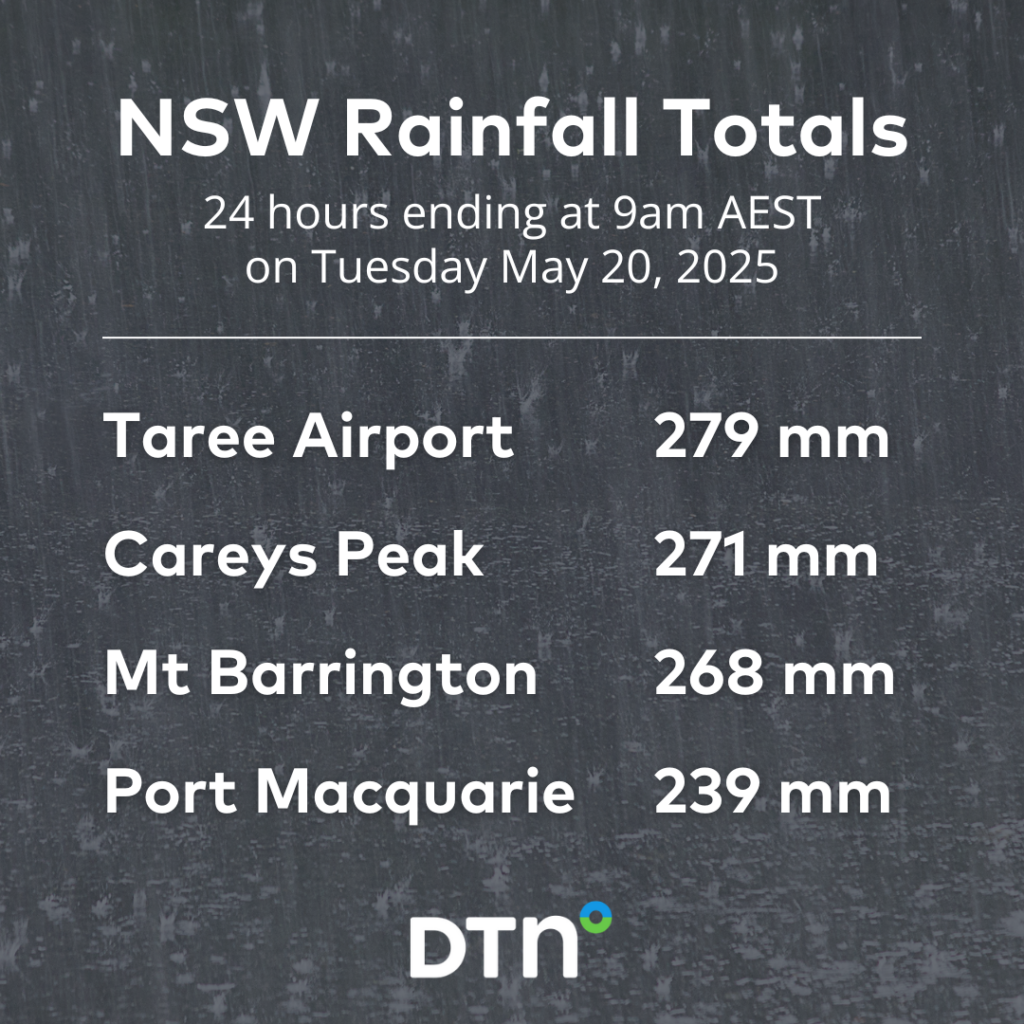
Some areas in the state’s Hunter and Mid North Coast districts have seen 200 to 300 mm of rain in the last two days, with much of this falling in less than 24 hours. Some of the standout rainfall totals from the 48 hours ending at 9am AEST on Tuesday, May 20 included:
- 317 mm at Careys Peak, with 271 mm in 24 hours
- 292 mm at Mount Barrington, including 268 mm in 24 hours
- 283 mm at Taree Airport, with 279 mm in 24 hours and 166 mm in 6 hours
- 243 mm at Port Macquarie, with 239 mm in 24 hours and 130 mm in 6 hours
This intense rainfall has already caused flash flooding as rivers, road and railway lines struggle to cope with the rapid inundation of water. Numerous schools and businesses are also closed across the Hunter and Mid North Coast regions.
As of 10:30am AEST on Tuesday, major flooding was occurring in the Gloucester, Manning, Paterson and Williams Rivers, while minor to moderate flood warnings were also in place for numerous other rivers, creeks and lakes in eastern NSW.
Damaging winds have also been causing havoc in the last couple of days, easily toppling trees across roads and powerlines in the rain-softened soil. Early on Tuesday, wind gusts reached 83 km/h at Murrurundi Gap and 78 km/h at Nobbys Head.
Rain to continue for days
The low pressure trough that has been soaking eastern NSW over the last 48 hours is likely to linger near the coast for another two to three days. This near-stationary trough will continue to draw in moisture from the Tasman Sea and cause persistent rain over parts of the Hunter and Mid North coast districts and the adjacent ranges and tablelands.
In addition to the 100 to 300mm that’s already fallen in the last 48 hours, parts of the Mid North Coast and Hunter could see another 100 to 250mm between Tuesday and Thursday, with heavier isolated falls.
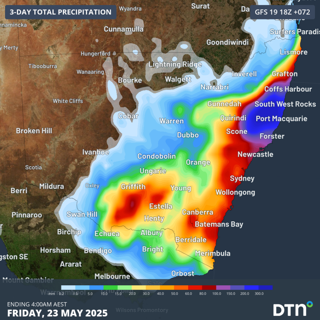
Image: Forecast accumulated rain during the 3 days ending at 4am AEST on Friday, May 23, 2025.
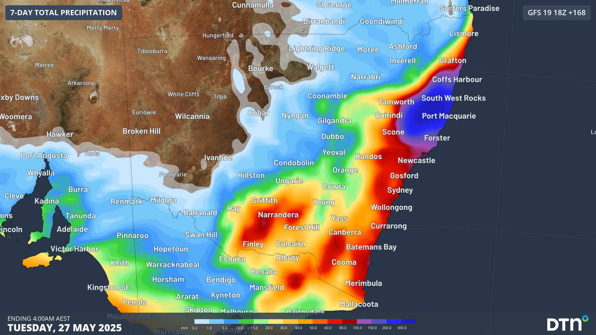
Rain from this system is also likely to extend further south and west between Wednesday and Friday, soaking a broader area of NSW and the ACT, and even extending over parts of eastern Victoria and Tasmania. A separate cold front should also deliver some rain to other areas of southern Australia from this weekend. The image below shows how much rain is being predicted by one computer model during the next seven days.
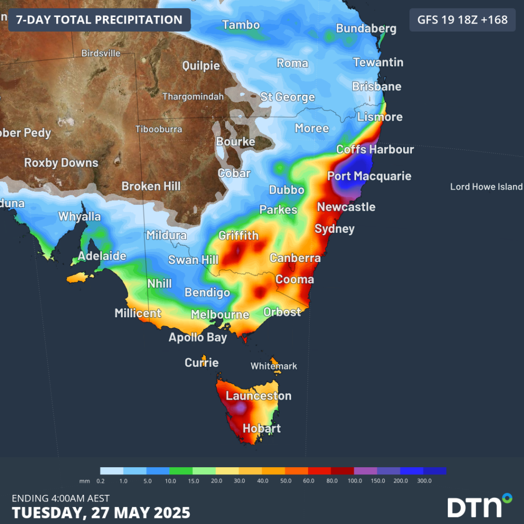
Image: Forecast accumulated rain during the 7 days ending at 4am AEST on Tuesday May 27, 2025.
The ongoing rain will continue to cause flooding in eastern NSW this week, impacting transport networks and other infrastructure and businesses. Check the latest road conditions before travelling and stay up to date with local warnings from the State Emergency Service and Bureau of Meteorology.
How DTN APAC’s Flood Risk System (FRS) can help
DTN APAC, delivers the Flood Risk System (FRS) to provide flood risk visibility. You can now easily visualise precipitation, and access rapid-update forecasting, across multiple sections of your site with the FRS geofenced alerting system. Gain a more precise determination with DTN APAC’s advanced geospatial technology creating hundreds of virtual ‘weather stations’ for each monitored section or culvert.
Rainfall is measured across each of your established catchments, with alerting calibrated to their individual thresholds. Alerts are raised when thresholds for any section are approaching or have been breached. This gives you targeted risk visibility to inform your assessment, operational response and emergency management.
The FRS can be integrated into your existing DTN APAC interface, or your own monitoring and control systems. Real-time monitoring of each catchment’s predefined thresholds is coupled with forecasting of rain, so you can provide your team with the most up-to-date information on whether conditions will ease, continue, or worsen.
To find out more about large range of products and services please visit our website or email us at sales.apac@dtn.com




