
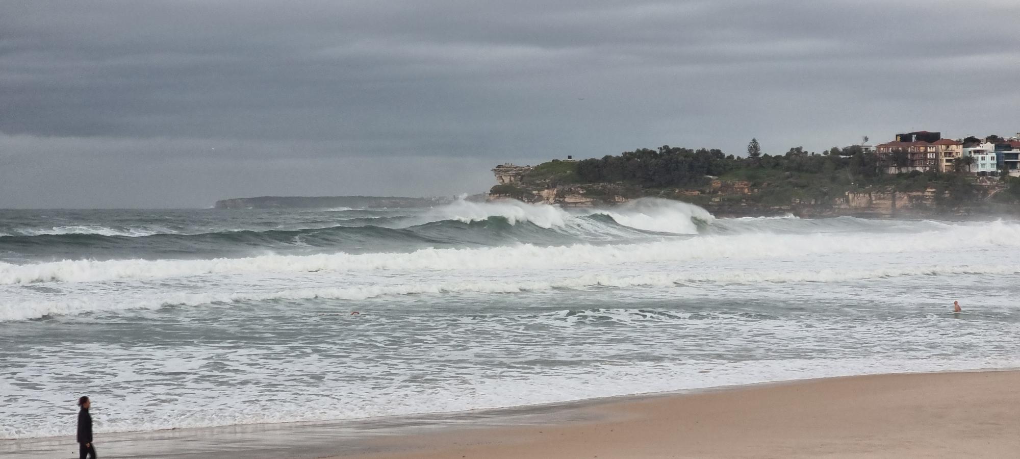
Massive waves reaching nearly 6 metres impacted the NSW coast on Sunday, with damaging waves continuing to impact the central coastline on Monday.
A Tasman Low is behind mammouth southeasterly swell along the eastern seaboard and it’s not going anywhere fast, with the large waves set to continue until mid-week.
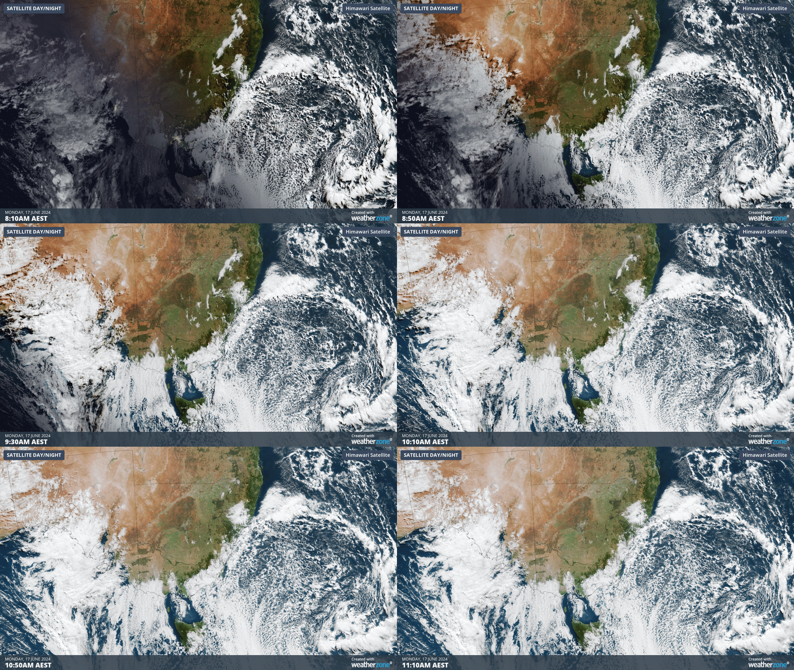
The satellite images below show cloud swirling in a clockwise direction around the Tasman Low just to the northwest of New Zealand. You can also see the clouds moving up the east coast of Australia, which is driven by fierce southerly winds.
The persistent gale force southerly winds associated with the low continue to whip up large swell along the NSW coast, including Bondi.
Bondi Beach Sydney #bondi #bondibeach #sydney #surf @newscomauHQ pic.twitter.com/OHsHMsqhkP
— Paul (@lefthandwave) June 16, 2024
The graph below shows that Sydney’s wave height peaked at 5.2 metres at 2am on Monday, June 17.
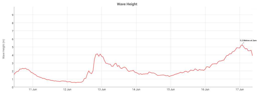
Image: Significant wave height. Source: Manly Hydraulics Laboratory.
Not only are these waves large, but they are powerful, with the wave period reaching just under 15 seconds on Sunday in Sydney. This means each individual wave carries a substantial amount of energy behind it.
Further south Port Kembla recorded waves of 5.6 metres, meanwhile Eden’s peaked at 5.8 metres.
You can see that the waves have reduced slightly on Monday morning, with heights lingering at around 4 metres off Sydney.
Waves of 4 to 6 metres are set to continue Monday along the central NSW coastline, with the potential to cause localised damage and coastal erosion, especially along the south- facing beaches.
While the damaging surf should ease later Monday, large waves will continue to impact the NSW coast until Wednesday.
DTN APAC offers a comprehensive suite of services, refined through years of collaboration with the marine, ports and offshore industries, to optimise the safety and efficiency of your operations.
We work with you to understand your intrinsic operational challenges and customise high-precision forecasting, metocean and aviation services to your exact location and operational scope.
When working offshore, our solutions can underpin planning and safe execution for offshore oil and gas enterprises and wind farms. Our data can support your exploration, development, rig moving, shuttle tanker operations, and production and decommissioning phases. Whether your crews are on-site, being transported to shore, or diving to perform maintenance, we deliver tailored weather risk briefings to ensure you choose the optimal time to proceed.
Weatherzone’s trusted nowcasting and forecasting system, OpticastTM, allows you to rapidly respond to changing conditions offshore, en route and in port. We take your port topography and berth orientation into account, ensuring site-specific forecasts. For offshore oil & gas, wind farms, ports and logistics, we have your weather situational awareness covered, no matter where you are. We deliver real-time severe weather and lightning alerts to your team via your integrated dashboard: Portzone, and our Weatherguard app.
Weatherzone’s Total Lightning Network (TLN) ensures you avoid hours of unnecessary downtime by providing the most accurate technology in lightning detection and alerting. Safeguard your teams and assets with lighting and Dangerous Thunderstorm Alerts (DTAs), customised to your existing parameters and delivered in real-time across all devices in your network. You gain full spatial awareness of developing severe weather systems, allowing you to plan ahead and, where needed, execute your shutdown and evacuation procedures.
With extreme conditions slowing production and affecting infrastructure, safety and transport, trust us to deliver Australia’s most precise weather data and tailored insight, giving you decisive confidence when it’s most needed. For more information please contact us at apac.sales@dtn.com.




