The eruption of Indonesia’s Mt Lewotobi Laki-laki has reportedly killed at least nine people, caused widespread evacuations, and wreaked havoc with aviation.
Many Australians are among those whose travel plans to Bali and nearby locations have been disrupted, and this video clearly shows how airborne ash has drifted westwards towards Bali all week in persistent trade winds over the Indonesian region.
Image: Unlike air travellers (until Thursday) the ash was airborne on its way to Bali.
Mt Lewotobi is a twin volcano comprised of two main peaks, Laki-laki (male) and Permpuan (female). It was Mt Laki-laki that erupted last Monday, November 4, and ash and other volcanic material continue to spew into the atmosphere.
The mountain is located approximately 800km east of the island of Bali, the tourist hotspot favoured by Aussies to which some (but not all) flights have finally resumed this Thursday after several days of disruptions.
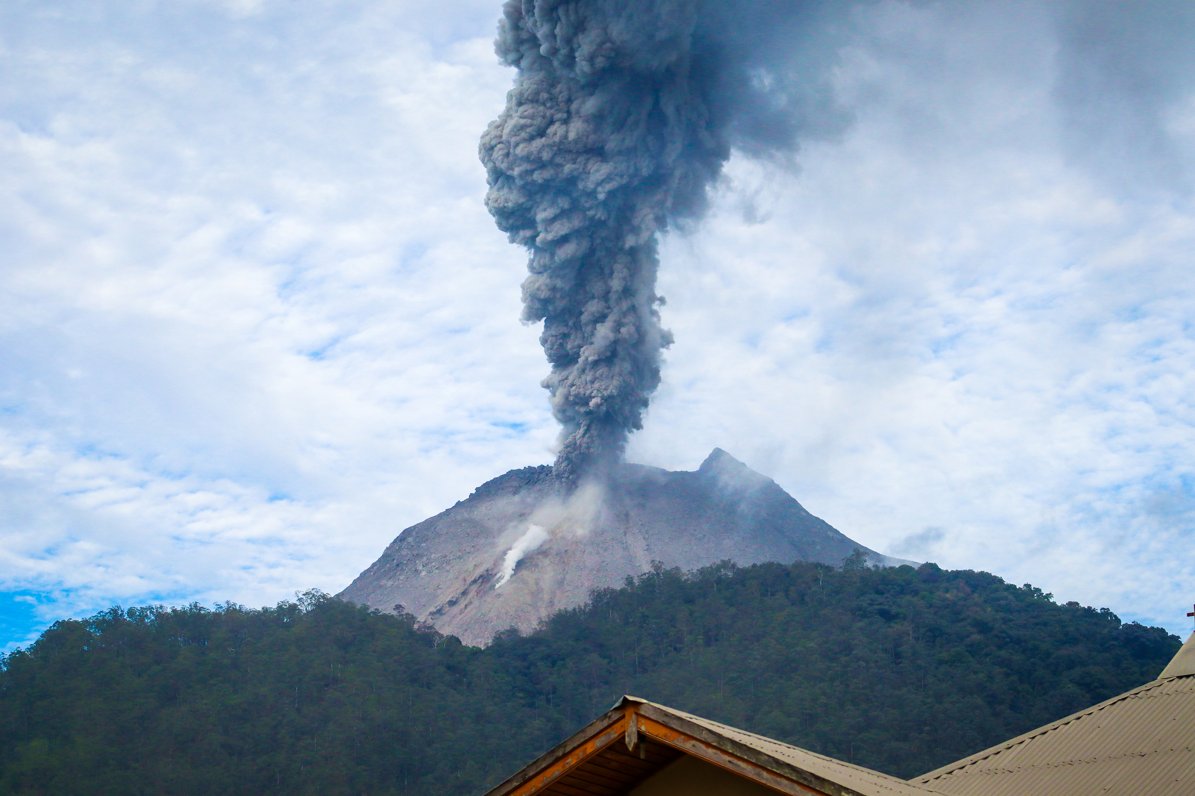
Image: Mt Lewotobi during a lesser eruption in June 2024. Image: Jimmy Tandjoeng via iStock.
Indonesia has 130 active volcanoes, by far the most of any country, with more than 1000 eruptions recorded over the course of its history.
Why is volcanic ash dangerous for aviation?
As Weatherzone meteorologist Felix Levesque explains, “Aircraft flying through volcanic ash suffer from abrasion, which is damaging to windshields and the leading edges of the wings.
“Additionally, ingesting ash particles into the engines melts the ash into molten glass, which can block the air flow and cause the engine to stall when the ash re-solidifies in the turbine.”
Ash clouds are often projected tens of thousands of metres into the atmosphere. Since most commercial jets cruise at around 8000 to 11,000 metres, this makes them highly susceptible to damage from ash clouds.
The hazard was little understood until 1982 when a British Airways jet flying to Australia lost power in all four engines over Indonesia before regaining power at a lower altitude (where the atmosphere was free of ash). The problem occurred again as the jet ascended so the pilot descended again and eventually pulled off a difficult emergency landing in Jakarta with minimal visibility due to the sand-blasting effect on the windshield.
There’s a documentary about that flight on YouTube.
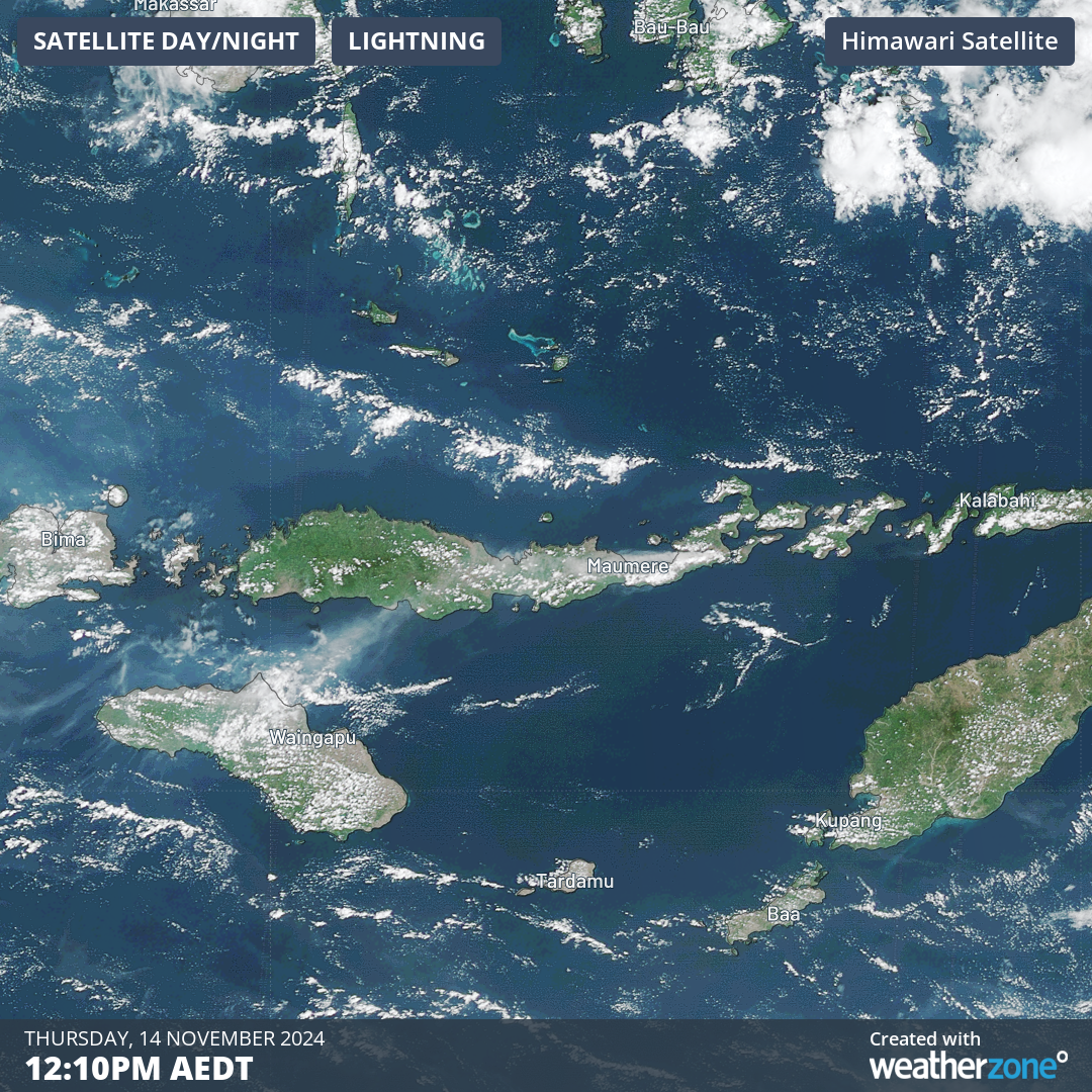
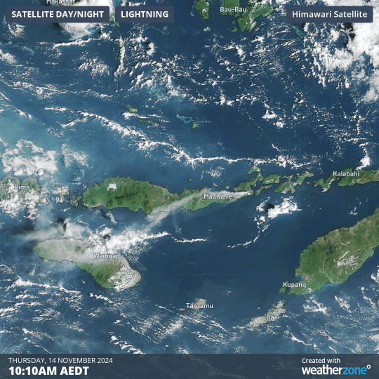
Image: Volcanic ash drifting in a southwesterly direction from Mt Lewotobi on the southeastern tip of Flores, Indonesia’s ninth-largest Island.
DTN APAC delivers a proven aviation weather briefing system, developed in collaboration with the industry, to keep your enterprise performing at peak efficiency.
We meticulously tailor actionable weather intelligence to suit the scope of your company’s work, on the ground and in the air. Accurate and comprehensive international data informs your daily decisions on safety, fuel loads and staffing.
Working alongside our global network of partners and suppliers we collate the data to give you full situational awareness of both en route and port specific conditions. Weatherzone is accredited and adheres to standards for aviation meteorology set by the World Meteorological Organisation (WMO) and the International Civil Aviation Organisation (ICAO). Registered with the ICAO and providing safety critical OPTMET data with permission from Air Services Australia, our aviation services meet the industry’s stringent requirements.
This is weather intelligence delivered in an easy to visualise format. No matter what the weather has in store, we give you clear foresight to make informed decisions. For more information please visit our website or email us at sales.apac@dtn.com.


