A low pressure system offshore Far North Qld has already dumped half a metre of rain in 48 hours, with more to come this week as the low potentially deepens into a tropical cyclone.
The images below show cloud and rain circling clockwise around the low, with the heaviest rain occurring between Cairns and Innisfail on Wednesday afternoon.
Image: Himawari-9 satellite image and radar for the three hours leading up to 1:30pm AEDT on Wednesday, January 29
The developing low pressure system has already dumped 200-500 mm of rain on Qld’s North Tropical Coast in the last couple of days.
The heaviest rain in the 48 hours to 9am on Wednesday fell between Cairns and Ingham, including:
- 538 mm at Clyde Road, near the Russel River to the northeast of Babinda
- 406 mm at Aloomba
- 338 mm at Gordonvale
- 342 mm at Cairns Racecourse (makes 342 mm in 48 hours to 9am Wednesday)
The low that soaked Qld’s North Tropical Coast over the past few days is one of five tropical lows being monitored by the Bureau of Meteorology for possible tropical cyclone development in the coming week.
The activity across northern Australia this coming week is due to the presence of two tropical waves, the MJO and Kelvin wave and a potential monsoon surge. The monsoons potential entrance this week is a tardy one, making this the latest onset on record for Darwin.
The maps below shows the predicted accumulated rainfall over northern Australia in the next 10 days from two different computer models.
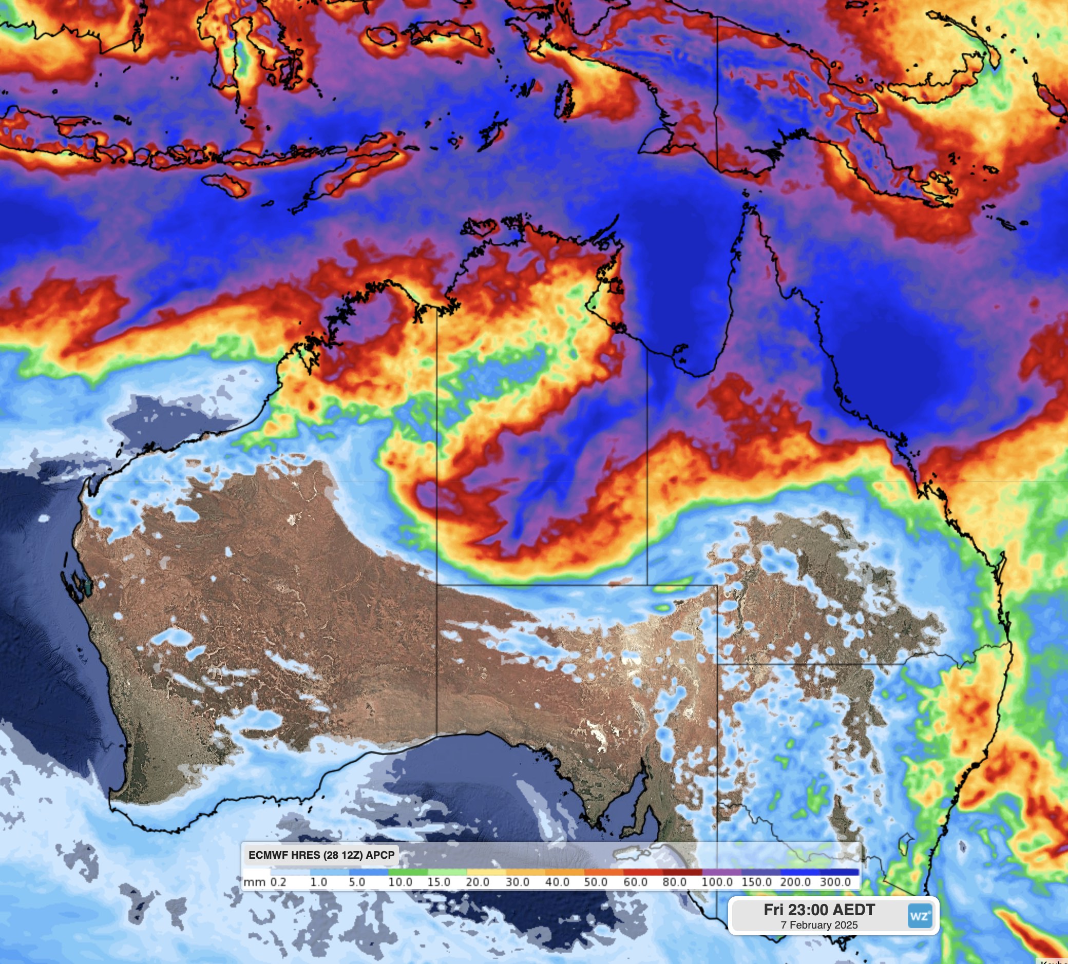
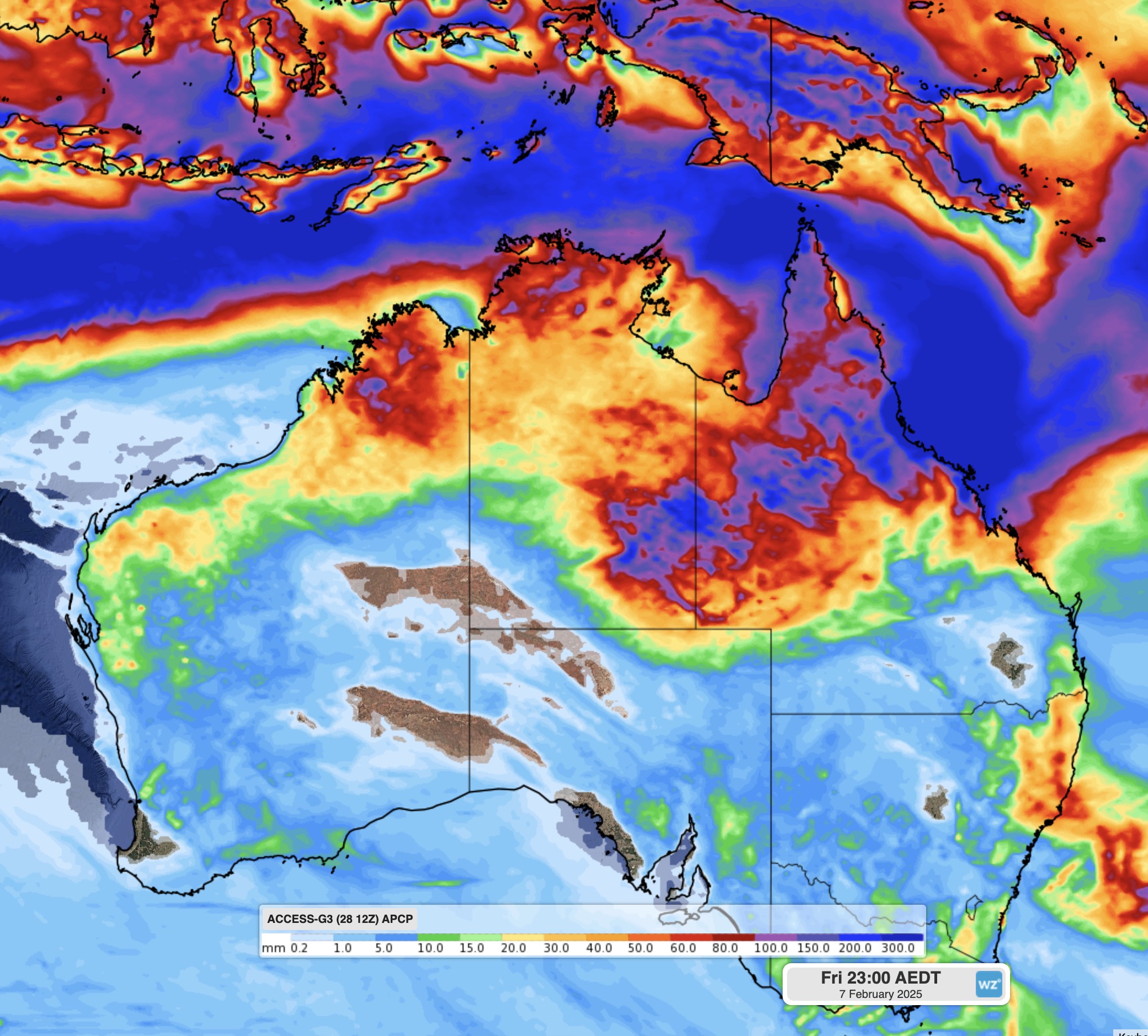
Images: Forecast accumulated rain during the 10 days ending on February 7, 2025, according to the ECMWF-HRES model (top) and ACCESS-G model (bottom).
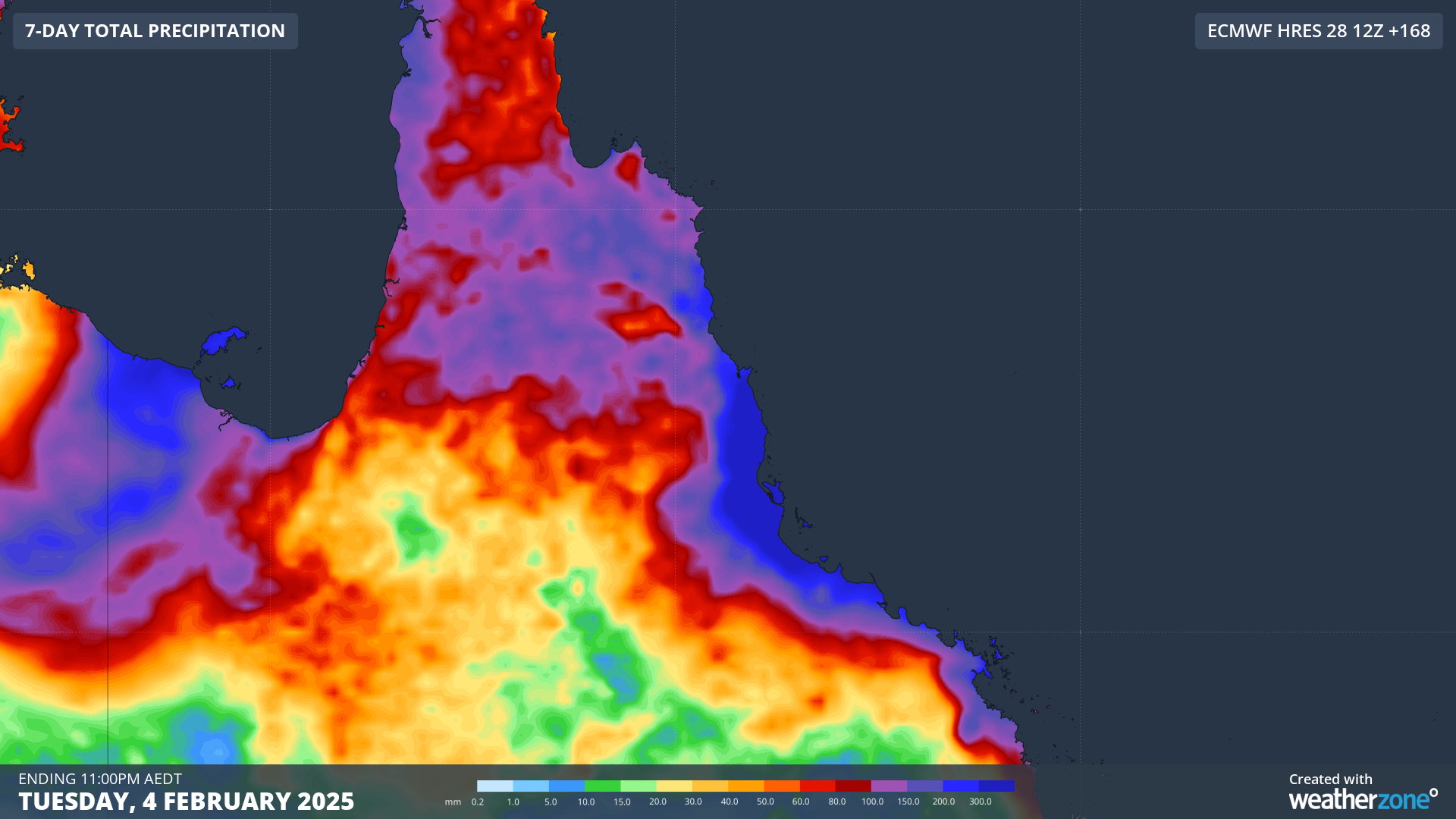
Heavy rainfall will continue over the region in the coming days before intensifying over the weekend across the tropical north coast of Qld.
Computer models are suggesting daily rainfall totals at this stage could exceed 600mm north of Townsville on Sunday and Monday, February 3. On Tuesday and Wednesday, they are suggesting 24-hour totals of 100mm in the region.
This rainfall is dependent on the strength and position of the low, with the Bureau of Meteorology giving the low a medium chance of developing into a cyclone later in the week.
Although latest model runs show the low too close to the coast for significant development into a cyclone, which could reduce the risk of gales in the region early next week.
Regardless of its category, heavy rainfall and fierce winds will likely impact port operations in the coming week and DTN APAC are providing daily updates to our clients in the region.
The critical updates from our meteorologists allow harbour masters, vessel transport services and pilotage to make informed weather-influenced decisions.
We deliver detailed forecasts across the port and to berth level, as well as severe weather alerts keeping your staff safe and minimising infrastructure damage. We will support you, 24/7, keeping you informed and making your critical decisions easier. For more information contact us at sales.apac@dtn.com


