Sydney and the Illawarra will experience an early-season spike in fire danger ratings on Wednesday and Thursday as a burst of warm, dry and windy weather hits eastern NSW.
While the start of this week was abnormally cold in Sydney and surrounding areas, temperatures will climb quickly over the next couple of days as warmer northwesterly winds develop across NSW.
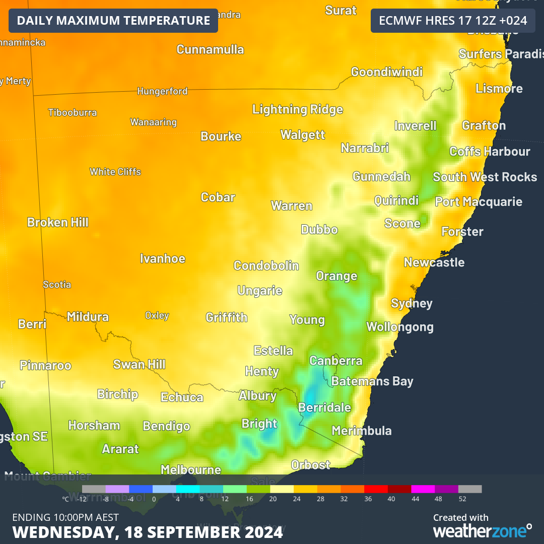
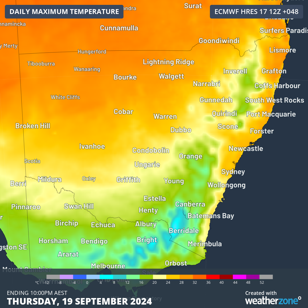
Images: Forecast maximum temperatures on Wednesday and Thursday this week
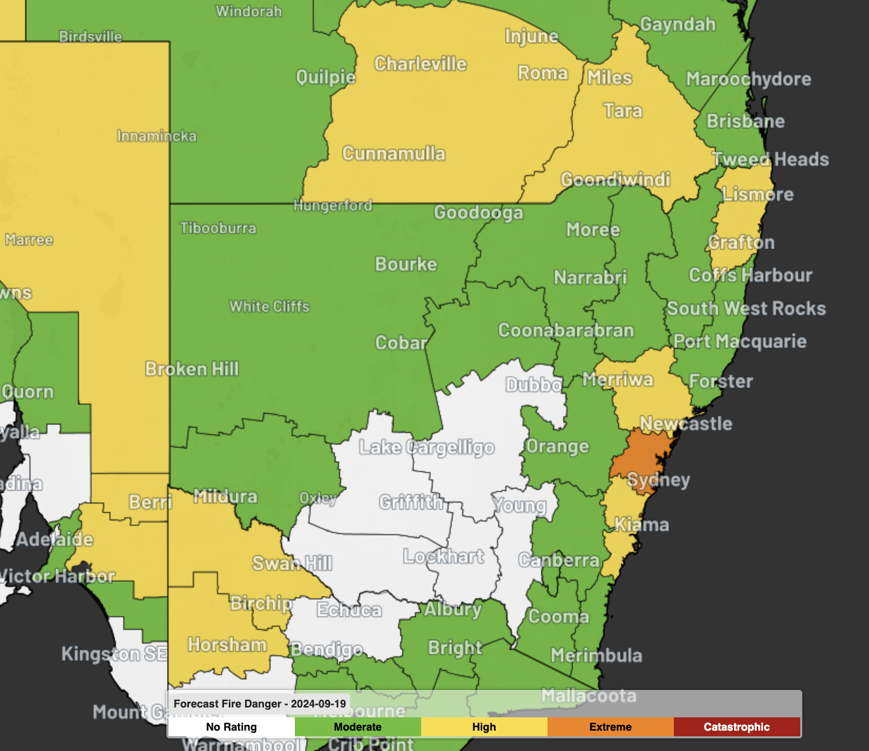
A combination of increasing temperatures, blustery winds and low relative humidity will cause fire danger ratings to increase in parts of central and northern NSW on Wednesday and Thursday.
Fire danger ratings in Australia fall into a five-tiered scale based on the likely consequences of a fire, if one were to start:
- No rating: This rating is used on days of minimal fire risk when no action is required.
- Moderate: Stay up to date and be ready to act if there is a fire.
- High: There is a heightened risk of fires. Life and property may be at risk. The safest option is to avoid bush fire risk areas.
- Extreme: Dangerous fire conditions. Check bush fire plan and ensure that your property is safe. If a fire starts, you need to take immediate action. Reconsider travel through bushfire risk areas.
- Catastrophic: The most dangerous conditions for a fire. Homes cannot withstand fires in these conditions. Your life may depend on the decisions you make. Stay safe by going to a safer location early in the morning or the night before.
The Greater Sydney and Illawarra/Shoalhaven fire weather districts are forecast to see High fire danger ratings on Wednesday, with a Total Fire Ban (TFB) in place for Illawarra/Shoalhaven. Conditions will deteriorate further on Thursday, with Extreme fire danger forecast for the Greater Sydney district and High fire danger predicted in the Far North Coast, Greater Hunter, North Western and Illawarra/Shoalhaven districts. TFBs for Thursday are issued by the RFS around 4pm each day, with a least some of these districts required to follow TFB rules.
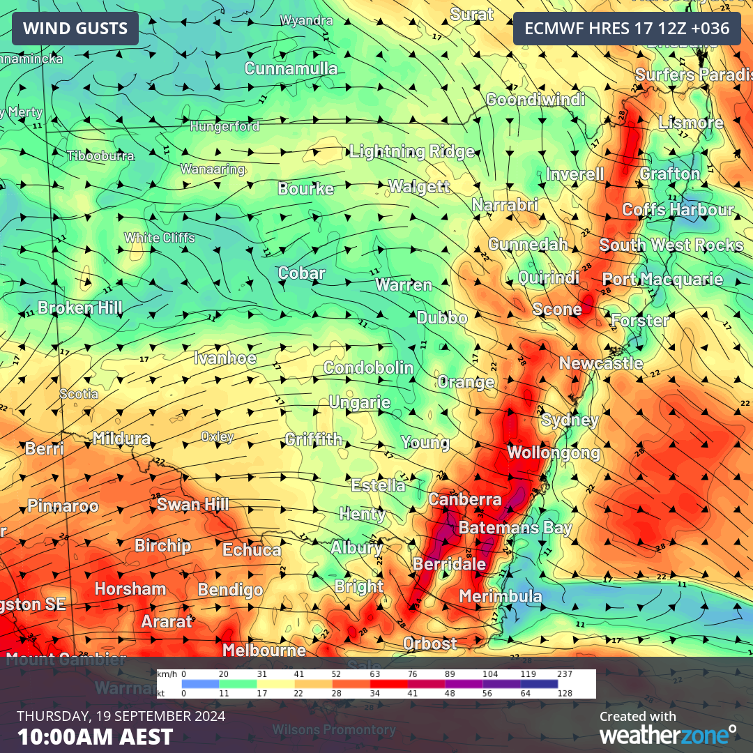
Image: Forecast 10m wind gusts at 10am on Thursday
This week’s spike in fire danger comes after NSW registered its warmest August on record, with Sydney also having its second warmest August on record. Such abnormal late-winter heat helped dry out vegetation for the start of spring, providing plenty of fuel for early-season fires.
This hot end to winter resulted in more than 90 fires burning across NSW on August 28. A few days later, more than 60 fires were burning across the state on September 2 despite fire bans being issued in Sydney and the Illawarra/Shoalhaven.
Visit the RFS website for the latest information on fire danger ratings, fire bans and active bushfire across NSW.
DTN APAC serves the forestry, fire, safety and emergency sectors, delivering trusted weather data and severe weather alerting to maintain safety, protect your assets and underpin your planning. Some of our key products are:
- Access to the Total Lightning Network, delivering unparalleled accuracy of lightning strike data
- Fire hotspot tracking and alerting through Stormtracker, so new fires can be assessed and controlled nearly immediately after they form
- Seasonal briefings by our expert meteorologists and climatologists customised to your business to better tailor your preparedness for the upcoming seasons
For more information, please visit our website or email us at apac.sales@dtn.com.


