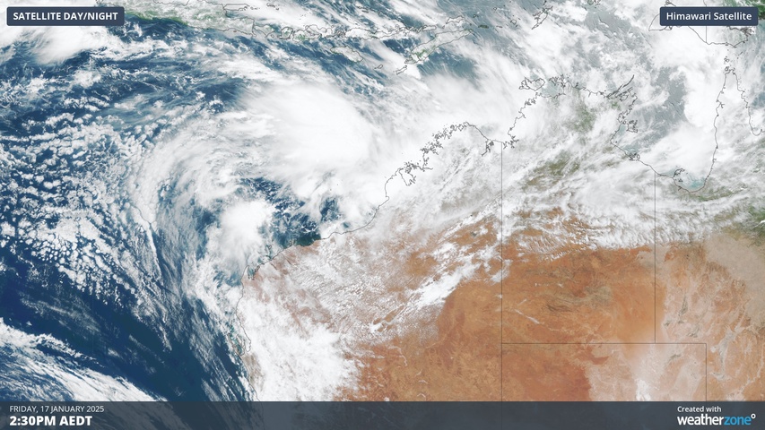
A developing low pressure system off Australia’s northwest coast has a high chance of becoming a tropical cyclone this weekend, with the potential for heavy rain and wind to impact some mining and port clients in the Pilbara.
Two separate areas of low pressure lying off the northern coast of WA are expected to consolidate into one low pressure system by Saturday. This low is likely to gain strength during the weekend as it draws energy from abnormally warm seas sitting off the Pilbara coast.
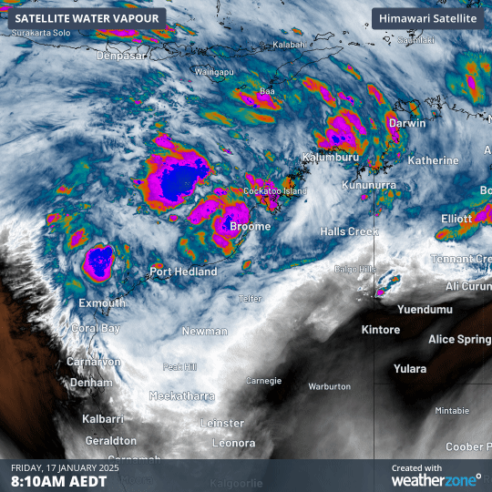
Image: Enhanced water vapour satellite images showing cloud building around two areas of low pressure to the north of WA on Friday, January 17, 2025.
Forecast models suggest that the low will track towards the west-southwest and build in strength this weekend and early next week, with a high risk that it will become a tropical cyclone on Sunday or Monday.
Most computer models suggest that the soon-to-be tropical cyclone should remain away from the WA coastline between now and at least Monday. However, it could still pass close enough to cause and increase in wind and rain for part of the Pilbara. It’s also important to point out that tropical cyclone movement is notoriously difficult to predict, even more so when the system hasn’t yet formed.
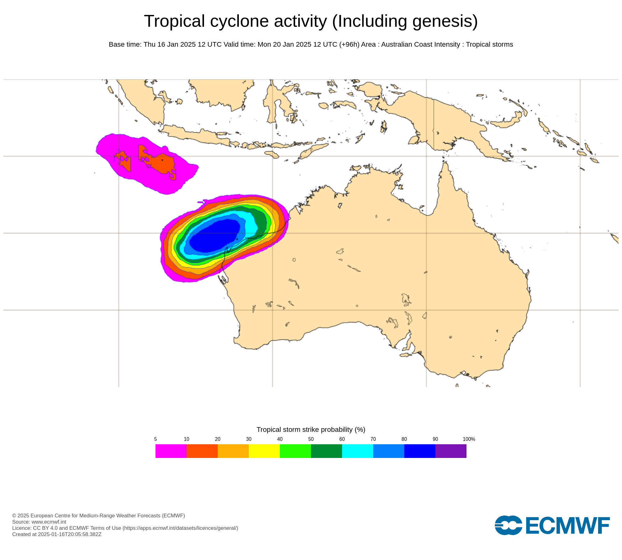
Image: Tropical cyclone likelihood according to the ECMWF ensemble model. The colours show the probability that a tropical cyclone will pass within 300km of a given location within a time window of 48 hours. Source: ECMWF
At this stage, anyone in WA’s Pilbara and Gascoyne regions should pay close attention to the latest forecasts and warnings over the coming days. Details can change frequently with these developing tropical systems.
If this low does develop into a tropical cyclone, it will be the second cyclone to form in the Australian region so far this season, and it will be named Sean.
As the climate delivers increasingly severe weather events, their potential to impact your business operations grows.
DTN APAC, specialises in industry-leading forecast, alerting and threat analysis of tropical cyclones, offering you expert, customised solutions when the weather turns wild.
Providing rapid-update forecast information, we alert you to any low-pressure system gaining power within your region and, unlike other providers, can track its development out to 7 days. This gives you the time to prepare and safeguard your staff, sites and assets.
You will have the most precise weather intelligence charting rainfall, wind speeds and potential storm surges to help you make critical decisions quickly. Whether it’s adjusting key work schedules, protecting your staff or securing your site, we have the alerting capability to keep you steps ahead of the storm.
We will support you, 24/7, keeping you informed and making your critical decisions easier. For more information contact us at sales.apac@dtn.com


