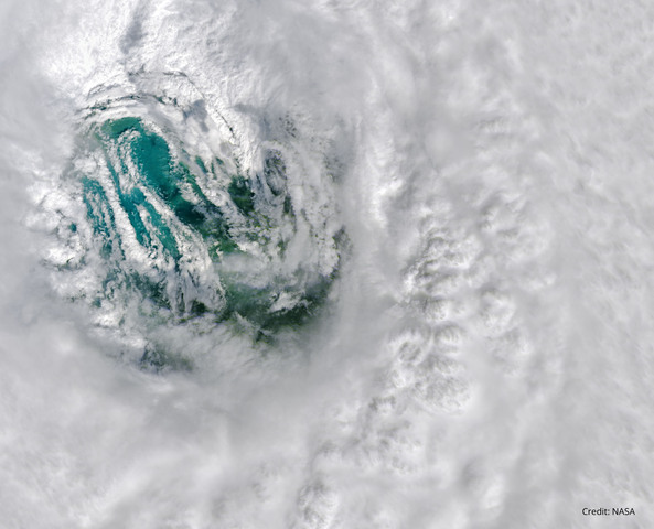
Tropical cyclones are one of the most powerful weather systems on Earth, with top-tier cyclones producing wind gusts in excess of 300 km/h, torrential rain and dangerous storm surges. But what is it like to be in the direct path of a landfalling tropical cyclone and how strong can they get?
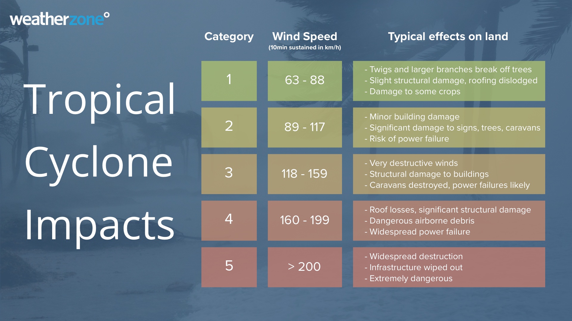
All tropical cyclones in the Australian region are ranked using a 5-tiered scale based on maximum mean wind speed. When using the Australian scale, mean wind speed refers to the wind speed averaged over a 10-minute period.
For a system to be classified as a tropical cyclone in Australia, it needs to be a warm-cored low pressure system with 10-minute average wind speeds of at least 63 km/h (34 knots) extending more than halfway around its centre for at least six hours.
There are five categories for tropical cyclones in Australia based on wind speed:
- Category 1 – mean wind speeds of 63 to 88 km/h
- Category 2 – mean wind speeds of 89 to 117 km/h
- Category 3 – mean wind speeds of 118 to 159 km/h
- Category 4 – mean wind speeds of 160 to 199 km/h
- Category 5 – mean wind speeds > 200 km/h
Low-end tropical cyclones (categories 1 and 2) will typically produce damaging to destructive winds that can cause some damage to infrastructure and the landscape.
Severe tropical cyclones, defined as category three and above in Australia, are particularly dangerous systems that cause very destructive winds and more widespread damage.
The table below gives you a guide of the typical effects you would expect to see on land for each category tropical cyclone category.
The proliferation of mobile phone cameras and growing popularity of storm chasing in recent years has provided a wealth of video footage from inside the core of tropical cyclones around the world.
One of the most well-known tropical cyclone chasers is Josh Morgerman, who has intercepted dozens of tropical cyclones around the world, including the devastating Hurricane Dorian as it slammed into the Bahamas in 2019.
All tropical cyclones are capable of causing severe weather that may be life-threatening. So, it is important to always monitor the latest tropical cyclone advisories if you are anywhere in northern Australia during the tropical cyclone season, which runs between November and April.
How Weatherzone can help you prepare
DTN APAC has a suite of tropical cyclones services we provide to deliver our clients with as much forewarning of tropical cyclones as we can. We have 4 levels of forecasts timeframes:
- Tropical cyclone seasonal outlooks
- Weekly tropical update
- Daily 7-day tropical cyclone forecast
- Detailed tropical cyclone impacts (issued every 1-6 hours aligning with the BoM’s offical advisories)
Through these products you can have as much preparation as possible for tropical cyclones and their impacts. To find out more, please email us at apac.sales@dtn.com.


