A waterspout was spotted just off the Sydney coast on Sunday. These beautiful and sometimes violent systems are often spotted off the Australian coast at this time of year, so we go through some frequently asked questions about them.
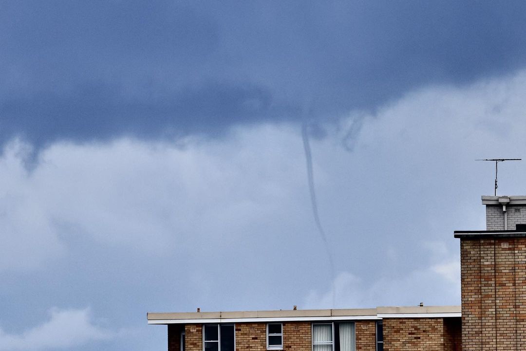
Image: A waterspout spotted off the Sydney Coast on Sunday. It is likely the waterspout is making contact with the water behind the building. Credit @seabz76 Instagram
What is a waterspout?
Waterspouts are a spinning column of both liquid water and water vapour that stretch from water up to a cumulus or cumulonimbus cloud (i.e. clouds that cause showers and/or thunderstorms).
How do they form?
Waterspouts form when cold air converges over a large body of relatively warm water. Vortices of water and air start spinning up on the water’s surface, caused by an influx of warm air. This spinning grows faster until it has enough momentum to lift a region of water into the air. A cloud of sea spray forms, followed by a thin column of water vapour that connects to the clouds. Because the column is formed by water vapour, parts of the waterspout can become nearly invisible at times.
Video: A waterspout spotted near Darwin early this year. The raised surface of the water can be clearly seen in white. Credit @seabz76 Instagram
Are waterspouts different to tornadoes?
While waterspouts appear similar to tornadoes, the vast majority are non-tornadic and form fundamentally different. Tornadoes form from a supercell cloud and move down towards the surface, and are therefore much stronger, larger and more dangerous than waterspouts. Waterspouts usually produce wind gusts between 80 and 110km/h, while gusts from tornadoes are often above 120km/h and can exceeded 400km/h.
Where and when do they form?
Waterspouts commonly form in the Australian tropics and east coast of Queensland and New South Wales during heavy showers and storms that are just offshore. Near the east coast, waterspouts are most common during February to July, when waters are warm, and the air starts to cool down. In the tropics, they largely occur between November and April during the wet season, and often occur during monsoon bursts.
Amazing morning waterspout off of Airley Beach, Australia (Courtesy Catch My Drift Charters), April 12. See where waterspouts are occurring around the world at: https://t.co/WPioHG02Jy pic.twitter.com/x8muzwAHws
— ICWR (@ICWR) April 14, 2023
How dangerous are they?
Waterspouts pose no real threat to those on the land while they occur, although powerful waterspouts have been known to throw fish and frogs onto the nearby shore. However, on the water, they can be particularly dangerous to boats and people. Their rotation causes thousands of litres of water to be flung into the air, and can easily lift jet skis, small boats, or swimmers. Waterspouts have been known to cripple fleets of boats in the past, like the 1551 Malta Waterspout that killed at least 600 people.
Can more than one waterspout form at a time?
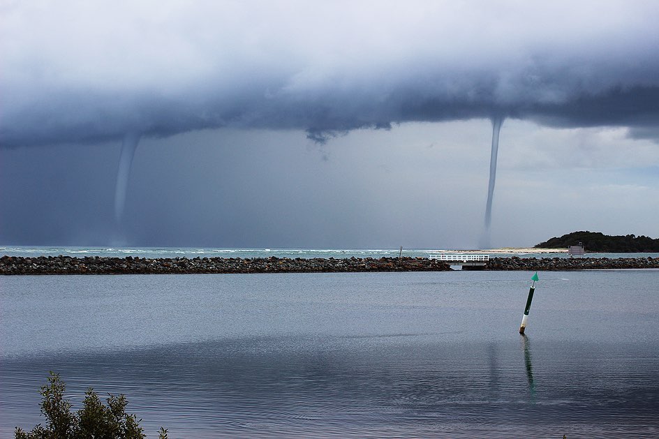
Yes, outbreaks of waterspouts are somewhat common off the east coast of Australia, usually in pairs or triplets. This is possible because waterspouts are small (usually between 30-100m in diameter) and can occur within large regions that meet the same formation criteria. However, a particularly large outbreak occurred off the Mid North Coast of NSW in May 2021, when at least six, but possibly more than 10 waterspouts were spotted off the coast at the same time.
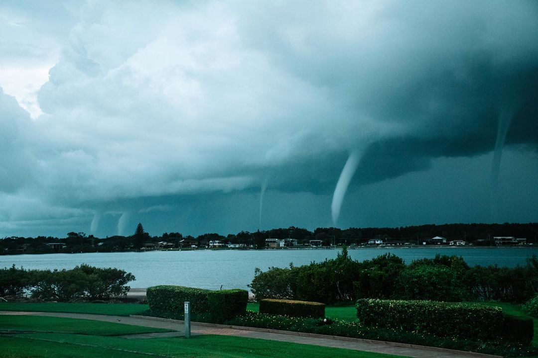
Image: A waterspout outbreak spotted near Taree in May 2021. Credit @Kirrajane00 Instagram.
Overall, waterspouts are amazing weather phenomena to behold, but are best observed from a safe distance.
DTN APAC has a variety of products to help any marine service, including storm tracking (to keep an eye for possible waterspouts), weather alerting, and wind, wave and tropical cyclone forecasts. To find out more, visit our website or email us at apac.sales@dtn.com.


