
Western Australia is copping a bit of everything today, with warnings in place for damaging winds, flash flooding and fires.
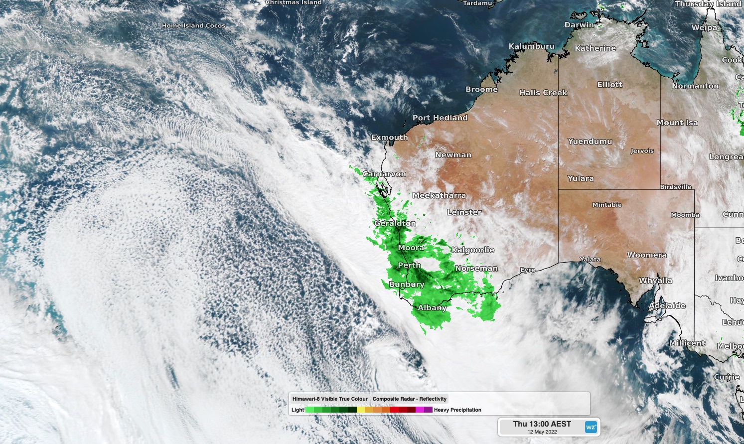
A stream of moisture being carried south from Ex-Tropical Cyclone Karim is interacting with a cold front passing over Western Australia today, producing widespread rain and thick cloud cover.

Image: Composite satellite and radar image showing a large mass of cloud and rain moving over western and southern districts of Western Australia on Thursday.
The heaviest rain during the 24 hours to 9am on Thursday fell over the far southwest of WA, where several gauges near Augusta collected around 50mm. Further north, Perth picked up 11 mm and Lancelin saw just over 30 mm.
The heaviest rain is likely to spread further north between Thursday afternoon and Friday morning as a low pressure system moves over the state from the Indian Ocean.
A severe weather warning has been issued for heavy rain and damaging winds in parts of the Central West, western Gascoyne and western Pilbara districts in response to this low. Six-hourly rainfall rates of 60 to 90 mm are possible in these districts, with isolated falls potentially reaching 100 to 150 mm. Wind gusts could reach 90 km/h in parts of the Gascoyne and Central West districts on Thursday afternoon and night.
A separate severe weather warning is also in place for damaging winds along the state’s south coast from about Augusta to just west of Esperance, where 90 km/h gusts are possible between Thursday night and Friday afternoon.
While heavy rain is one of the main threats from this system, its blustery winds are also creating dangerous fire weather in parts of the state’s north. A fire weather warning has been issued for the Gascoyne Inland fire weather district on Thursday. Very High fire danger ratings may also occur in the Eucla and South Interior districts on Friday as the front moves further east.
The combination of thick cloud, cold air and showers have also kept a cap on temperatures across southwestern parts of the state today. At midday, Perth was only sitting on 12.4ºC but wind chill was making it feel like 9.2ºC. This is well below the city’s average May maximum temperature of 22ºC.
Wind, rain and fire danger ratings should all ease from the west on Friday and across the whole state on the weekend as a high pressure system moves in from the west.
Heavy rain and mine sites
Heavy rainfall and flooding at a mine site or associated railways or roads can shut down operations for days, costing the business economically. Within the mine site, heavy rain can damage the haul roads used by dump trucks on a daily basis as part of standard operations. In some cases, this can become unsafe and can change the slope, road and ramp stability of the mine resulting in deadly landslides.
Weatherzone have developed a flood risk system which accurately determines rainfall intensity at any given point along your mine site, catchment, road or railway.
The system uses radar technology which typically scans every six to ten minutes, sending your business regular alerts or updates for your specific mine site or railway using geofencing technology.
Will the flood event subside, continue or worsen? The rainfall risk system is used in combination with Opticast™, an industry leading forecast system which forecasts rainfall intensity and accumulation at your location.
Weatherzone also provides businesses with long term rainfall forecasting solutions out to six months, which allows businesses to plan well in advance and reduce the impact on day-to-day operations. For more information, please contact us at apac.sales@dtn.com.




