If you think Melbourne and indeed the whole state of Victoria has been cold in recent days by summer standards – and especially this Wednesday morning – you’re absolutely right.
In fact, Victoria has just registered its coldest summer temperature on record, when the mercury dipped to -5.4°C at Mt Hotham at 5:09 am on Wednesday.
That beat the old record of -5.2°C, also at Mt Hotham, way back on December 20, 1978.
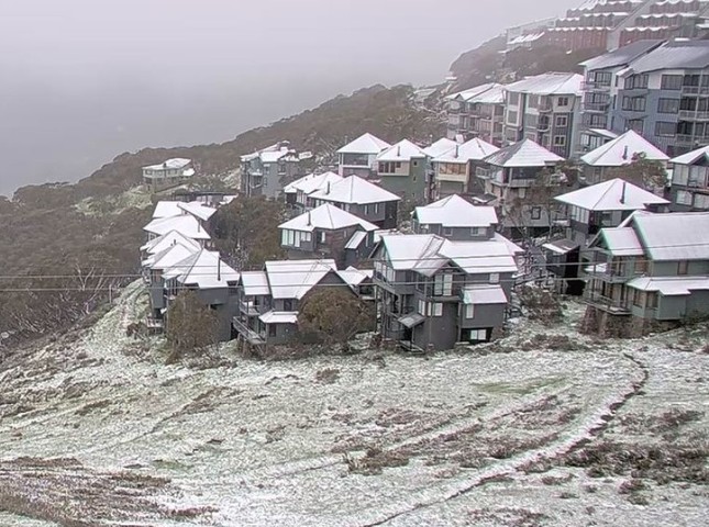
The culprit for the unseasonably chilly weather is a strong cold front which moved through overnight. In its wake, cold, showery weather is persisting in southern Victoria, with snow falling to about 1200 m in the Victorian Alps. Snow is also falling in Tasmania and the NSW Snowy Mountains.
Why this freezing summer outbreak?
The image below gives you an idea. It shows live temps in the southern part of Australia just before 10 am Wednesday, as well as the direction of the airflow (the small white arrows).
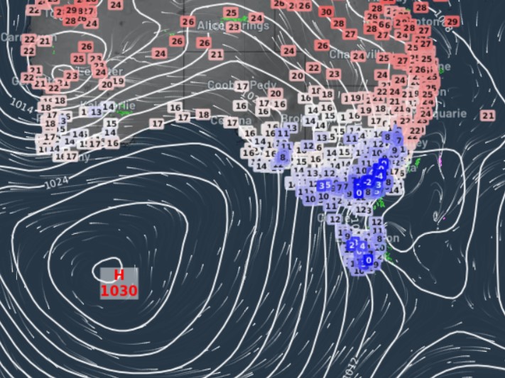
The position of that high pressure system south of Western Australia is the key here.
The highs are normally centred much further north at this time of year. Because this one is so far south, the air moving anti-clockwise around it is dragging frigid air towards Tasmania and southern mainland Australia from much further south than you’d usually expect at this time of year.
While showers will ease in most parts later today, the effects of that cold airmass will be with us for at least a couple of days.
- In Melbourne, temperatures are not expected to top 15°C on Wednesday, with a max of 16°C on Thursday before a gradual warming trend sets in.
So if you’re one of the many Melburnians wondering when this endless winter will turn to summer, we can’t promise classic summer heat any time soon, but we can at least state that temps should climb into the mid-twenties by Monday.
Meanwhile as this cold airmass starts to dry out later tonight, an exceptionally cold night by summer standards can be expected on Wednesday night into Thursday morning. We’ll keep you posted tomorrow if any further overnight temperature records have been broken. At this stage, that seems pretty likely.
To find out more about Weatherzone’s 14-day temperature forecasts, please email us at apac.sales@dtn.com.


