
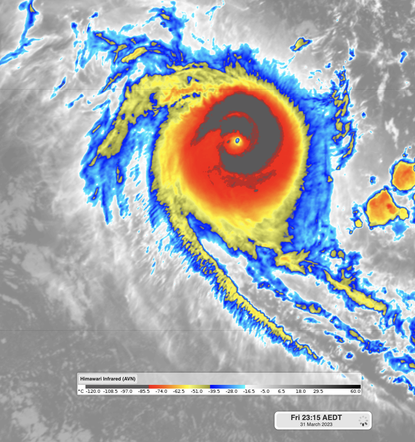
Severe Tropical Cyclone Herman developed, reached a category 5 system and weakened all within the space of five days.
The Bureau of Meteorology named Tropical Cyclone Herman at 8pm WST on Wednesday 29th. Within 36 hours of forming, it went from a category 1 system with winds exceeding 100km/h to a powerful category 5 system with winds in excess of 280km/h.
Herman became the second category 5 system of the 2022-23 tropical cyclone season, after Darian developed back in December (note that Freddy only reached category 4 while over Australian waters). This makes it the first time in 9 years we have had a season with two category 5 systems.
A typical tropical cyclone in a favourable environment will usually intensify by about one category per day, therefore taking four days to go from a category 1 to a category 5 system. Herman experienced rapid intensification, when winds increase by 55km/h (or about two categories) within 24 hours. Overachieving Herman reached this threshold in just 12 hours between 8pm Friday and 8am Saturday.
Rapid intensification can only happen when conditions are perfect for development. This includes:
- Hot ocean temperatures, usually above 30°C
- Minimal wind speed or direction changes with height (known as wind shear)
- Plenty of moisture available (provided by thunderstorms)
The last isn’t a requirement, but it certainly helps being a small system. When a tropical cyclone is small, the amount of energy it requires to spin-up is lesser than for a large system. Herman was considered a small system, being less than 400km across as a category 5.
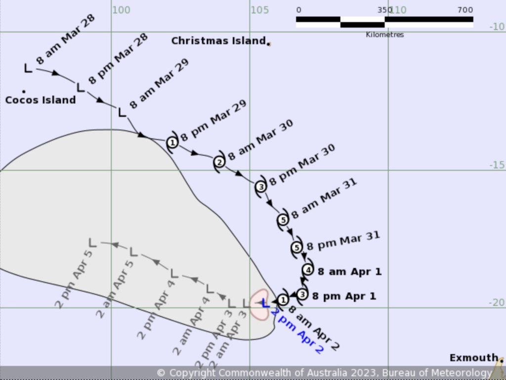
Image: BoM final observed and forecast track for Herman at 2pm WST on Sunday
As quickly as it formed, Herman dissipated. All the major conditions it needed to rapidly intensify were taken away as it moved further south and interacted with an upper trough. Water temperatures were closer to 26°C (tropical cyclones need waters warmer than 26.5°C to intensify), wind shear greatly increased, and dry air started to move into the system. You can see how quickly the trough tore apart Herman in this video:
Video: Enhanced infrared satellite of Tropical Cyclone Herman weakening. Colours indicate the cloud top temperature as seen from space. Dark greys and reds indicate cold cloud tops, the sign of a strong system. Yellows, blues and whites are progressively warmer cloud tops, and therefore weaker systems
Herman has now dissipated completely and is unlikely to reform again. However, eyes are further north for a system that could develop near East Timor late this week.
DTN APAC has a suite of tropical cyclones services we provide to deliver our clients with as much forewarning of tropical cyclones as we can. We have 4 levels of forecasts timeframes:
- Tropical cyclone seasonal outlooks
- Weekly tropical update
- Daily 7-day tropical cyclone forecast
- Detailed tropical cyclone impacts (issued every 1-6 hours aligning with offical advisories)
Through these products you can have as much preparation as possible for tropical cyclones and their impacts. To find out more, please visit our website or email us at apac.sales@dtn.com.




