The long-awaited monsoon has officially arrived over northern Australia, supplying the sustaining rain that is critical to the northern flora and fauna.
The monsoon arrival means over the next week or two, the north will see frequent rain, showers, and thunderstorms. Initially, this will occur over the Top End (including Darwin) but will move further south to reach areas of the Kimberley and northern Queensland during the Christmas weekend.
Video: Enhanced infrared satellite from Himawari-9 showing the area of tropical activity slowly descending south towards northern Australia over the last few days
What is the monsoon?
The monsoon is like a giant seabreeze circulation, except instead of being on the scale of cities, it is on the scale of continents. Like a seabreeze, air wants to move from cooler regions to warmer ones to cool them down. During November to April, air wants to flow from the cooler Northern Hemisphere to the hotter Southern Hemisphere, converging in an area called the monsoon trough.
However, the true monsoon is a bit more complicated because it depends on weather patterns on both sides of the equator. So, the monsoon trough can form, and breakdown based on these patterns. Typically, the monsoon will reach Australia three times during the wet season.
That is why the monsoon only tends to arrive once the conditions are right, often arriving for the first time around Christmas. Other climate factors like the El Niño Southern Oscillation (ENSO) also influence the timing of the first monsoon, shifting its arrival later (El Niño) or earlier (La Niña).
This year’s arrival is right around average overall, but is a bit late compared to a typical La Niña year. However, Far North Queensland did experience ‘monsoon-like’ conditions during the first week of December.
Why is the monsoon so important?
The monsoon is critical to the climate of northern Australia, as its widespread rainfall heralds a transformation from a dry, red landscape to a lush oasis, filling lakes, dams, and wetlands.


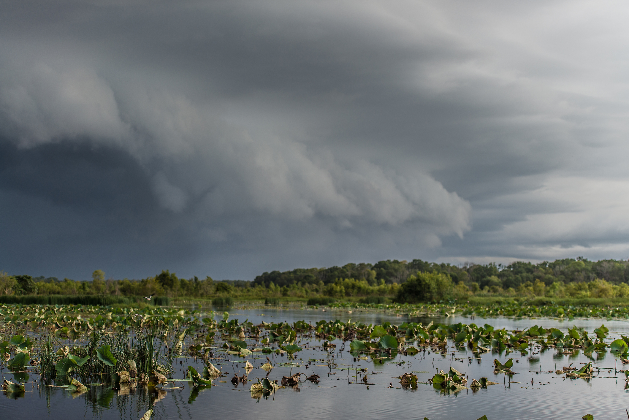
Image: Fogg Dam in the Northern Territory during the wet season
Another benefit to the monsoon is a break from oppressive heat and humidity that accumulates in the north during the ‘build-up’. Katherine had an average maximum temperature of 38.1°C last week and felt up to five degrees hotter at times with the humidity. This week’s maximum will average five degrees cooler and have some cooling burst of rain that will bring the mercury under 30°C at times.
For all its benefits, the monsoon does bring an increased risk of tropical cyclones developing in the Australian region. A tropical low is developing in the Timor Sea that will move south and make landfall near the WA-NT border on Friday. This system is currently expected to develop into a category 1 tropical cyclone before the landfall, so stay up to date with the latest warnings and advisories here.
Weatherzone provides detailed services written by our meteorologists outlining when the monsoon is likely to arrive up to 4 weeks in advanced. In addition, we have regular forecast and alerting services to prepare your business for any tropical cyclones that may be around or heading your way. To find out more, please email us at apac.sales@dtn.com.


