
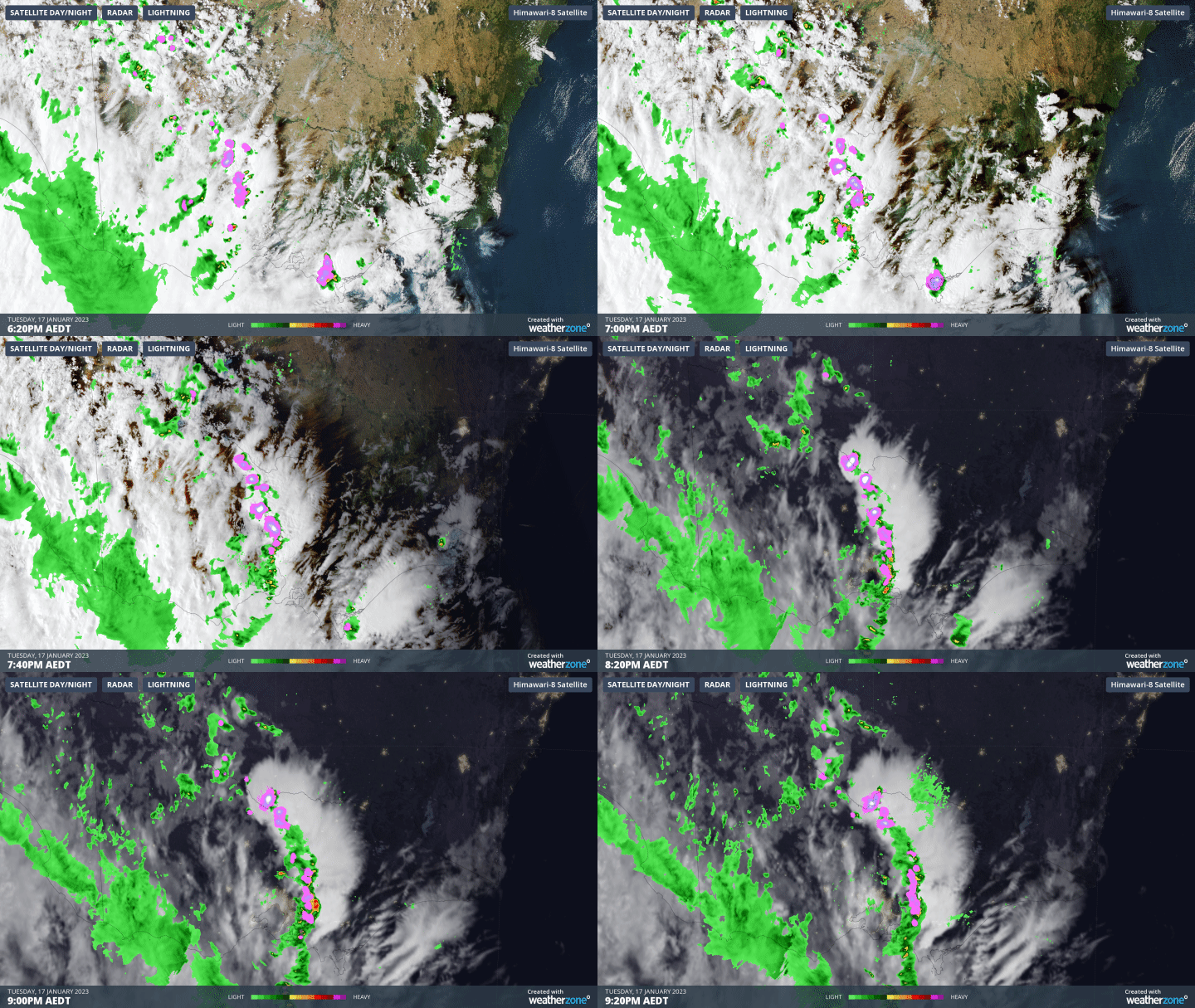
Heavy rain and storms lashed Victoria overnight, as a squall line crossed the state just after dark.
We wrote an explainer story yesterday on squall lines, and it’s well worth reading so that you can understand exactly what’s going on in the graphic below, which shows a three-hour loop between 6:20 and 9:20 pm.
Things got really interesting just after midnight in the vicinity of Euroa (about two hours northeast of Melbourne on the Hume Freeway) when a “mesoscale low” developed: that’s a large complex of thunderstorms formed when high wind shear (wind changing direction & speed with height) causes a vertical column of air to start to rotate.
On a smaller scale, these systems have the potential to generate tornadoes, however last night’s mesoscale low was a little too large. Meanwhile the storms delivered falls in the range of 10 to 40 mm in parts of southern and Central Victoria, with lighter falls in all other districts. Some of the readings of note included:
- Echuca 40 mm
- Shepparton 26 mm
- Mt Donna Buang 26 mm
- Melbourne 6 mm
But the soaking didn’t end in the small hours. A second band of showers formed early on Wednesday morning and is still crossing southeastern Australia with a cold front as we write this story. You can see it illustrated below on this morning’s three-hour loop.
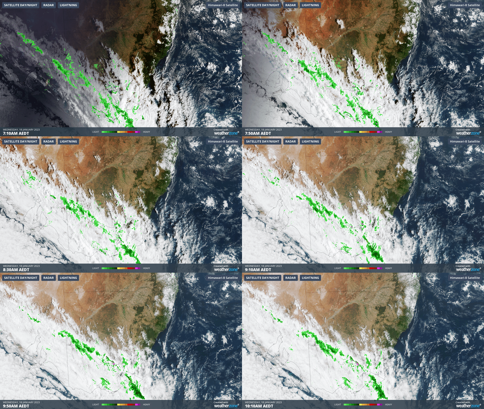
Melbourne has already seen an additional 3 mm on Wednesday morning with locations across several Victorian forecast districts recording similar totals to 10:30 am.
Temperatures have also now dropped across most of Victoria, and as we told you yesterday, no location in the state will see 30 degrees today after Victorian temps maxed out at 42.3°C in the Mallee district in the state’s northwest on Tuesday.
DTN APAC can provide alerts when lightning is detected within a certain distance of your assets, allowing you to safely and efficiently avoid thunderstorms. To find out more, please email us at apac.sales@dtn.com.




