
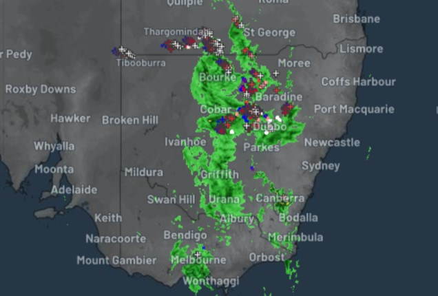
The wild wet spring weather continues. Heavy overnight rain has again fallen across a broad stretch of southeastern Australia, with the heaviest falls in central and western Victoria, southern NSW and northern Tasmania.
The latest burst of rain and storms occurred as an approaching cold front tapped into abundant tropical moisture which had already made its way south from northern Australia.
As many as 55 flood warnings are already in place in NSW alone, with numerous warnings also in effect in other states, and the situation will probably become extremely serious on the weekend, with heavy rain again forecast across a huge area, particularly on Saturday, and particularly north of the Murray River.
Meanwhile some of the overnight rainfall readings to 9 am Friday included:
New South Wales
- 97 mm at Sydney Airport
- 37 mm at Hay airport, most of which fell in early morning storms around 7:30 am Friday
- Falls in the 10-25 mm range at numerous locations, mostly in the state’s southeast
Victoria
- 64 mm at Bung Bong (a small town about 65 km NW of Ballarat)
- Falls in the 10-25 mm range at numerous locations right across the state
Tasmania
- 103 mm at two stations on the Central Plateau
- 109 mm at Gray in the state’s northeast
The situation as we write this story on Friday morning continues to intensify across an enormous area, as you can see on the Friday morning radar loop below.
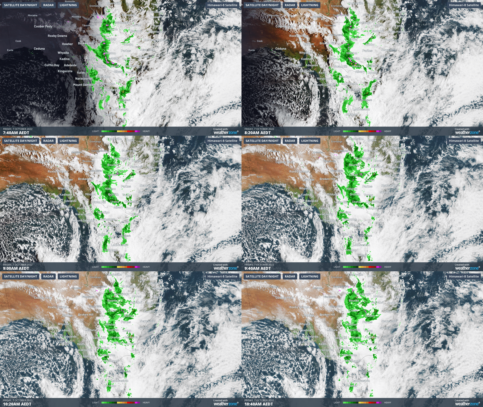
In terms of the heaviest population centres, storms are currently moving through Melbourne and Canberra, while Sydney is having a brief respite from the wet stuff, after breaking its annual rainfall record yesterday.
The Melbourne area also copped a decent drenching overnight, with 15.2 mm to 9 am, most of that falling in a rainband with embedded storms that moved through around midnight.
Melbourne should cool down significantly over the weekend, with wintry max temps around 15°C, but skies should dry up.
As mentioned, that won’t be the case further north, with most of New South Wales facing its most dangerous day yet this spring for both flash flooding and riverine flooding as rivers in already soaked catchments burst their banks.
For more information on Weatherzone’s thunderstorm forecasting, alerting and tracking, please contact us at apac.sales@dtn.com.




