Prosper in a dynamic world
Search

Spectacular Sydney storms extend city’s remarkable rain record

Nature’s fireworks lit up the Sydney skyline on Monday night as ominous shelf clouds and waves of rain swept across eastern NSW.

Showers and thunderstorms formed over central and eastern NSW on Monday afternoon and evening as a passing cold front and low pressure trough cut into a region of warmer and relatively moist air.

The day’s first thunderstorm over Sydney developed shortly after 3pm before another cell clipped the city’s south around 6pm. These were followed by a more active line of storms that passed over the Sydney Basin between 7:30 and 9:30pm.

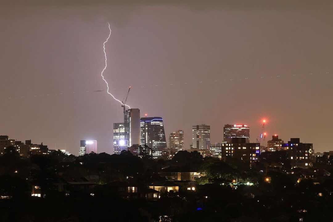
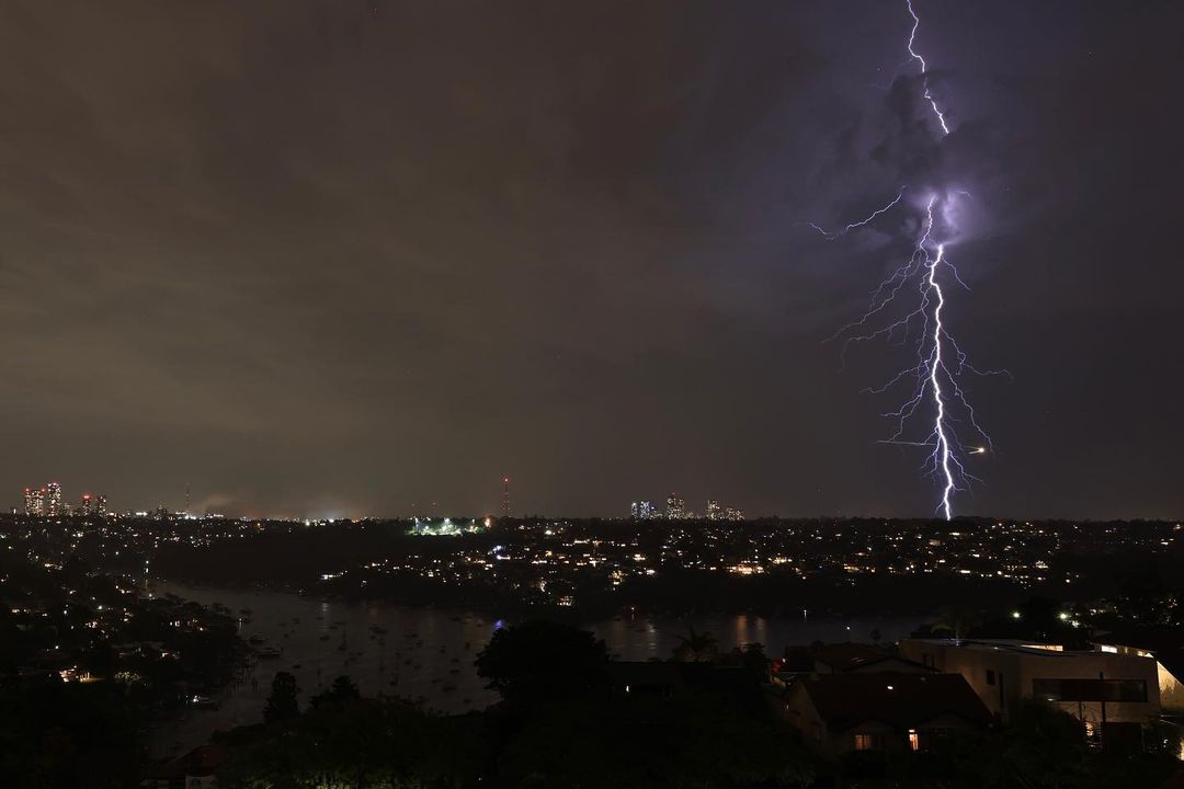
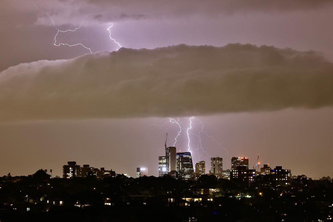
Images: Lightning over Sydney on Monday night. Source: @ihaig72sydney / Instagram

By midnight, several rounds of storms had hit the Sydney, producing more than 30,000 lightning strikes within 100 km of the city.

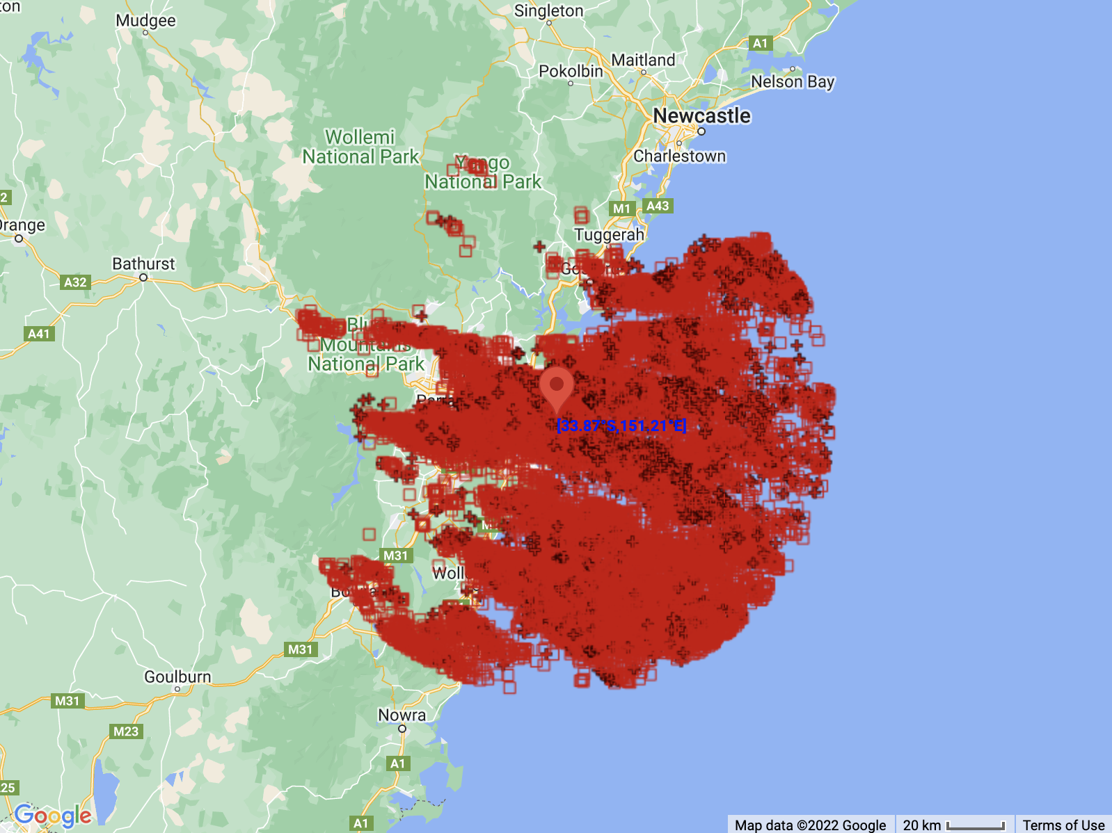
Image: Locations of 34,027 lightning strikes detected within 100 km of Sydney between 3pm and midnight on Monday, December 5.

The evening storms were an unwelcome sight for crowds at Jack Johnson’s concert in the Opera House’s Forecourt, which had to be cancelled due to the risk of lightning. According to a post on Jack Johnson’s Instagram page, “The lightning and electrical activity in the area posed a significant risk to public safety and at the venue’s direction we had to stop immediately.”

Monday’s early-summer thunderstorms delivered around 5 to 10 mm of rain across the Sydney Basin, with 6.6 mm falling at Observatory Hill in the city.

While this wasn’t a lot of rain by local standards, it pushed Sydney’s running annual rainfall total for 2022 up to a whopping 2458.4 mm. This is more than twice the city’s long-term annual average of 1213 mm and comfortably Sydney’s highest annual total on record, beating 2194 from 1950.

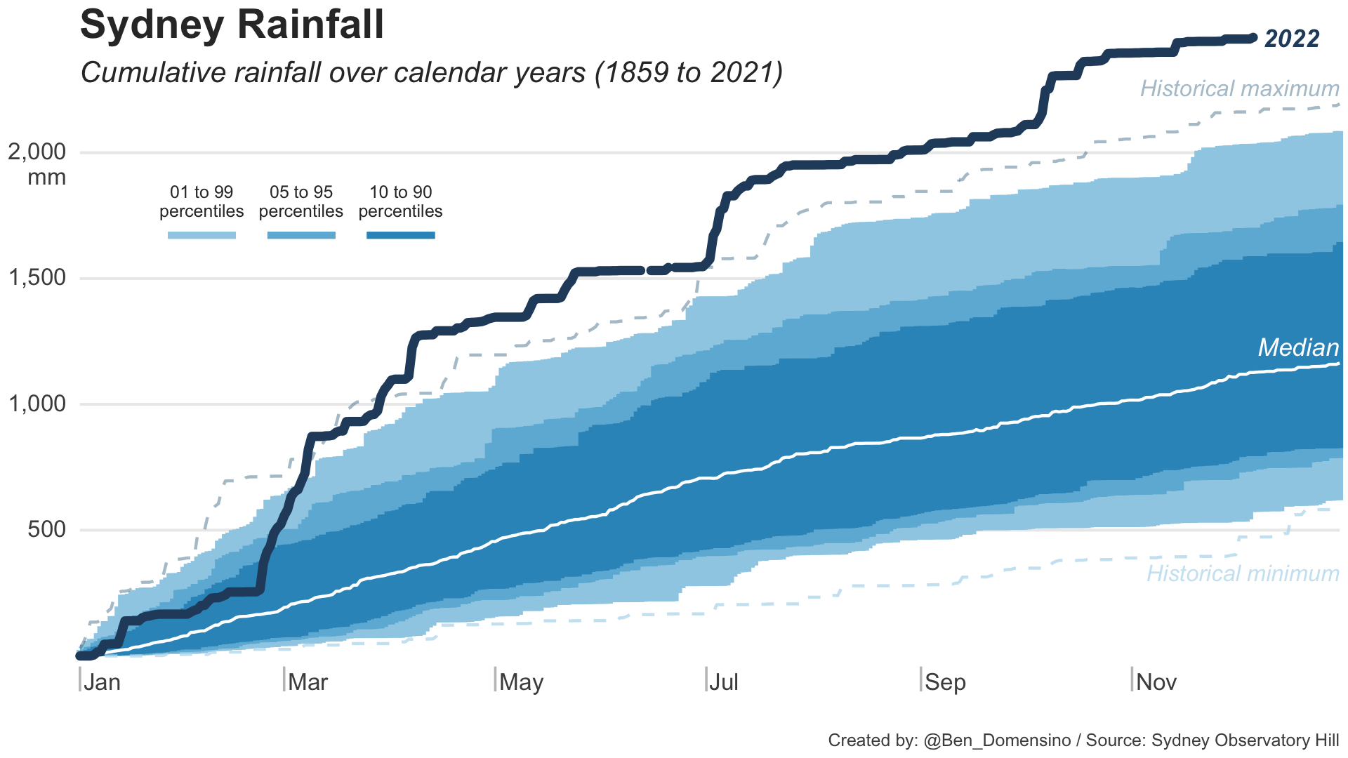
Image: Sydney’s accumulated rainfall for the year-to-date (up to 9am on December 6. 2022), compared to all other years in Sydney’s observation history, which dates back to 1859.

Sydney should stay mostly dry for the rest of this week, although there is a small chance of showers or storms on Wednesday and more substantial rain is possible early next week.

Latest news

Satisfy your weather obsession with these news headlines from around the nation, and the world.

From Kimberley to northern NSW: Bushfire outlook flags risk for resources sector this winter

Bushfire risk doesn’t usually make headlines in June, but AFAC’s winter seasonal outlook is putting mining and resources operators on alert from the Kimberley to the NSW.  Australia’s official seasonal bushfire outlook for winter 2026 was released by AFAC on Thursday, May 28. The outlook predicts increased fire risk across the northern parts of the Great Sandy Desert and surrounds […]

The signal was there weeks earlier: forecasting one of the year’s biggest wind events

In mid-May 2026, DTN APAC meteorologists flagged a strengthening Southern Ocean pattern in model guidance, signalling an extended run of record-challenging wind conditions across the NEM.  Nearly three weeks later, NEM wind generation climbed from around 1.5GW to more than 9GW, supplying roughly one-third of the grid and coming within 1GW of the all-time generation record.  The event highlighted […]

The 2026 Indian Southwest Monsoon onset is expected in the next two weeks

The Indian Southwest Monsoon will reach India in the next two weeks, but a developing El Niño could signal a drier than normal monsoon for businesses and major industries across the country. Southwest monsoon onset over southern India in the next two weeks The Indian Meteorological Department (IMD) is responsible for tracking the advance and […]

Rapid El Niño signal accelerating risk for Australian businesses

El Niño–favourable conditions are gathering pace across the tropical Pacific, with key ocean indicators approaching threshold levels and early atmospheric responses emerging.  While uncertainty remains around final El Niño strength, historical analogues show that even weak events can generate widespread impacts, including reduced rainfall, warmer daytime temperatures, increased frost risk, elevated fire danger, reduced tropical cyclone activity, and more. Industries including […]