The Southern Annular Mode (SAM) is an index that has a significant influence in Australia’s weather throughout the year. So, what is the SAM and how does it affect Australia?
What is the Southern Annular Mode (SAM)?
The SAM is simply an index that is used to monitor the position of a belt of westerly winds that flow from west to east between Australia and Antarctica.
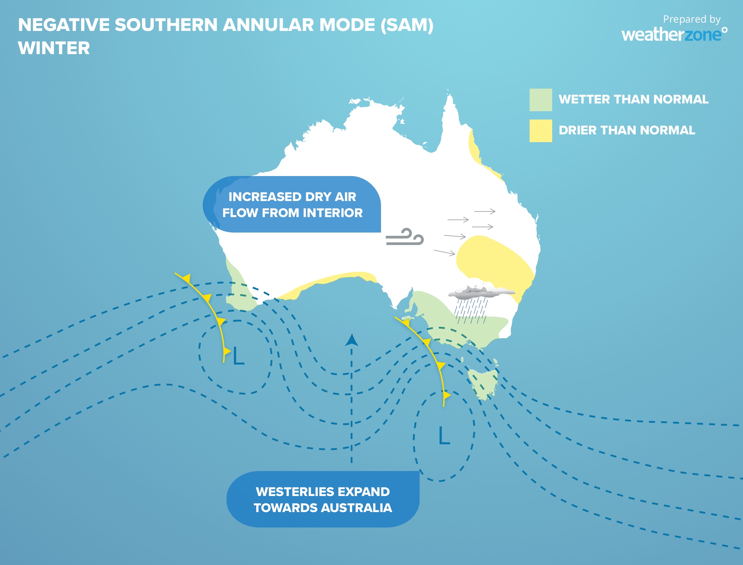
When the SAM is in a negative phase, these westerly winds, and the cold fronts and low pressure systems they carry, are located further north than usual for that time of year.
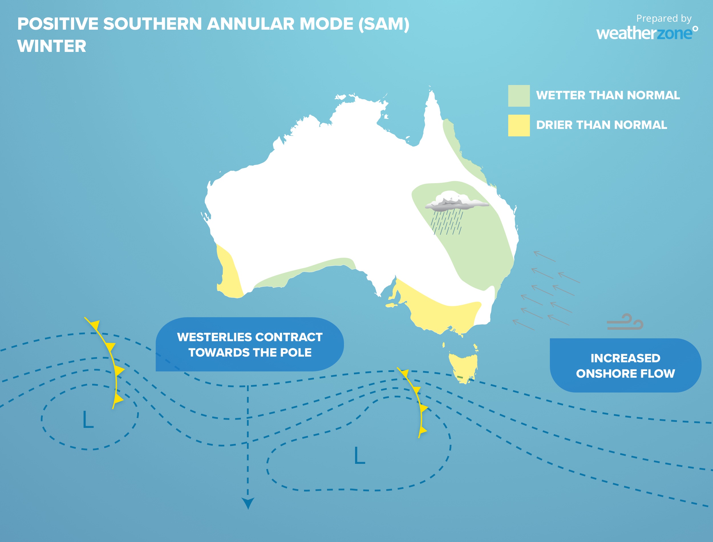
When the SAM is positive, the westerly winds, cold fronts and low pressure systems are located further south than usual.
How does the SAM change our weather?
The SAM can have a notable impact on Australia because it alters the location and strength of weather system affecting the continent.
Negative phases of the SAM during late-autumn and winter often:
- Increase rainfall over parts of southwestern and southeastern Australia
- Reduce rain in parts of eastern Australia
- Cause stronger westerly winds across southern Australia
By contrast, positive phases of the SAM in late autumn and winter can:
- Suppress rainfall in Australia’s southwest and southeast
- Increase rain over eastern Australia
- Exacerbate the impact of East Coast Lows near Australia’s eastern seaboard
For Australia’s alpine addicts, the SAM can also influence snow. In general, more snow is expected to fall in the Australian alps when the SAM is negative, and less snow is likely when it’s positive.
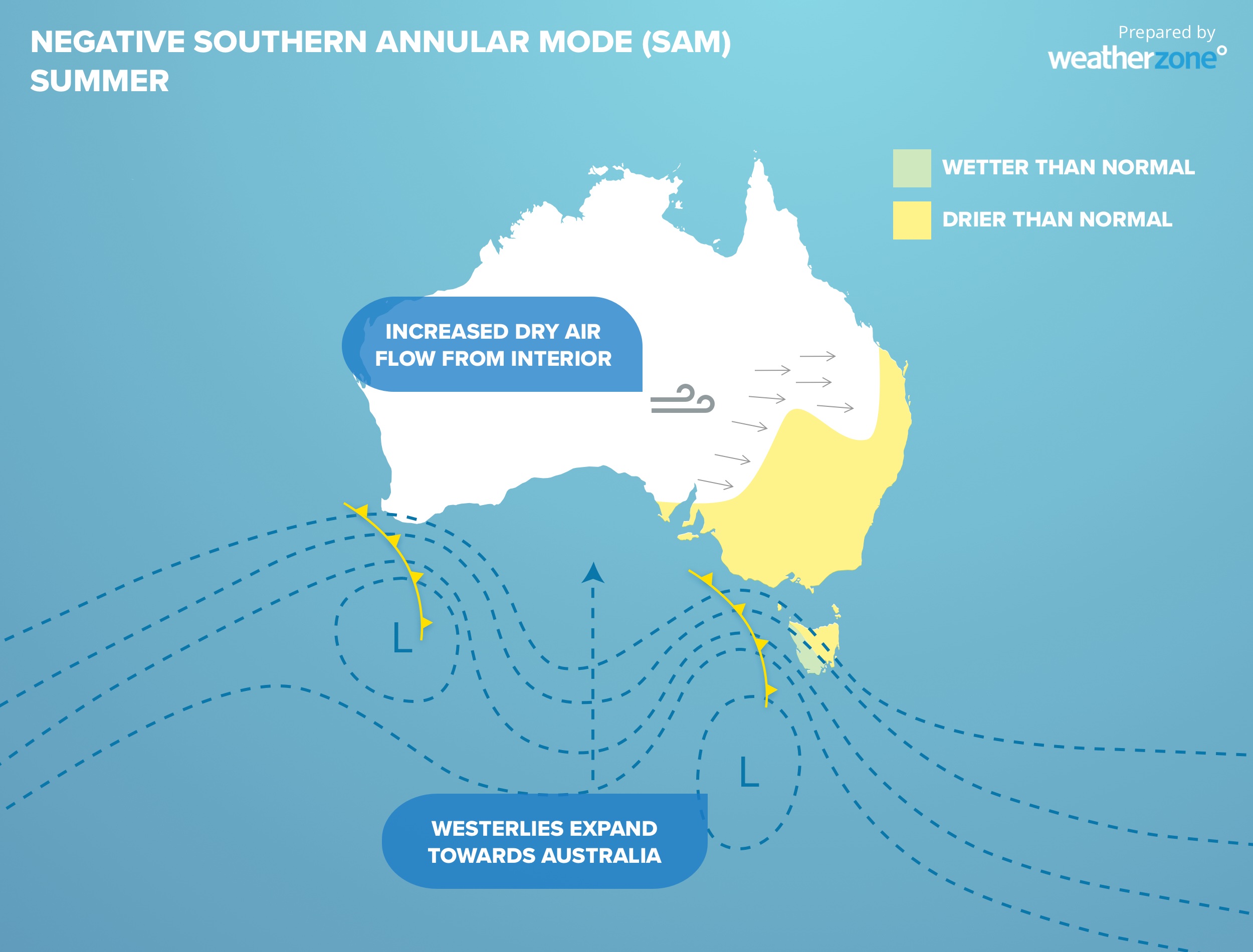
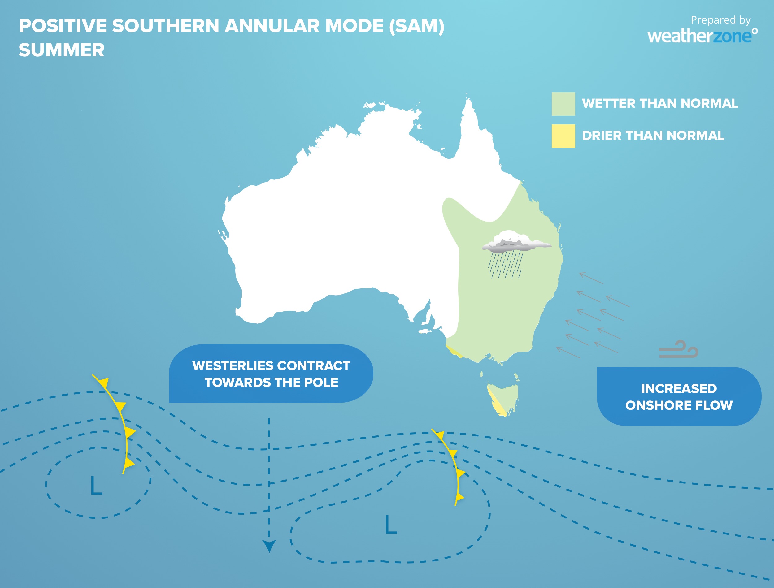
In summer, cold fronts typically become weaker compared to winter and rain-bearing easterly winds increase over eastern Australia. The SAM can have a noticeable effect on these summertime easterly winds.
A negative SAM during late-spring and summer typically:
- Suppresses easterly winds over eastern Australia and promotes drier westerlies
- Reduces rainfall over eastern and southeastern Australia
- Increases the likelihood of spring heatwaves in southeastern Australia
A positive SAM during summer will usually:
- Enhance the onshore flow of winds over eastern Australia
- Increase rainfall over eastern and southeastern Australia
- Decrease the likelihood of extreme heat in eastern and southeastern Australia
Examples of the influence of SAM
Parts of Australia’s east coast saw their wettest first half of a year on record in 2022, which culminated in a third major flood event of the year in central-eastern NSW.
The Southern Annular Mode (SAM) was predominantly positive during this prolonged wet period, with prevalent easterly winds influencing large parts of eastern Australia.
This period of positive SAM also coincided with La Niña in the Pacific Ocean, which further boosted the flow of moisture-laden air over eastern Australia.
The graph below shows that the SAM was mostly positive during the first six months of both 2022 and 2021.
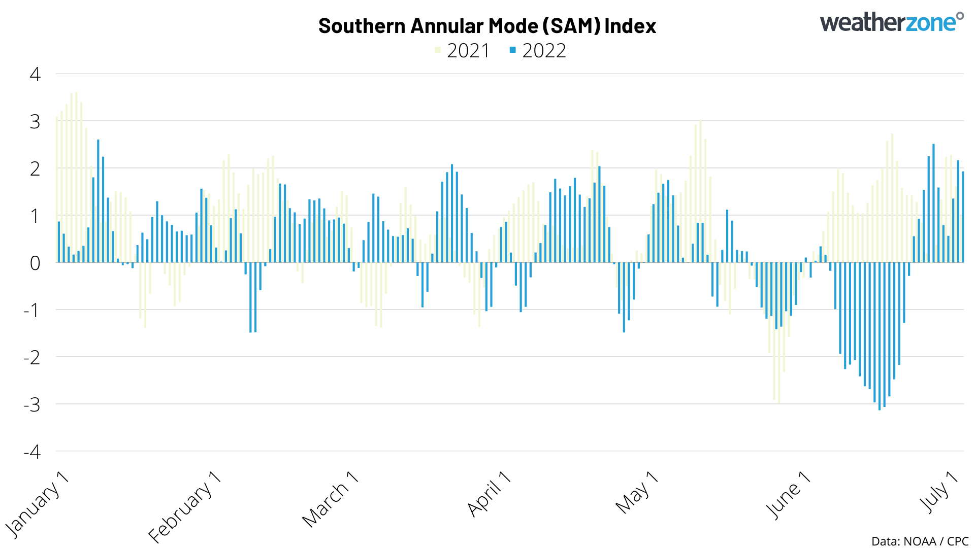
It is worth pointing out that the brief spell of negative SAM during June 2022 corresponded with a break in the rain, with NSW registering its driest June since 1986.
Can we predict SAM?
The Southern Annular Mode (SAM) can be forecast around two to four weeks in advance, however the confidence in the forecast greatly reduces after about 10 days.
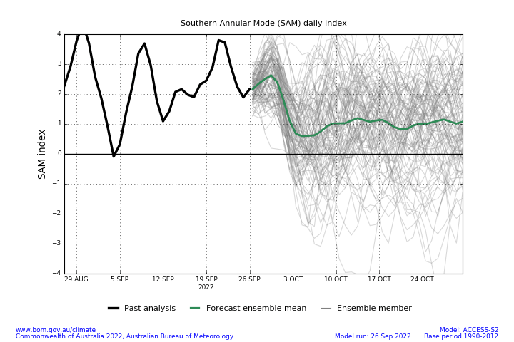
Image: Example of a SAM forecast in late-September 2022, showing increasing uncertainty in the model beyond about 7 to 10 days in the future. The black line is observed values of the SAM index, while the green lines are a model-based forecasts. Source: Bureau of Meteorology.
Phases of the El Nino Southern Oscillation (ENSO) can also influence the SAM for several months at a time and can be useful in predicting SAM at longer timescales.
In general, positive phases of the SAM are more likely during La Niña, while negative phases occur more frequently during El Niño.


